
Re-posted courtesy of Thunderbolts.info
In previous articles, we discussed evidence of electromagnetic and hydrodynamic forces that shaped the landscape with arcing currents in an atmospheric surface conductive path. We theorized these currents sent bolides of plasma jetting through the atmosphere, blow-torching the ground below into craters and mountainous blisters, based on observed characteristics of the landscape.
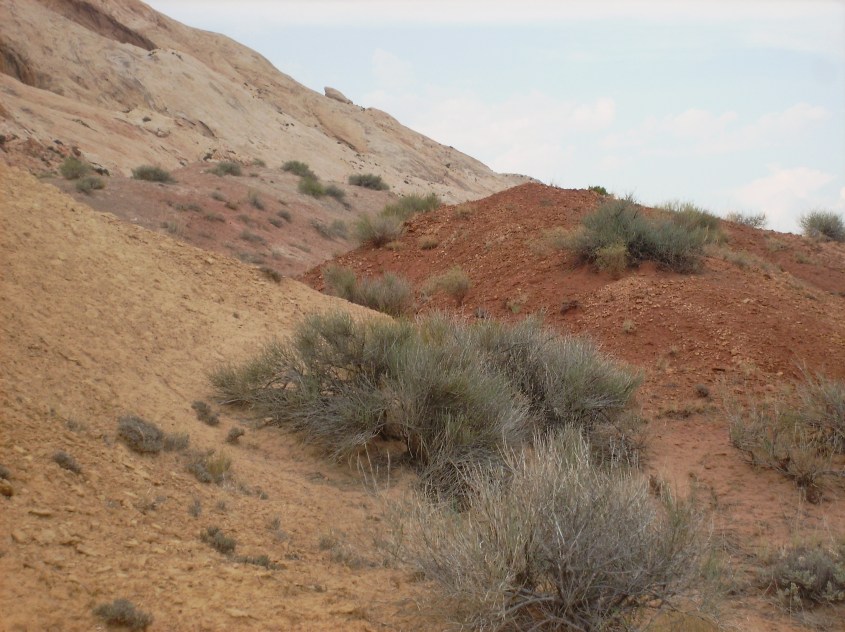
The evidence on the landscape is in the form of triangular buttressed mountains and related land forms that display the shape of windblown deposits created by hot supersonic winds under the influence of shock waves. The triangular forms are created by reflected shock waves, heat, winds, molten rock and dust stirred by the blast of the arc.
It’s an amazing concept that has the potential to be proven, as discussed in Arc Blast – Part 1, 2 and 3, and in the accompanying “Space News” episodes, “EU Geology – A New Beginning”, “The Arc Blasted Earth” and “Extraordinary Evidence of EU Geology”. To understand the full context of this discussion, be sure to view these materials.
Recent field examination of triangular buttress features on monoclines in the Four Corners region of the southwest U.S. provides some confirming evidence for the theory, some conflicting evidence, as well as new information to expand theories for Electric Earth geology.

Field Notes from Four Corners
“Four Corners” is a nickname for the location in North America where the borders of Arizona, Utah, New Mexico and Colorado meet. It is a region of splendid beauty, history, mystery and geology.
It is among the most ancient regions known to have been occupied by the earliest humans in North America. Blackened rock is decorated with archaic petroglyphs and pictographs. “Squatter Man” appears on random canyon walls.
It’s a region that suffered catastrophe, causing inhabitants to suddenly flee in a mass diaspora seven centuries ago. Cliff houses abandoned by the Anasazi Pueblo people haunt this region; derelict and silent in deep canyon clefts.
Through it flows the San Juan River, from headwaters at the Continental Divide immediately east of the region, to confluence with the Colorado River immediately to the west, before their joined flow cuts into Lake Powell and the Grand Canyon.
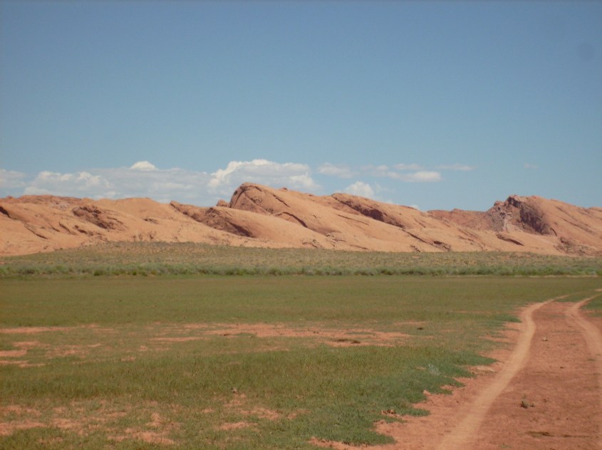
Yet the region is arid, desert plateau over 1500 meters above sea level. The geologic enigma of Monument Valley lies at its core. On a satellite image, it stands out like a bulls-eye on the landscape of North America.
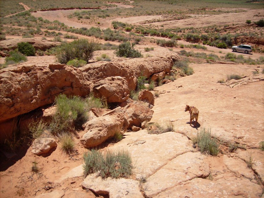
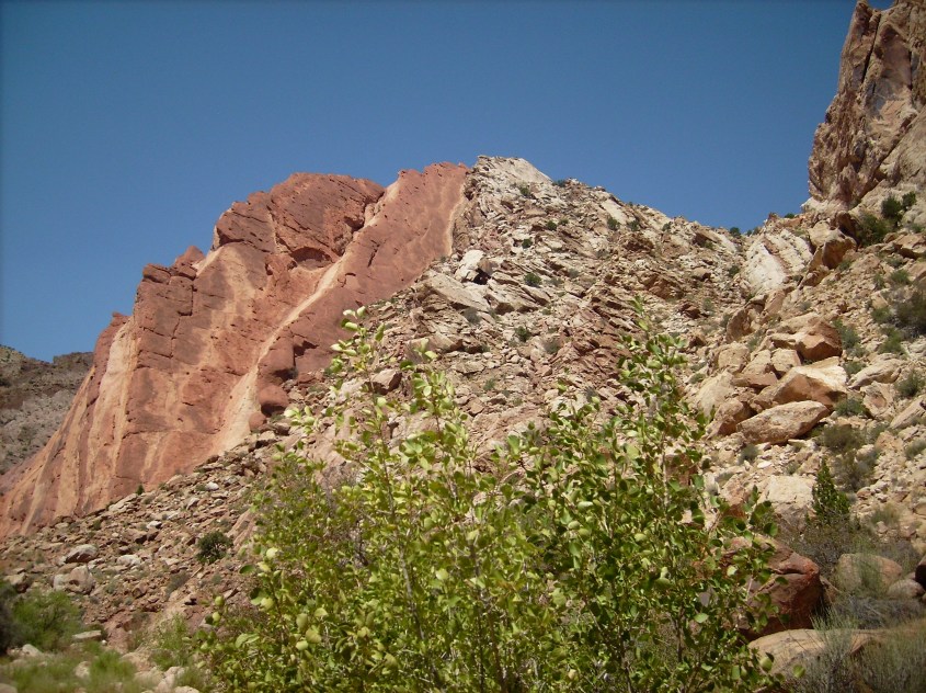
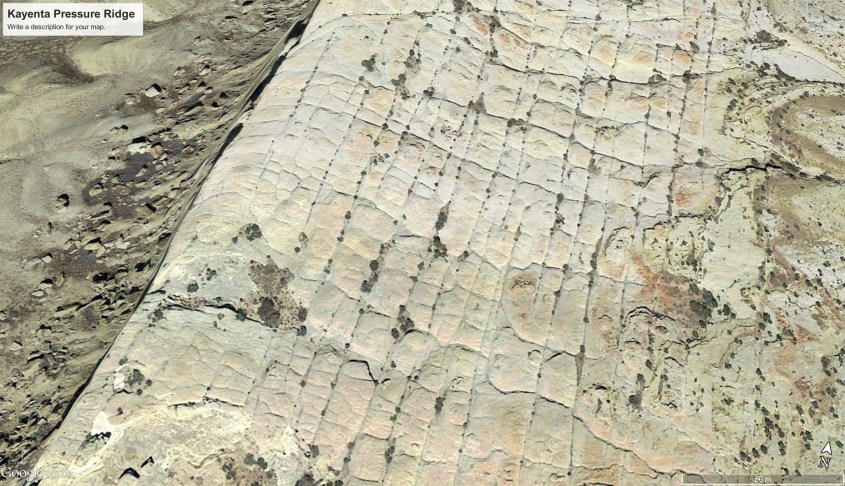
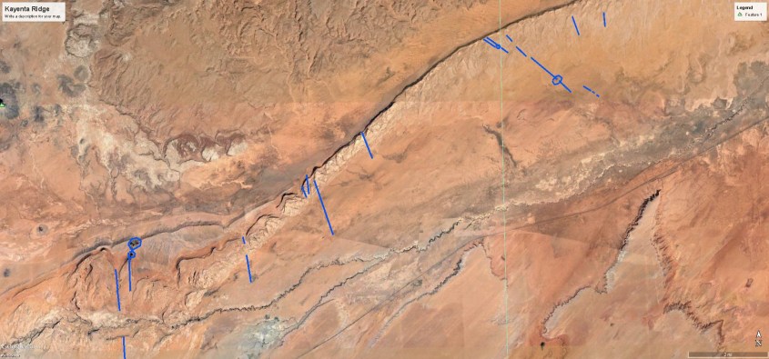
Near the Navajo town of Kayenta, Arizona is the southern end of a monocline – a curvalinear ridge nearly 100 km long, that extends from Kayenta east, and then north to Horse Mountain in Utah. It’s named Comb Ridge. It borders Monument Valley on the south, and east, and is sliced by the San Juan River at the mid-point. A field examination of Comb Ridge was recently performed and is the focus of this article. As we will discover, it holds answers about the form of our planet.
Pressure Ridge (AKA, The Monocline)
Below is an image of Comb Ridge near the town of Kayenta, Arizona. It was investigated on August 13, and a subsequent investigation was made the following week of another monocline ridge, the San Rafael Reef in Utah, to compare and confirm consistency of findings. A report on the findings of the San Rafael investigation is forthcoming, however some photographic evidence from the San Rafael Reef is used in this article to illustrate findings consistent to both monoclines.


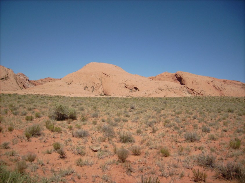
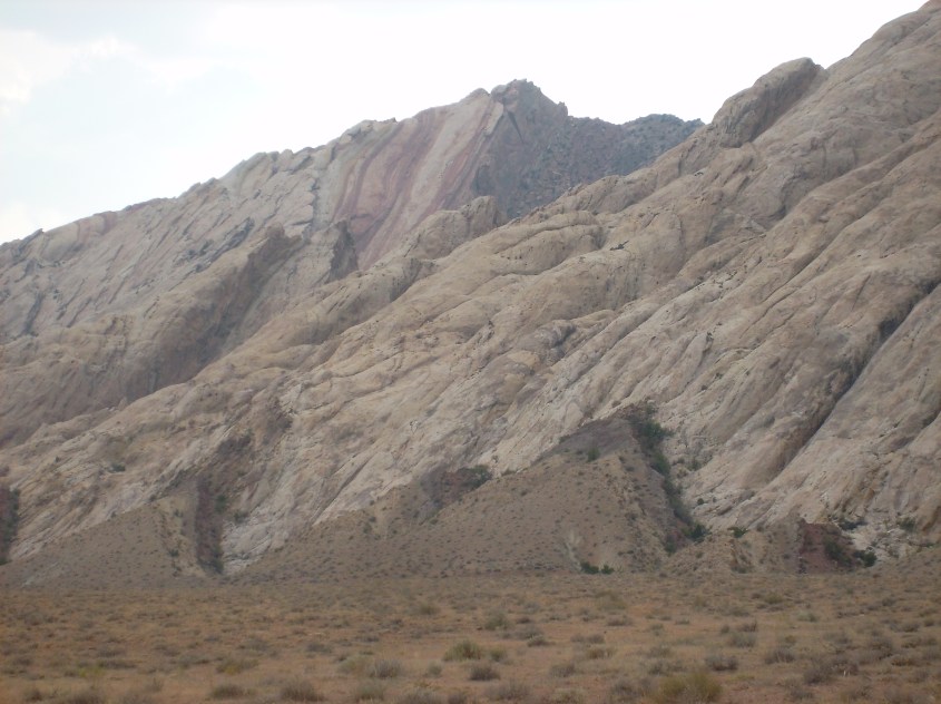
By mainstream reasoning, these are sandstone sediments that drape over the scarp of a deep basement fault, where one side of the fault lifts higher than the other leaving a linear ridge on the landscape. These ridges are often called hogbacks. They can be a linear hill stretching a few hundred meters, elevated a dozen meters in relief , or they can be a curvalinear mountain ranging more than a hundred kilometers long and a thousand meters in elevation.
Their most common characteristic is they display the layers of sediment exposed on one side along the steep and often jagged high end, and a shallower sloped and generally planar faced opposite side – a ski slope is the term often used.
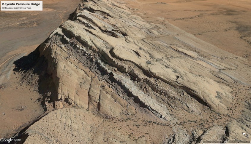
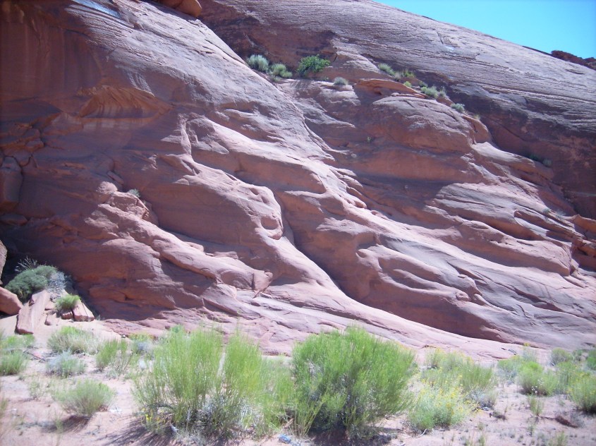
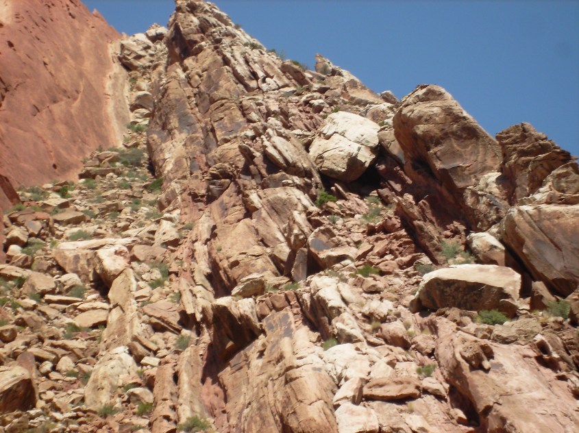
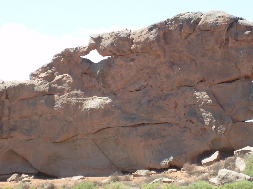
They also display particular features that betray their true origin. Namely, triangular buttresses.

Arcing current discharge will create a supersonic shock wave. A shock wave travels as a pressure wave though a medium until it hits a medium of higher density, and then it reflects. Shock reflections create standing waves in the general shape of triangles and diamonds, with other variables contributing additional effects that can modify the form.

These are not created in the same fashion as described in Arc Blast, however, at least not exactly the same. They are still created by supersonic shock waves and winds, only the cause of the winds is not an atmospheric arc, as described for an arc blast.
On-site examination of the monocline reveals no mountain core beneath, or behind the layers forming the buttresses as expected from an arc blast event. By all appearance, they are a windblown pressure ridge, against which the buttresses formed.
Mainstream theory holds that triangular buttresses on the monocline are either formed by seismic waves, or water erosion.
The seismic theory is nonsense, since the theory requires the triangles to form by shifting fault blocks and this simply does not comport with observation. That would create discontinuities and broken debris between shifted blocks and they aren’t present. The buttresses are monolithic layers and sheets without significant displacement at faults and cracks.
Seismic forces had nothing to do with forming them. Close examination of the hills and surroundings allows us to address water erosion more fully, and find evidence for a theory of electrical formation. Let’s begin with the survey.
Examining The Buttresses
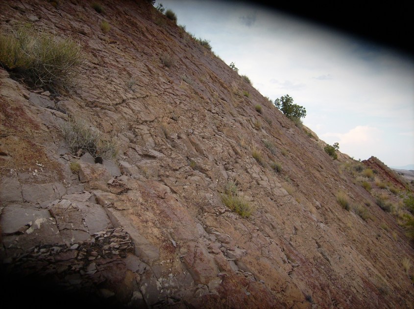
The dip of the stratified layers at the place of investigation was approximately 20 degrees, although other areas displayed both steeper and shallower angles of repose. The strike orientation (from center of triangles base to apex) was north – northwest. The hogback bends northward, so the strike near the north end is due west.
Water Erosion
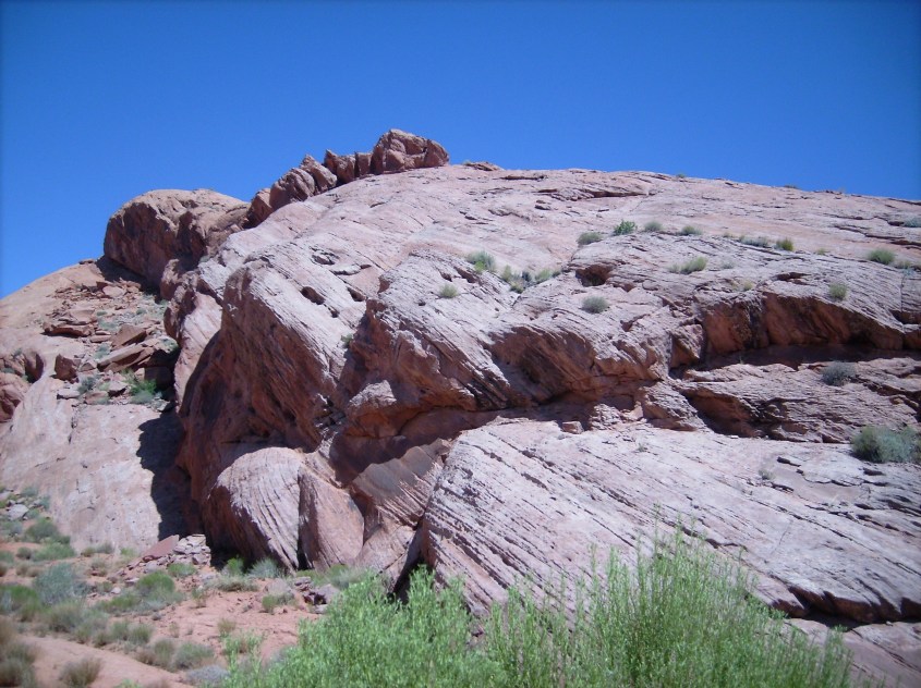
Definite signs of water erosion were found on exposed sandstone walls in the creek that ran between the base of the buttresses. Evidence of significant flow in the wash showed to a height of about five meters above the creek bed.
Here is found the smooth, rounded, water worn rock one expects to see as the result of water erosion. Creeks flow between buttresses in this fashion infrequently, so are not the cause of their consistent triangular formation. This creek was used as an access to traverse through the monocline.
Elsewhere, water erosion was not evident other than superficial surface erosion and discolorations. Following are several examples that dispute water erosion as the mechanism that formed the triangles.
Wind Blown Rock
The edges of layers show the fineness of strata. Moisture may have caused clay to swell, contributing to the weathering, but smoothed edges from flowing water is not evident.


Layered Strata
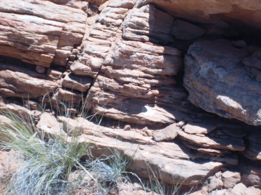
Strata are sandwiched in thin, straight, even layers, as well as monolithic concretions.
The San Rafael Reef displays mixed bands of what appears to be white Wingate Sandstone of Triassic age, and red Navajo Sandstone of Jurassic age. How they mixed in alternating bands on triangular Buttresses is best explained by supersonic winds.
Some layers are loosely consolidated sand and dirt in a mixed matrix including chunks of rock. Some are finely grained hard rock.
Still others are hard, flat and ruler straight layers of such thin, even depth, they appear as if electroplated onto the layer below. These layers are four to twelve inches of extremely hard rock, flat surfaced and scored with rectilinear fractures such that it resembles a brick wall. The rock even looks like baked brick, with smooth planar surfaces.
Also in the photo above, small triangular red discolorations appear in harmonic reflection across the base of the “brick wall” at about knee height, as if spray painted on – they can barely be discerned in the lower right.
Some layers display plastic deformation, as if molten, or hot and plastic when deposited. Typically seen composed of fine grained, tightly packed, homogeneous, hardened sandstone.

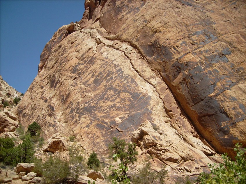
Shock Fractures
Striations and fractures appear throughout the buttresses. Typically they form at the same angle as the triangle, normal to it, or in checkerboard fashion as shown in the picture below, consistent with shock effects. Checkerboards appear in hardened strata that may have shrunk while cooling, creating a pillowing effect that widens striations at the surface. Water has superficially eroded striations vertical with respect to the hill, but horizontal striations are straight and clean.
An Unexpected Find – Dikes
Facing the windward side of Comb Ridge is a vast windswept plain that drops into a river valley running parallel to the ridge. The plain is nearly featureless, except for the appearance of linear dikes radiating away from the ridge towards the river. The dikes are of a dark brown sandstone that resembles the Chinle Formation of Triassic sediments. The Chinle displays this amorphous, dark sandstone, that looks like petrified, boiled mud, throughout the southern Colorado Plateau.
The appearance of Dikes, their location and orientation, are curious for mainstream interpretation, given that similar dikes in the region are attributed to volcanic action. Near the meeting point of the four corner States juts Shiprock mountain. It has dikes emanating from it in a “Y” formation (or “wye” – hint, hint). How do the dikes of Shiprock relate to dikes formed at a monocline?

Situational Awareness
The Comb Ridge dikes visible at the surface are highlighted in the image below. It is apparent the dikes are related to the buttresses. One might conclude these are shock induced features, given their relation to shock induced triangular buttresses. They radiate at angles consistent with the angle of the buttresses and appear to terminate at the ridge itself. Other curious features can be found along the dikes.
Future articles will further explore the Kayenta monocline, the dikes and the Four Corners region in general. This will include examination of fulgarite and fulgamite evidence, wind pattern evidence from the orientation of pressure ridges and buttresses, and the cause of winds and other forces that formed the landscape.

I have been looking at the geology of the Western Cape in Cape Town for many years knowing there is another story to be told and here it is right down to the finest detail…..I just need to know what landed in Cape Town to create the exact formations you have here in this Eye of the storm………..Please spend 5 minutes looking at Table Mountain and surrounds……something hit here and MS did video on it before we lost him……he reckons a vortex but I have no idea what next……..Absolutely amazing, I have looked at mountains knowing something was up since I was kid on my first building site…..I was surrounded by mounds of little mountains sand cement aggregate rubble water……all in a big mess evrywhere……I have always looked at them as building rubble and now here we are……fantastic…..i can breathe….
LikeLike
Yes Judy. I agree with your approach and comments.
LikeLike
This is so interesting and really above my level of comprehension BUT I’ll keep reading and re-reading it until it’s somewhat understandable. Your photographic expertise is very admirable, as well!
LikeLike