They call Mars ‘Scar Face’. His weapon, the Thunderbolt. They say his union with the Goddess, Venus, birthed creation.
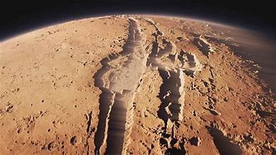
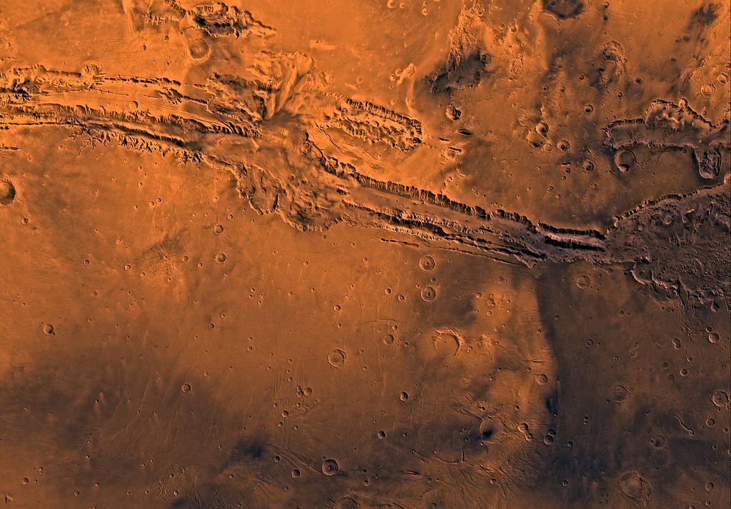
This legend is about Mars, told by the Pawnee, a North American First Nations tribe that had no telescopes. But the scar is there. Valles Marineris is the longest, deepest, most evil looking chasm in the Solar System. Yet it’s impossible to see with the naked eye given Mars’ vast distance from Earth. How odd the Pawnee seemed to know of it.
The Pawnee theory sounds like the Greek, Mayan, Incan, Egyptian and Norse mythologies. Did the Pawnee share their best leaf in the peace-pipe with everyone in the world? How else could such a randomly bizarre story spread? Or was everyone talking about an ancient, global event experienced and remembered at a time when Mars was so close it appeared as big as the Moon, or even bigger?
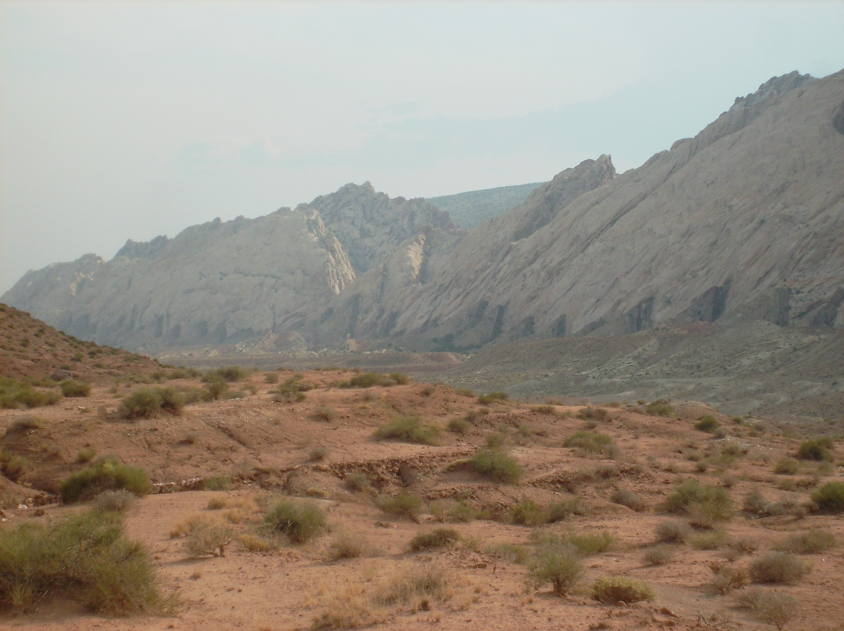
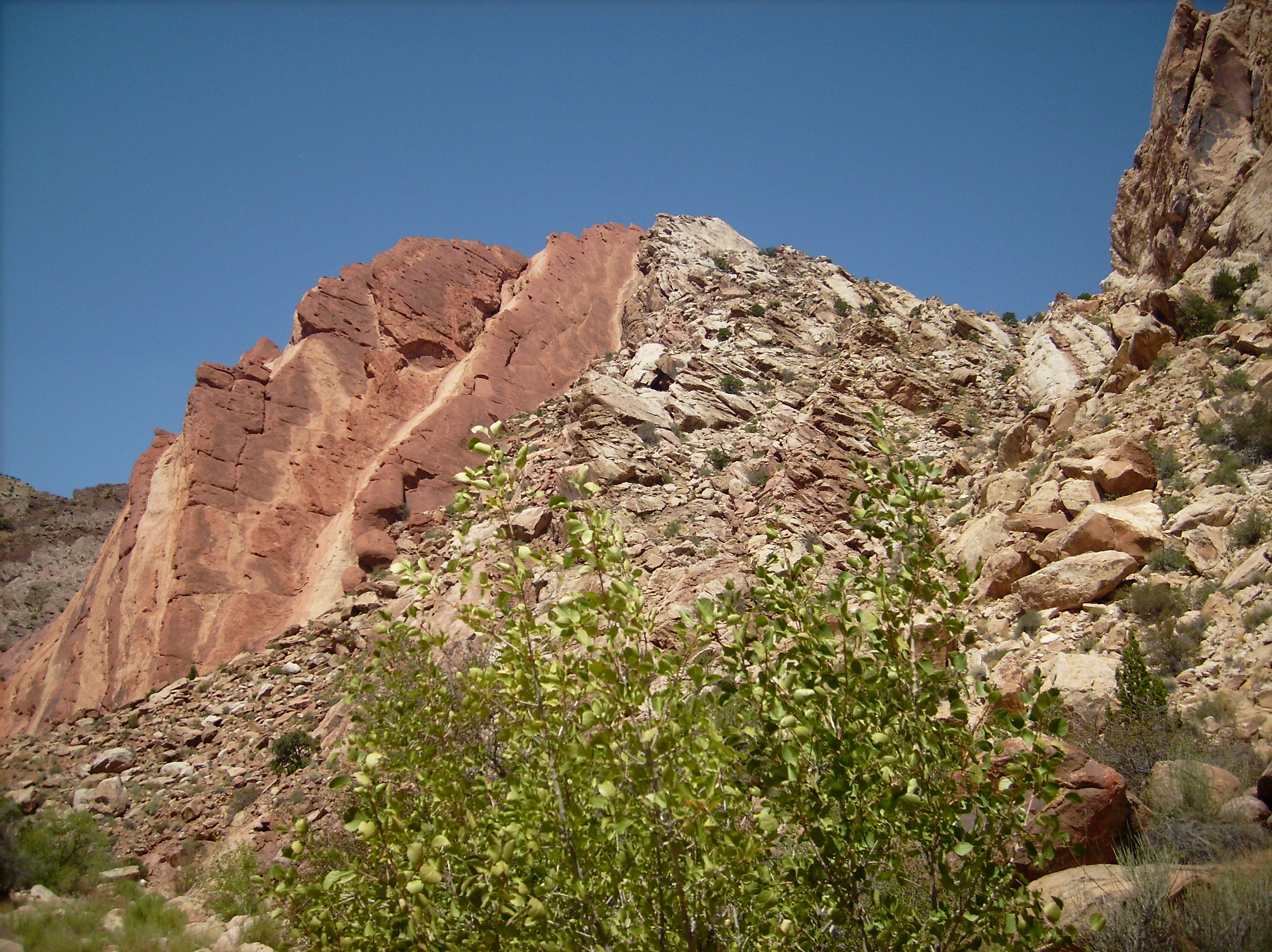
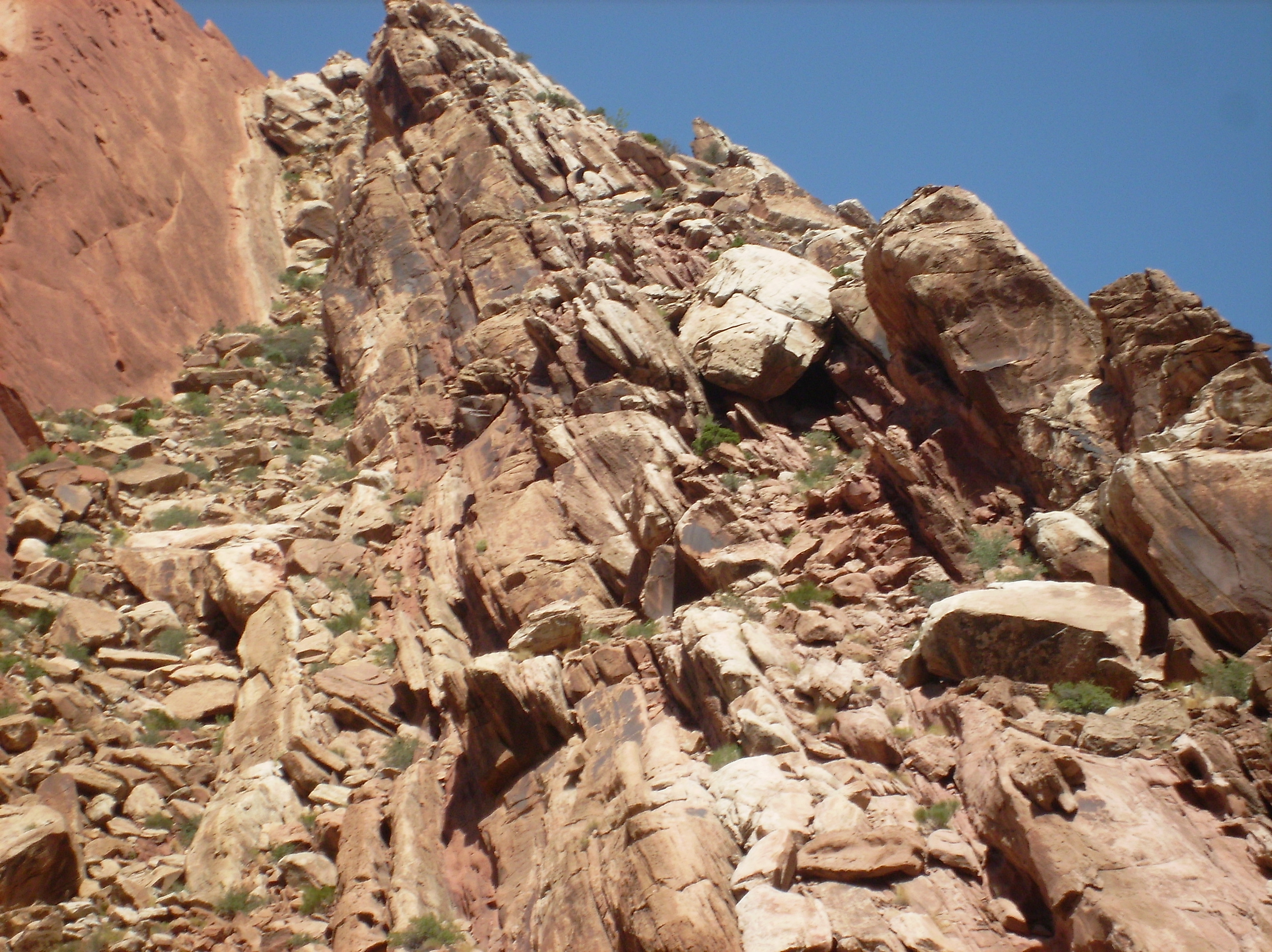
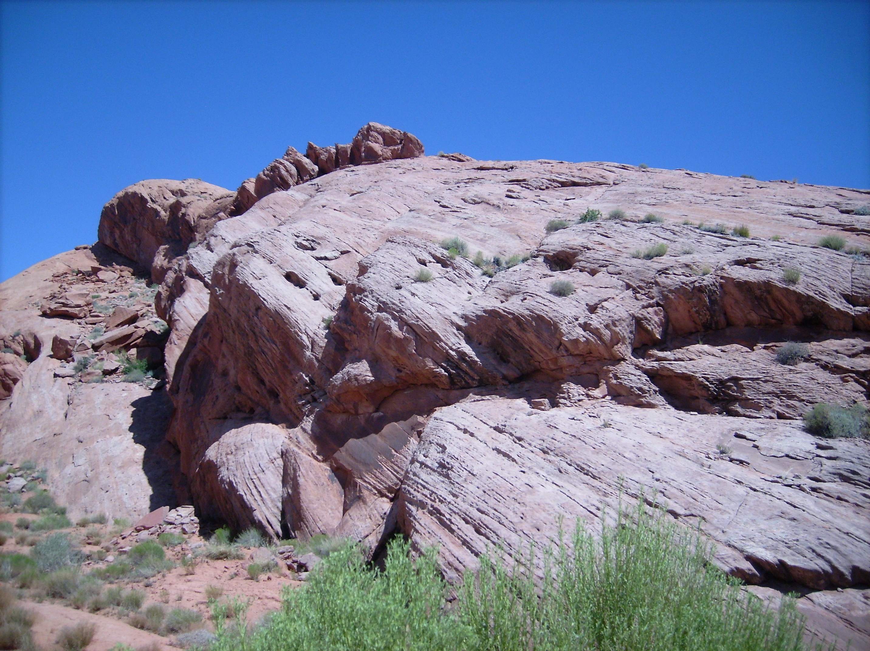
Mars is a desolate planet. Mostly sand and rock. The planet retains a remanent magnetism, but there is no active planetary circuit like Earth’s. Compared to Earth, it’s atmosphere is exceedingly thin. It can raise a dust storm, but no rain. We hear theories that Mars has lot’s of water somewhere deep inside, and indeed we’ve found enough to wet a teacup, but no rivers to carve canyons. Especially not one six-miles deep. There is no evidence on Mars to indicate Valles Marineris was carved by a river of any kind.
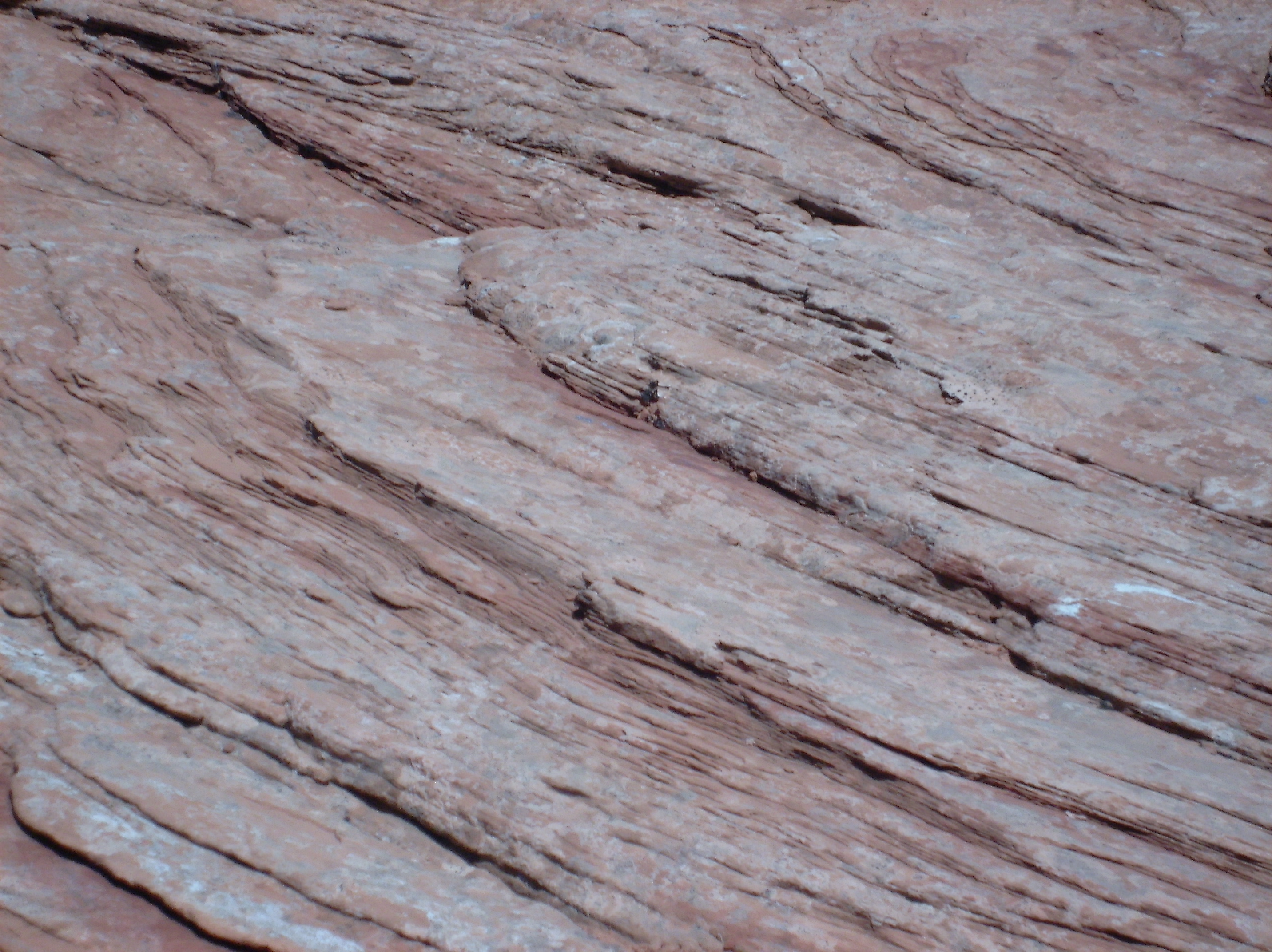
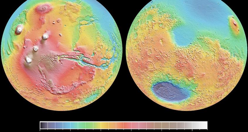
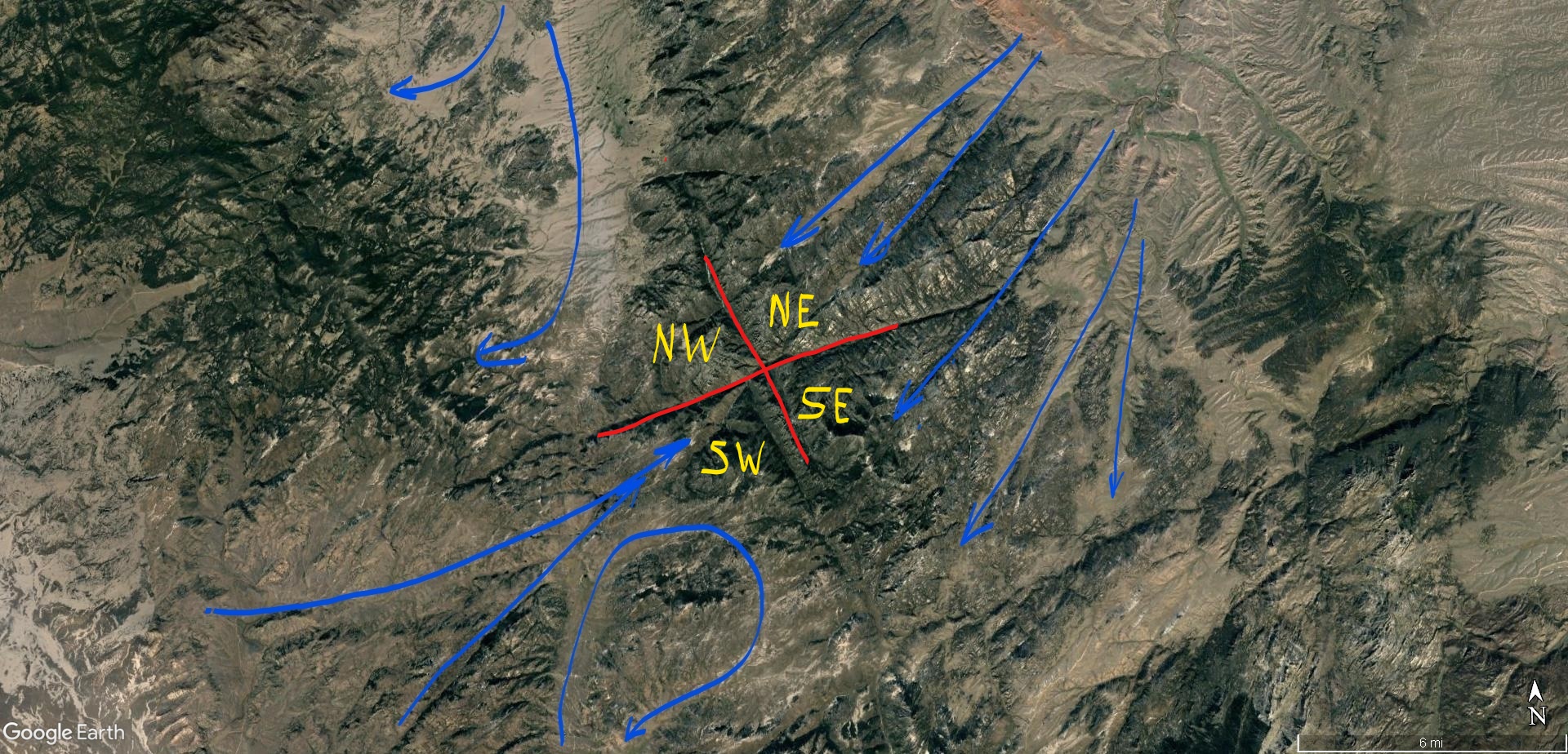
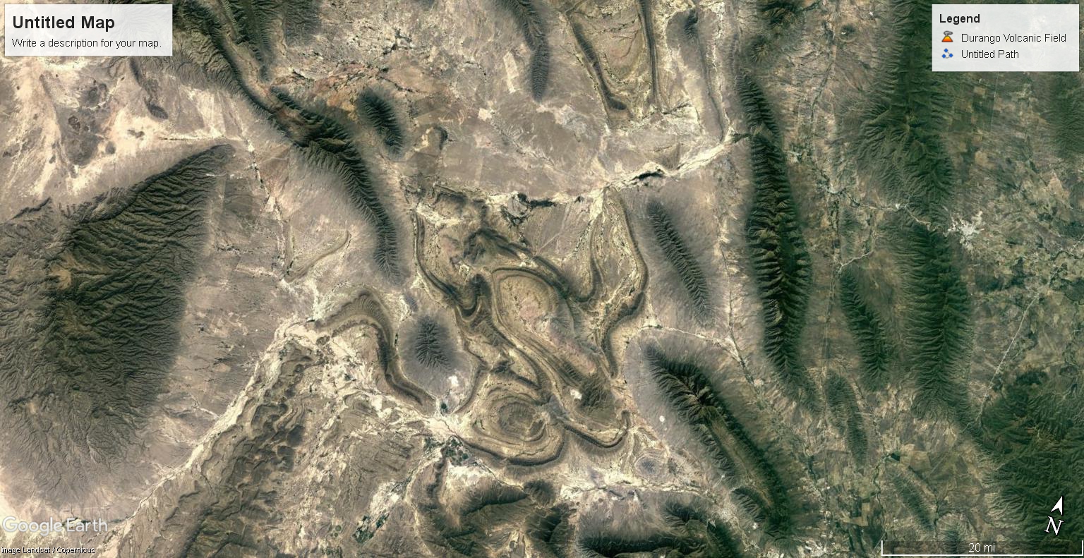
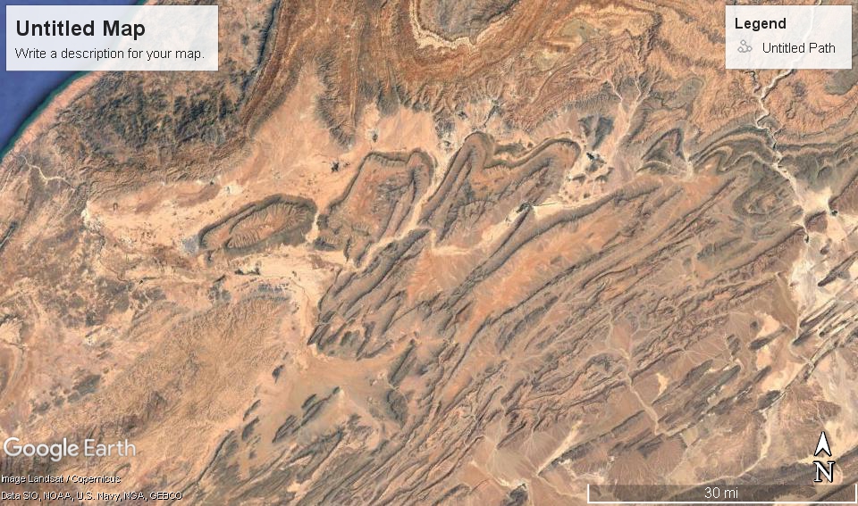
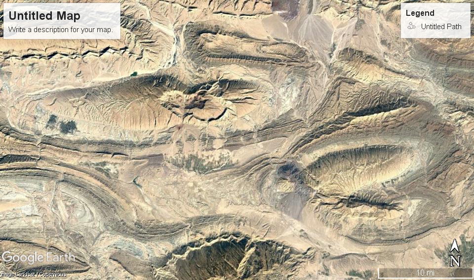
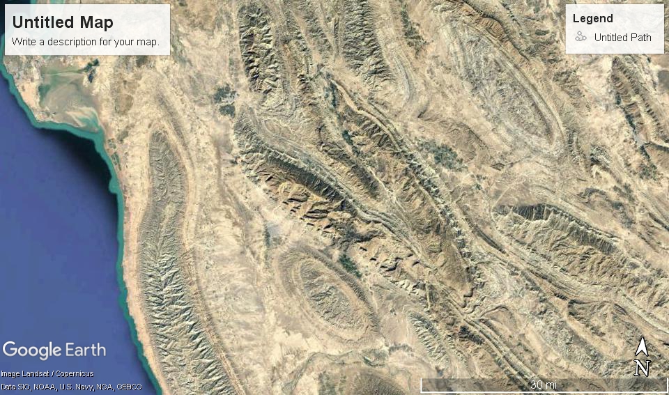
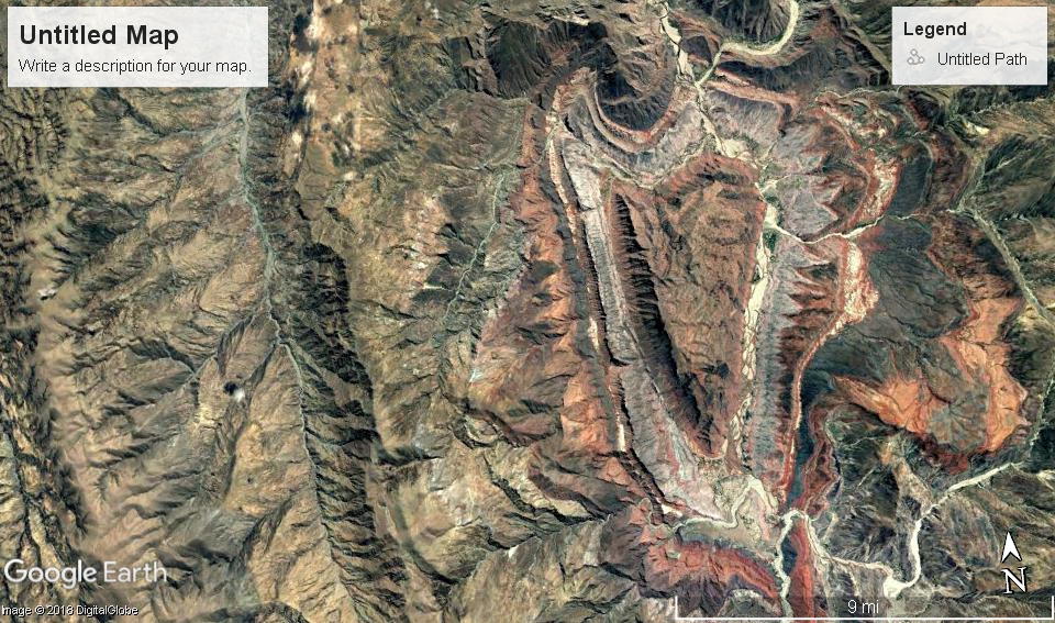
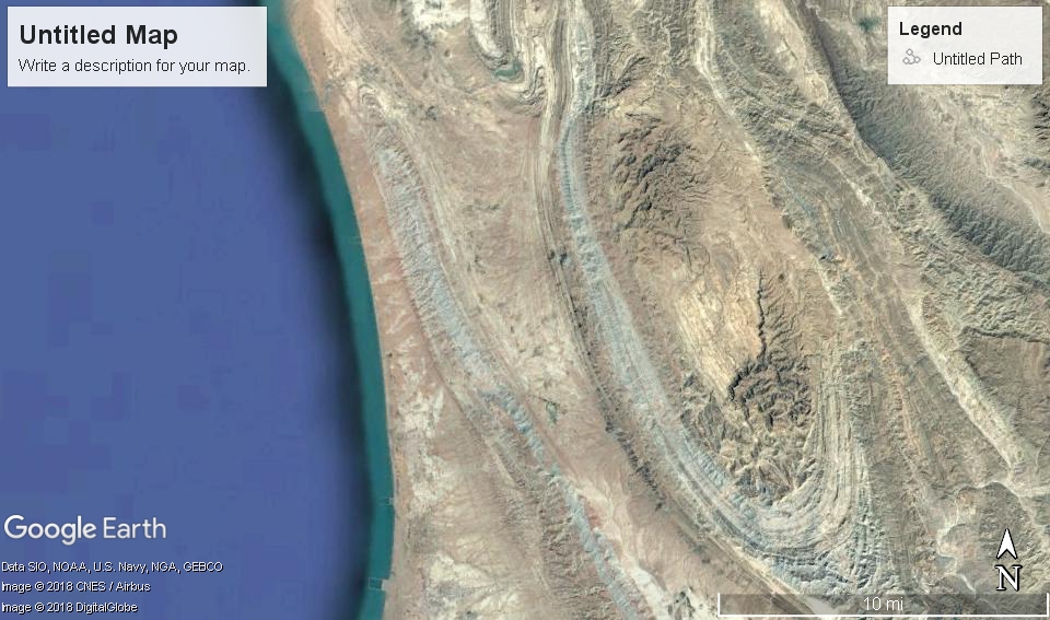
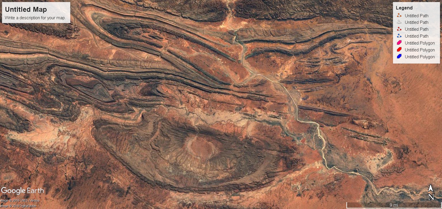
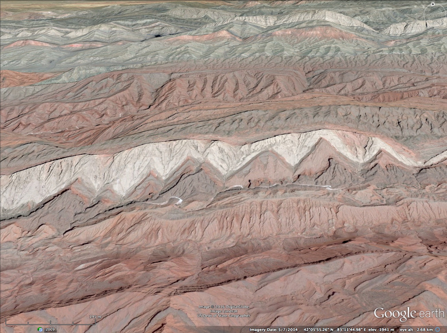
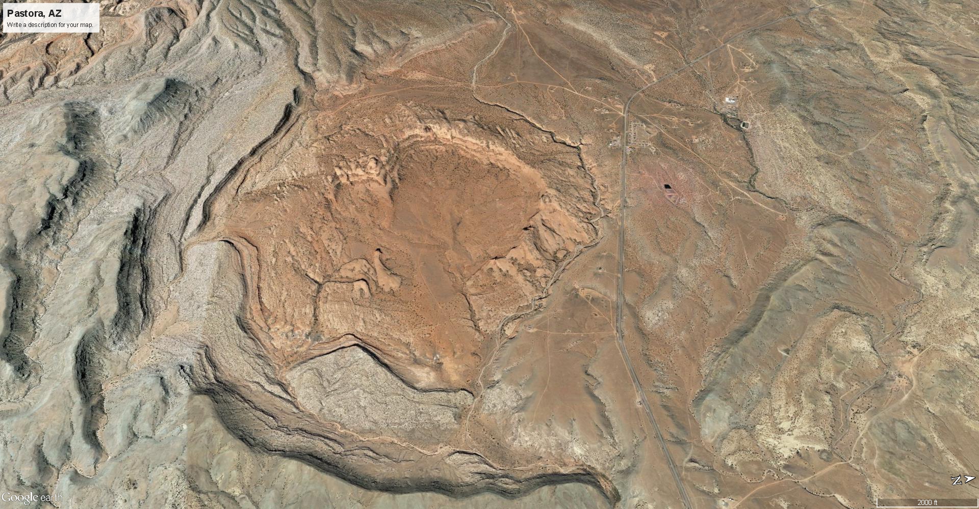
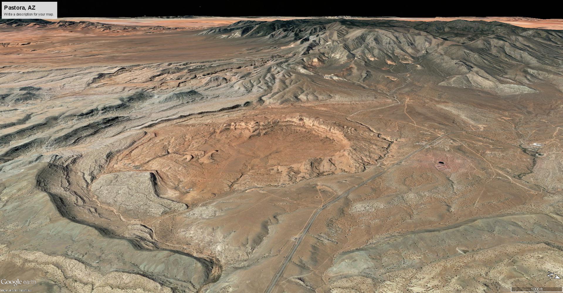
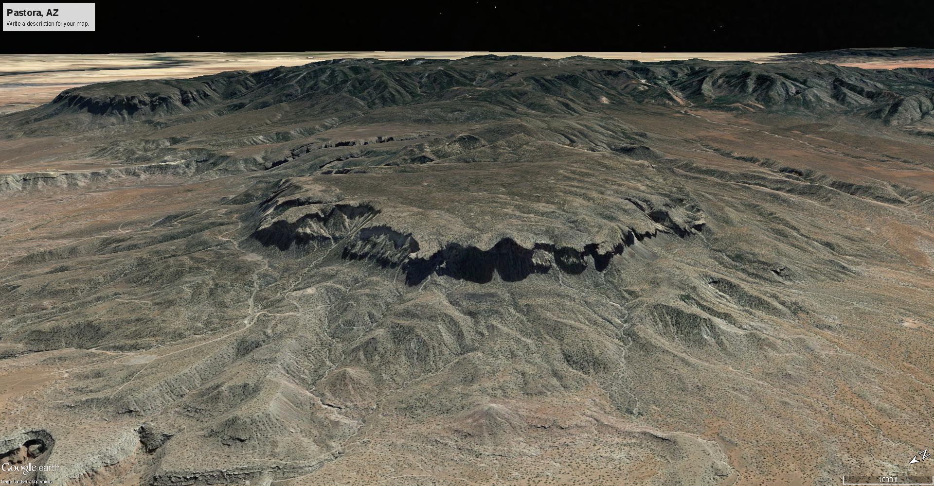
It resembles cuts made by a radial saw, not meandering water. There is a particular symmetry to both the canyon and it’s surroundings. The canyon is composed of parallel linear cuts, which divides the plateau it pierces into a figure-eight, with a ring of highlands and a ring of lowlands neatly segregated by the canyon. Beyond the west limb of the canyon, Tharsis Mons rises like three mice in a row, triangulated almost perfectly by Olympus Mons.
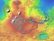


The entire Tharsis Mons structure is counterbalanced across the breadth of the canyon by giant craters – including the very deepest places on the planet. The Hellas Planitia and Argyre crater are anomalous sinks in the highlands, juxtaposed across the planet from the “volcanoes”, with the canyon smack in between. This is a dipolar symmetry, like anodes and cathodes in opposition across the width of a sphere.

There is no rational theory based on tectonic forces, volcanism, erosion, or impact that explains the collective symmetry of features, so it is ignored by “curious” scientists. However, classical physics does have an answer for anyone who chooses to find the truth.
Capacitor overload explains the gash, the dipolar symmetries, the craters and the other features. It doesn’t explain the cause, but if we listen to the ancients along with the evidence we get significant clues, because the stories always mention Venus. The discharge left a distinct pattern on the planet that tells the story of that day. This explanation can, and has, in part, already been demonstrated in the lab.
Capacitors fail explosively. They fire a spark from the inside-out, and blow a hole in their casing, sending a sonic shock-wave, sparks and molten-matter flying. Valles Marineris is the scar of a discharge from the interior of Mars, because the energy entering the planet exceeded the planet’s energy storage capacity.
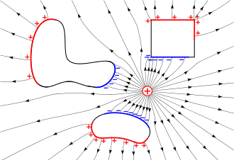
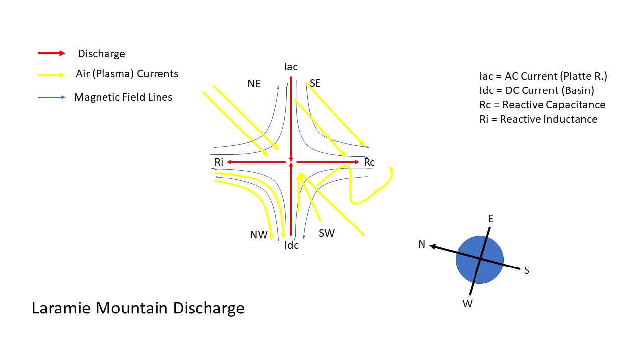
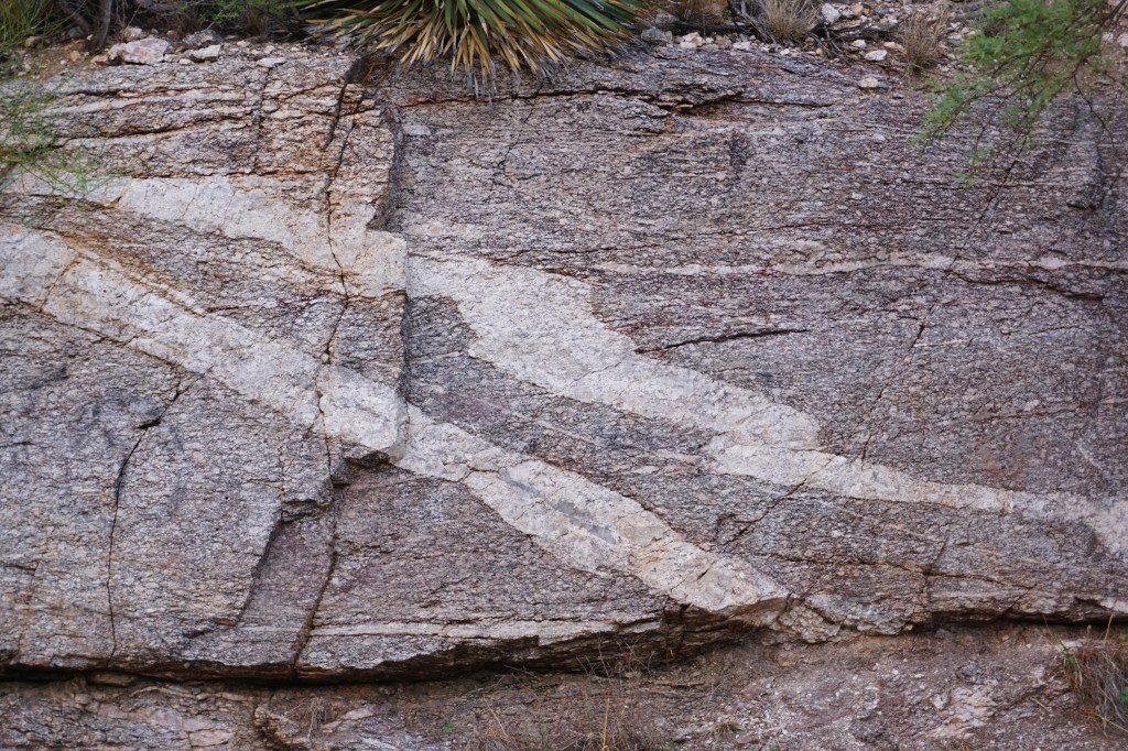
The straight-cut gash of the canyon itself is clear visual evidence of electro-magnetic forces. But the gash is not as straightforward as a simple cut from a plasma torch discharging through the planet’s crust. It is part of larger pattern that involves spherical capacitance, magnetic induction, drift currents, sputtering discharge and redistribution of matter. It is a pattern both anodic and cathodic, displaying dipolar alignments, multiple arc discharges and glowing plasma circuits shaped by magnetic induction.
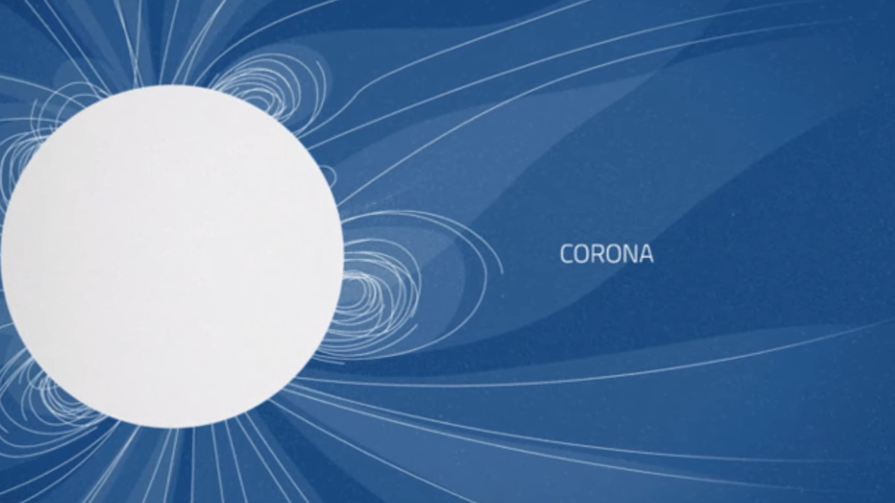
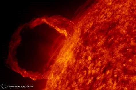
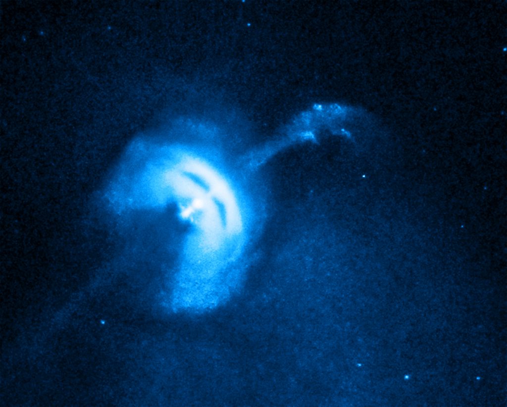
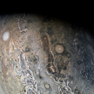
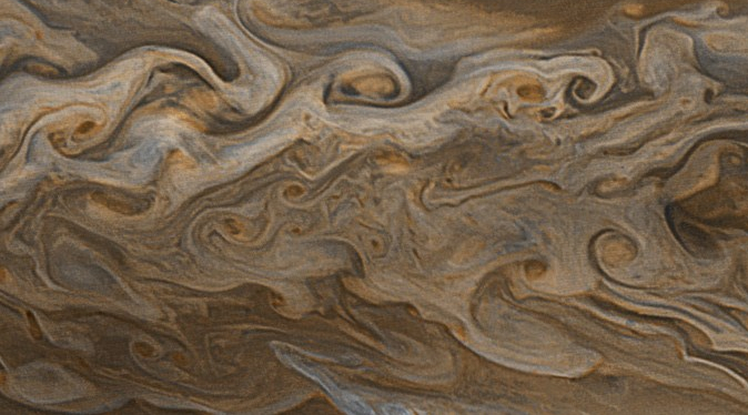
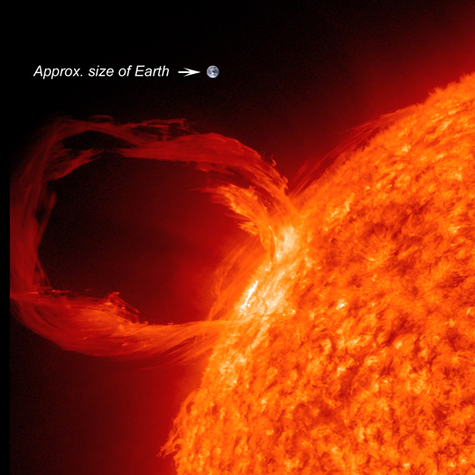
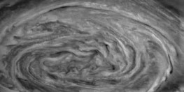
The best comparison to make is with a solar storm. Solar storms are examples of the Sun’s spherical capacitance in discharge mode. The Sun is always discharging, but Mars did it one time because of a sudden catastrophic overload. For either case, what the sparks do is very similar: they follow the magnetic fields.

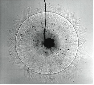
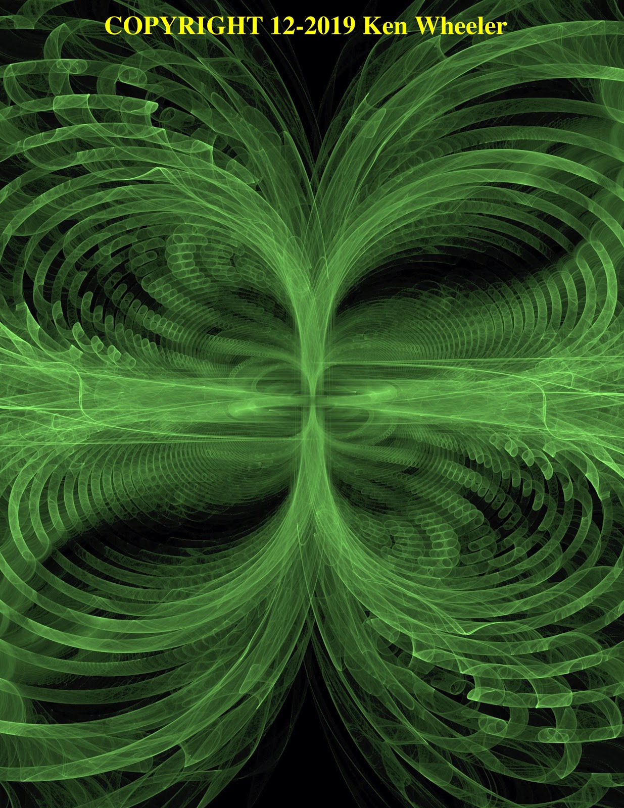
A blown spherical capacitor shoots violent, relativistic, arc-mode currents radially from the surface of the sphere, producing magnetic fields around the discharge. A Solar discharge, sometimes called a flare, does the same, creating similar magnetic field patterns. We can compare a solar storm with Valles Marineris and see these similar patterns, particularly the figure-eight magnetic field of an electric dipole.


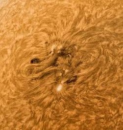


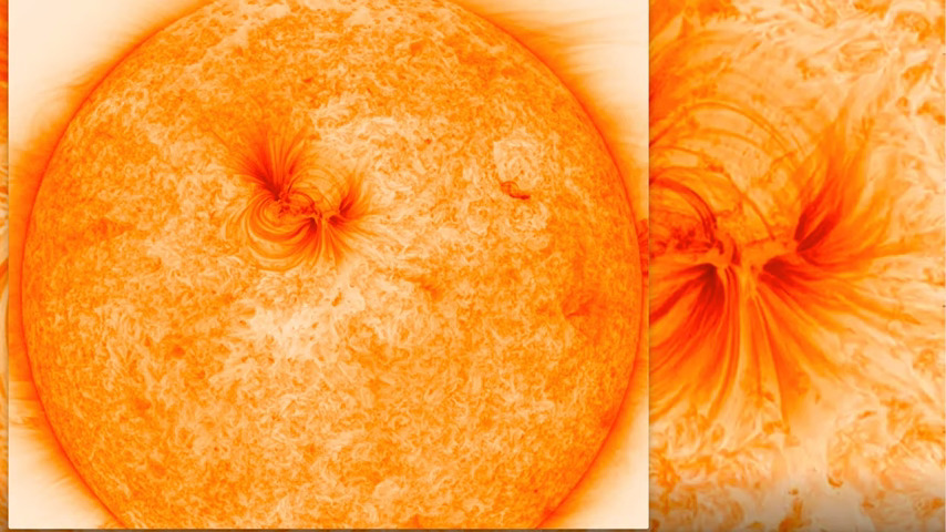
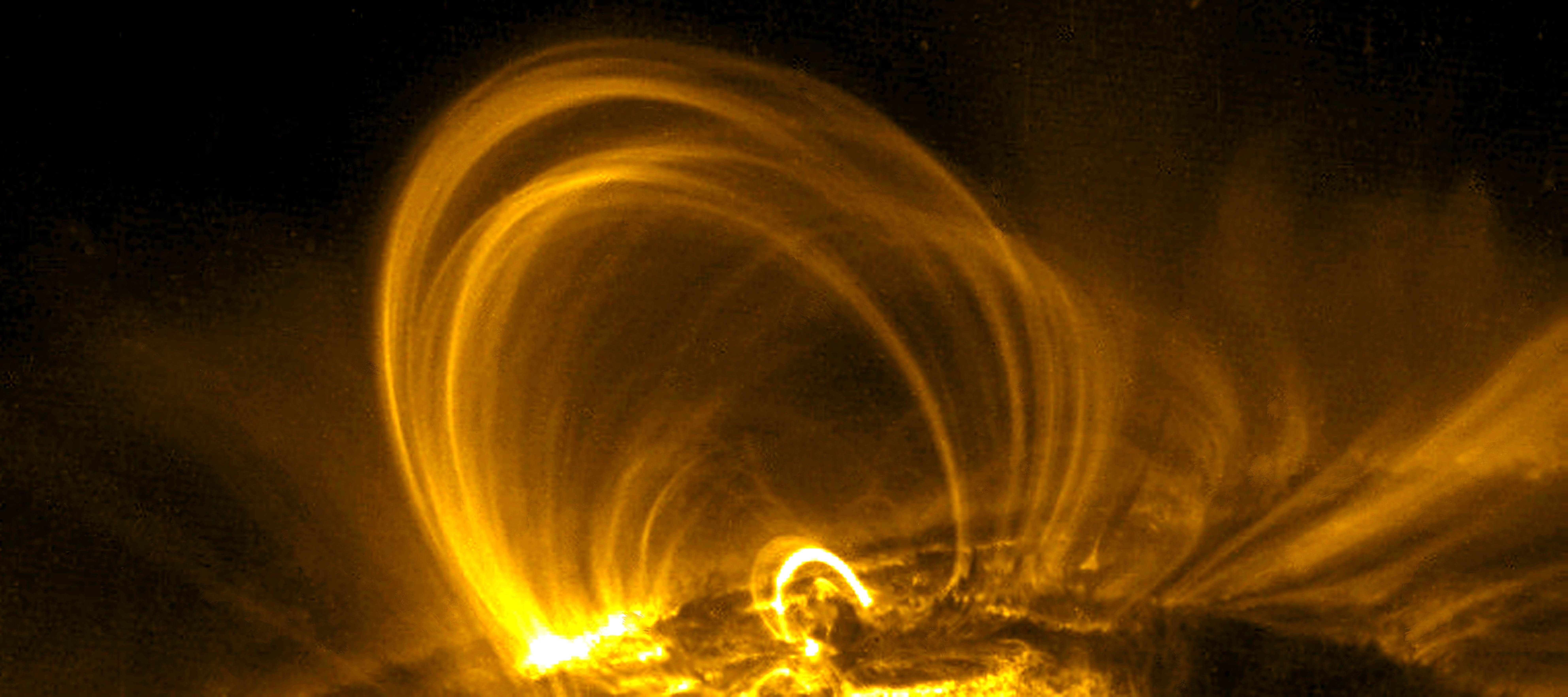
The figure eight pattern is due to the electric dipole, which is from currents rising and falling vertically with respect to the crust in coronal loops. The pattern isn’t unique to a blown capacitor. It’s not unique to the Sun, Mars or any particular electrified body, nor whether it is from an arc-mode discharge, or dark-mode drift currents. It’s a feature of the circuit pattern and the dipole it creates that causes the figure-eight E-M field under any of those conditions. So the circuit pattern can be recreated, and has, to produce similar results.
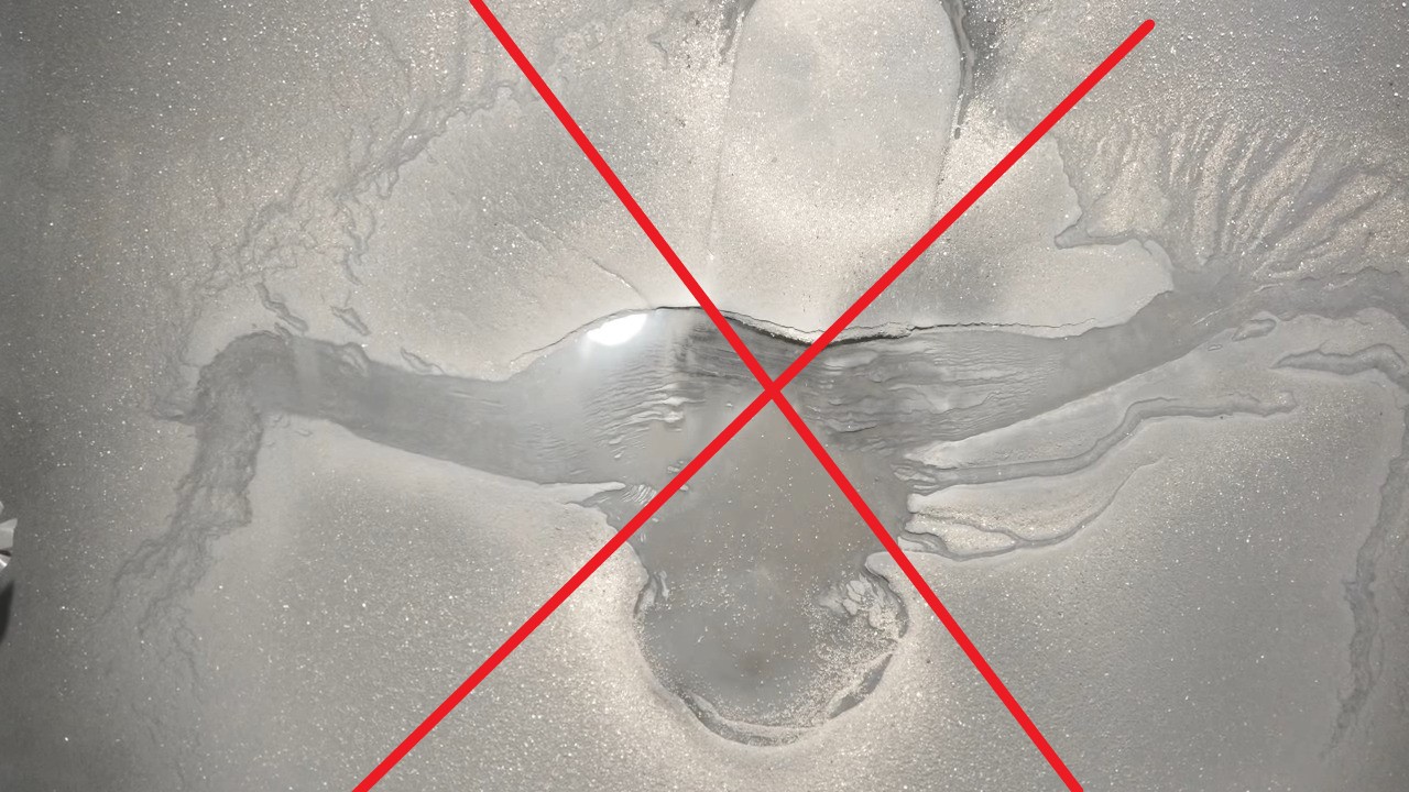


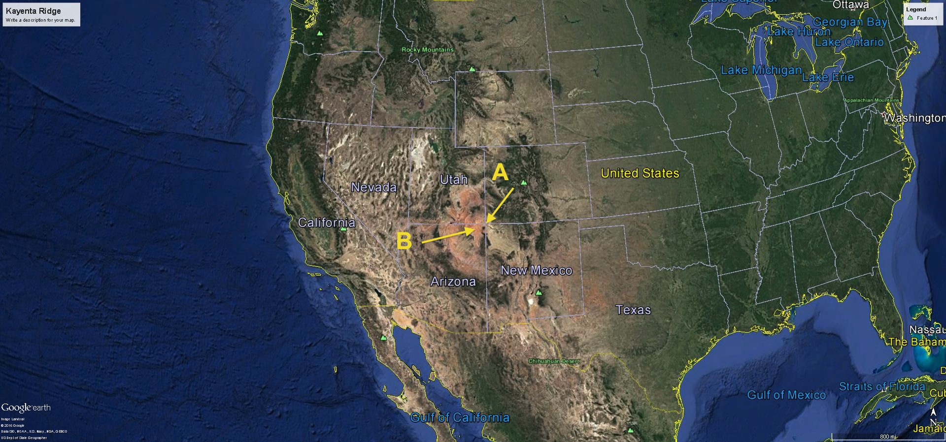
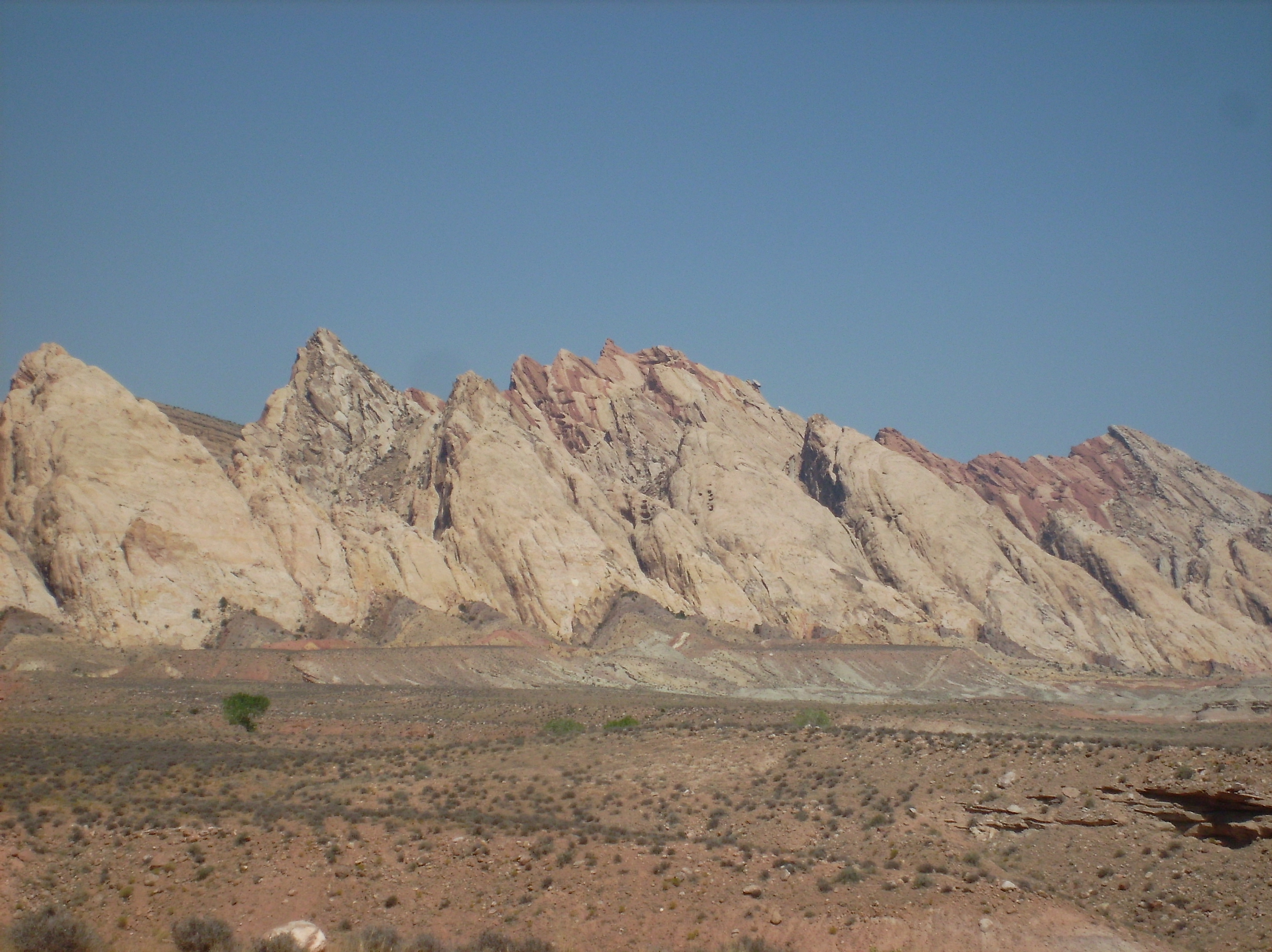
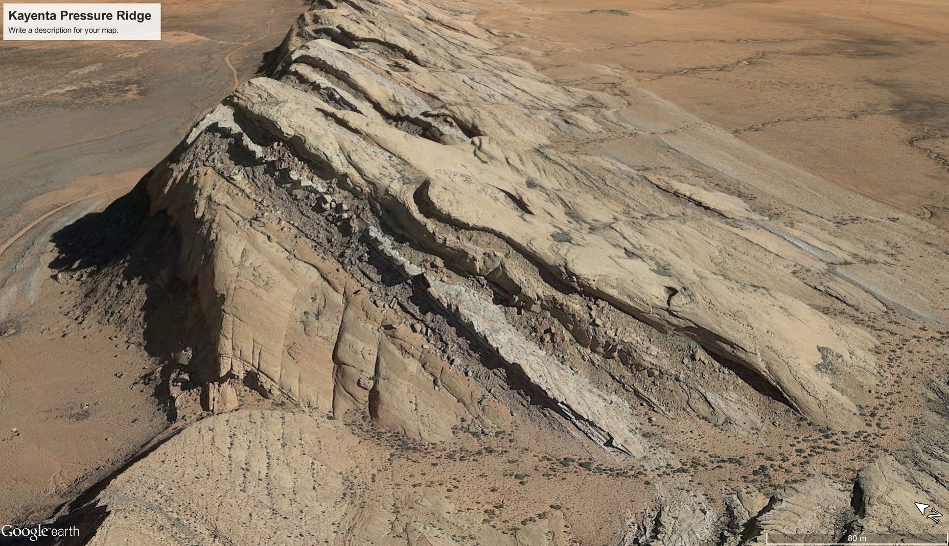
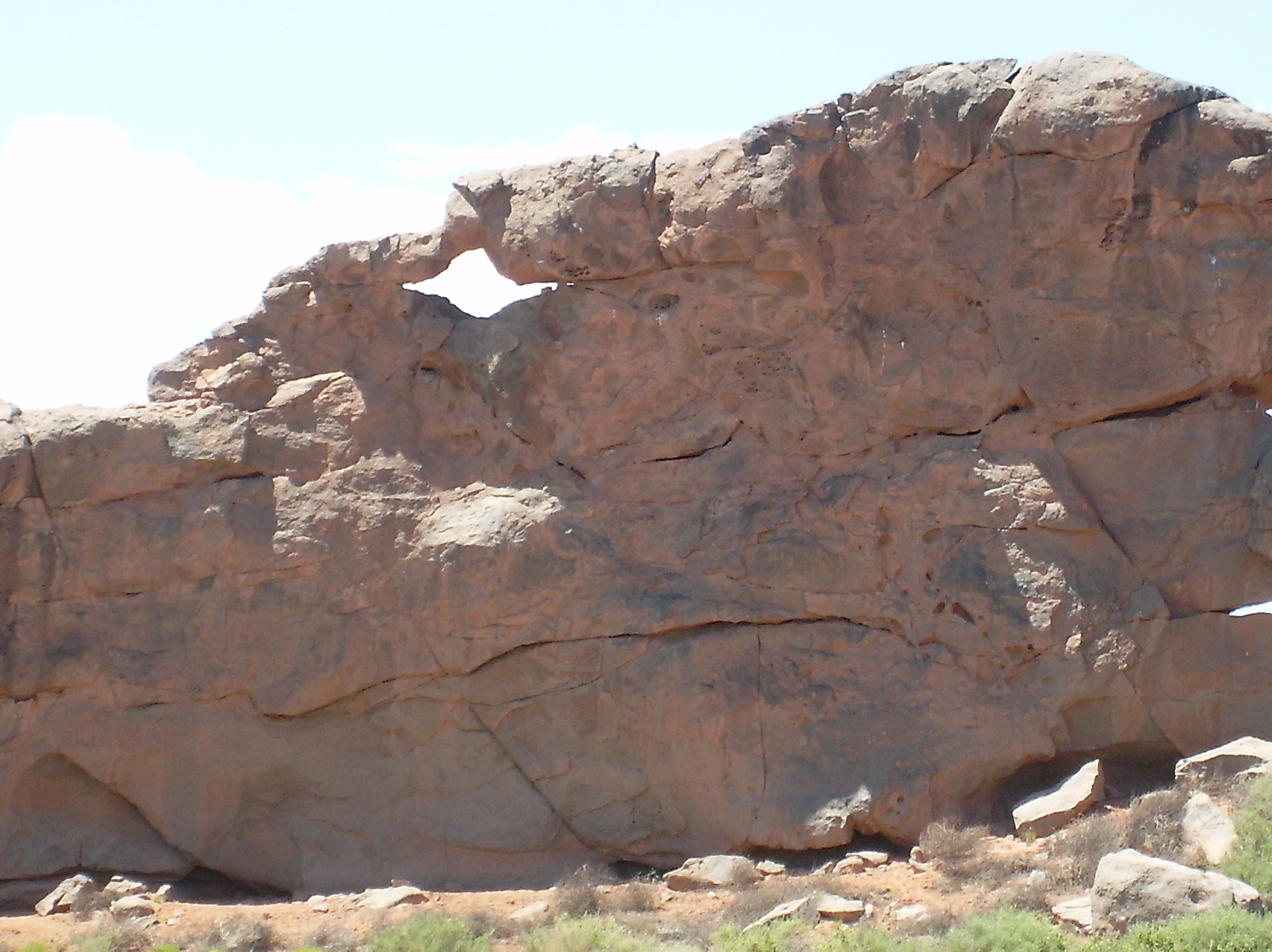
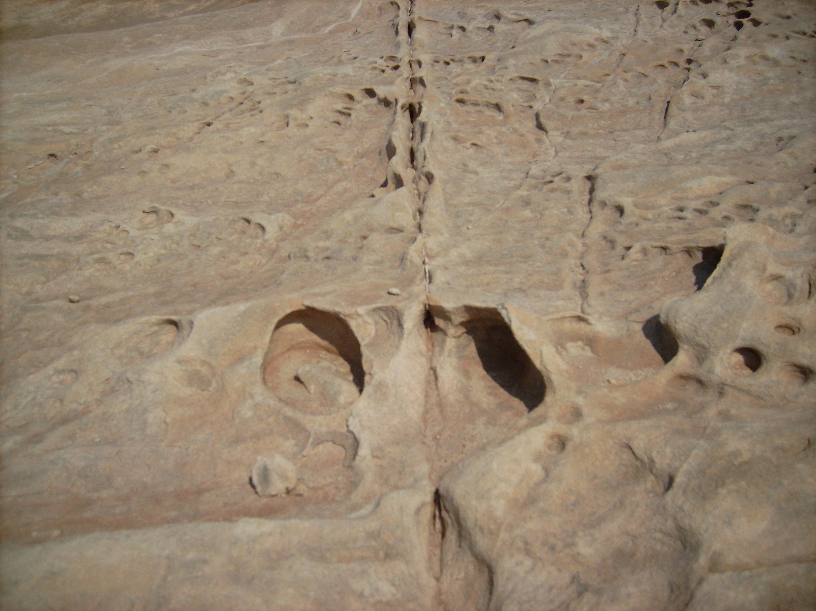
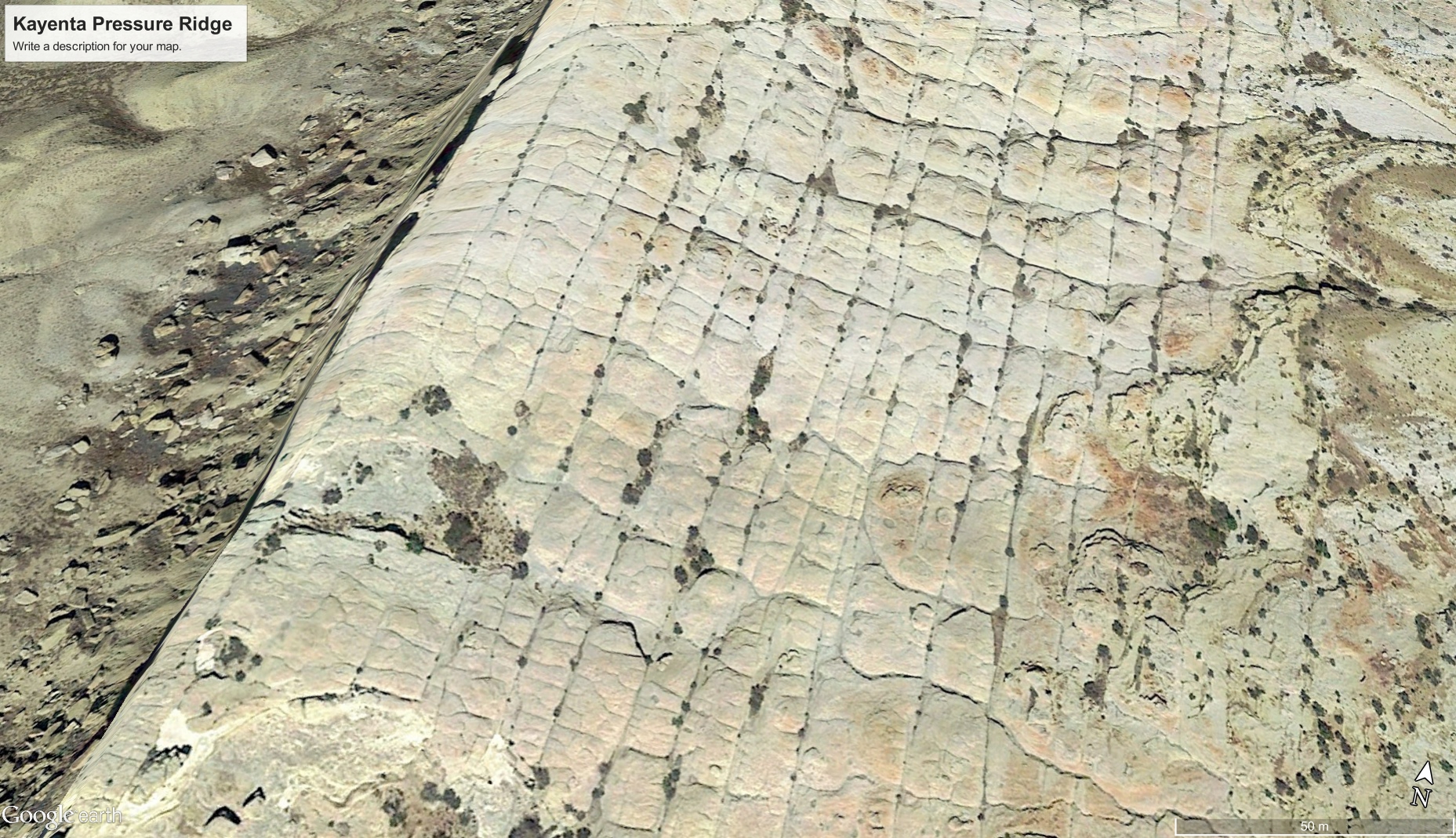
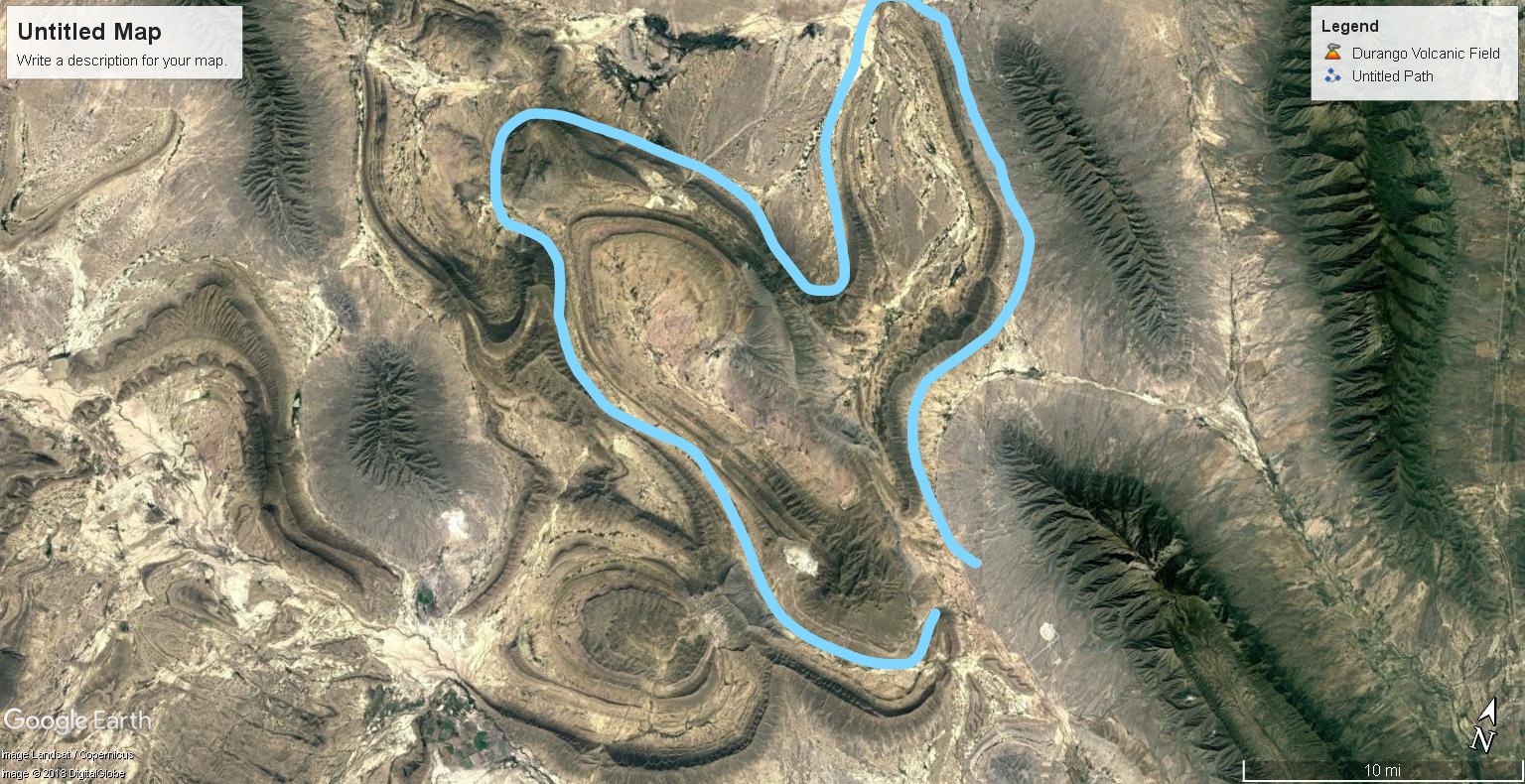
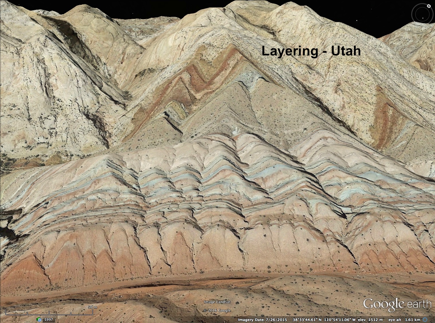
Michael Steinbacher and Billy Yelverton produced what they termed the “Crooked Smile”, which is in the same pattern as Valles Marineris. The entire experiment can be viewed at Thunderbolts.info: “Valles Marineris in the Laboratory?” I’ll just point out three observations important to the circuit.
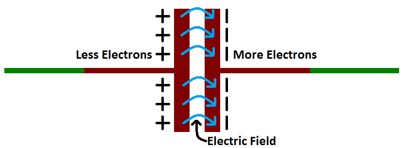
- They laid a dielectric layer over a grounded layer, producing capacitance between the electrodes and ground.
- The electrodes were composed of a matrix of pins to distribute charge, hung above the dielectric layer, to create a wide discharge column across an air gap.
- They sprinkled sand above the air gap over the plate so as to allow each grain to acquire charge as it drifted through the electric field.
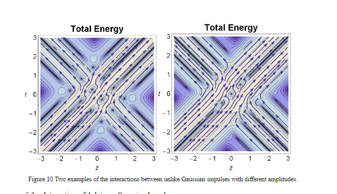
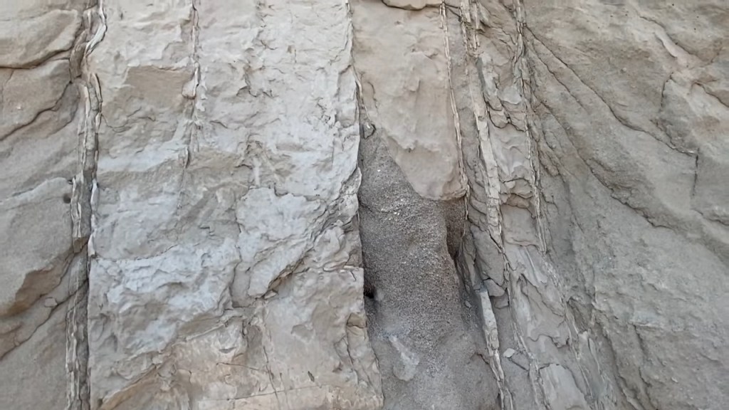
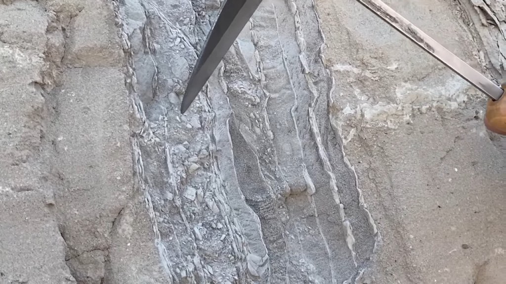
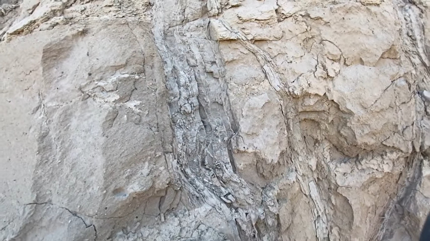
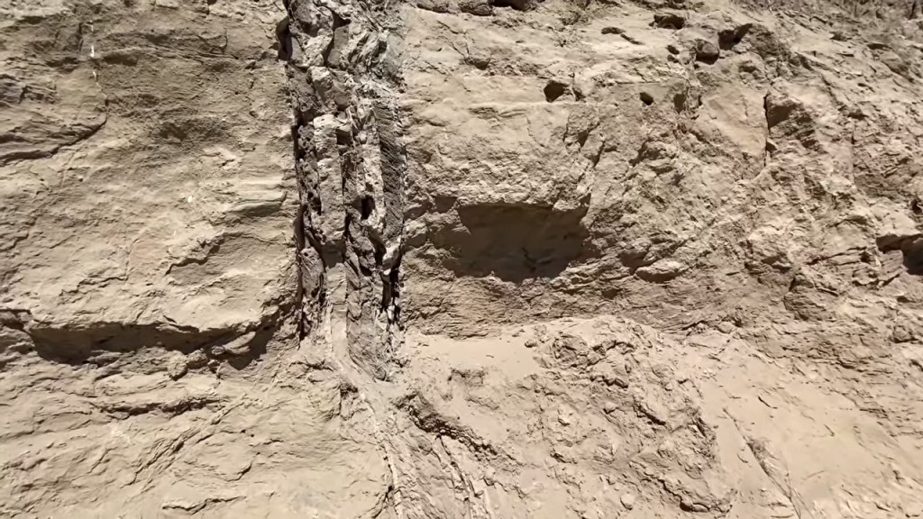
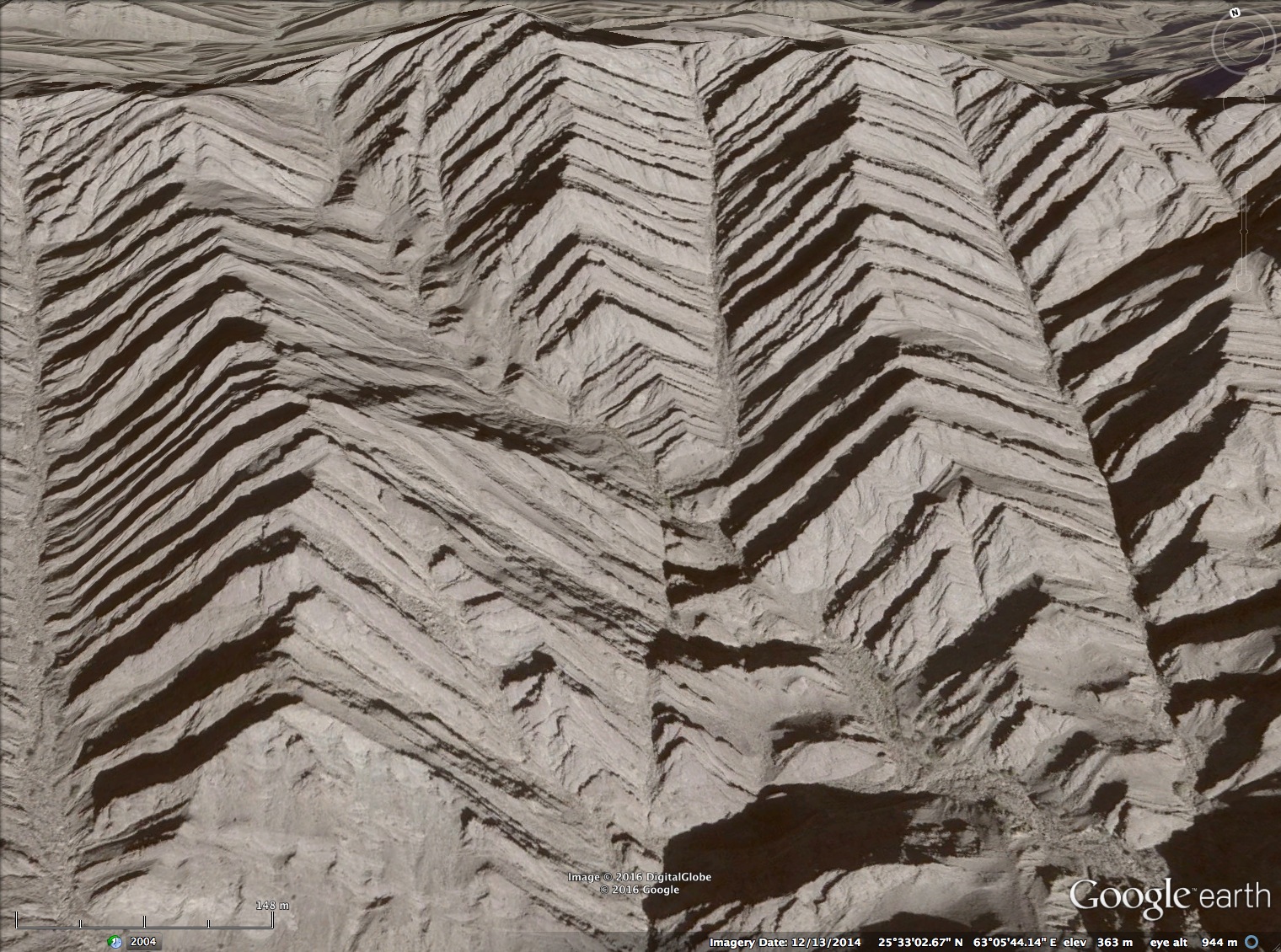
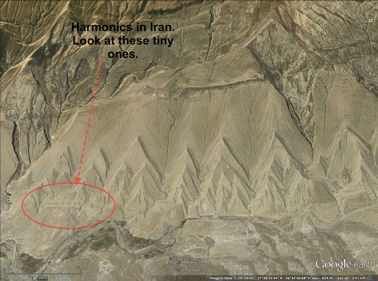
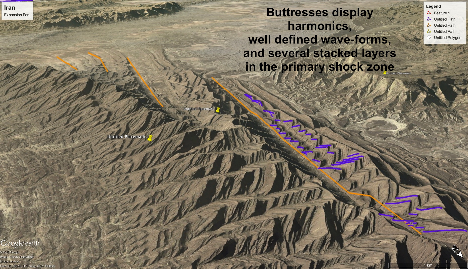
The sand landed either in layered deposits, or didn’t, leaving a sand-free surface. It’s the sand-free surface that takes the canyon’s crooked smile pattern. The crooked smile is an interference pattern caused by the capacitor layer, because it delays return currents by 90 degrees of phase. There is also a delay between actions of the electric field and the magnetic field, because the magnetic field lags. So what results is a multi-phase interference pattern of charge-saturated and desaturated zones on the dielectric plate that the charged sand is either repelled from, or attracted to.

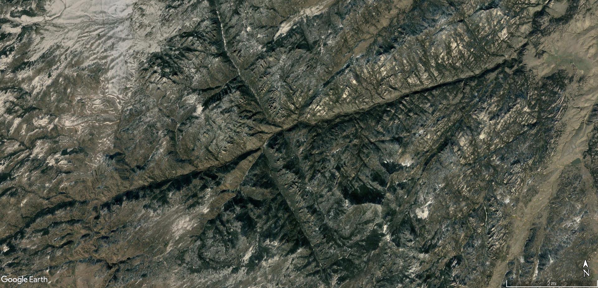


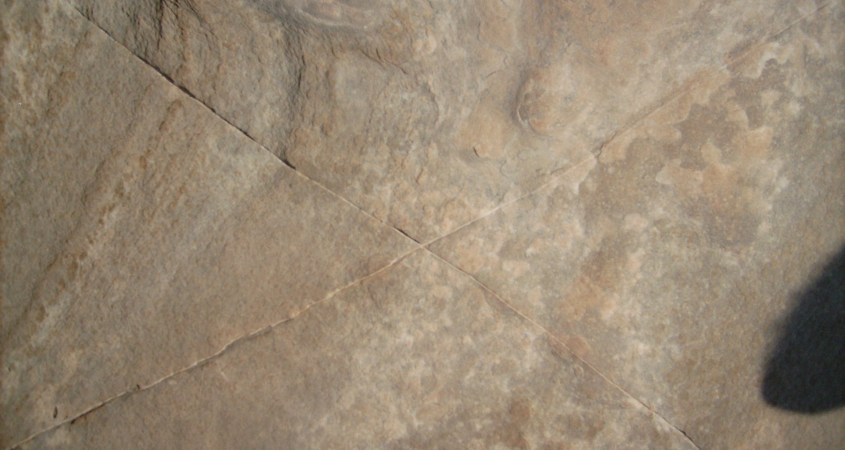
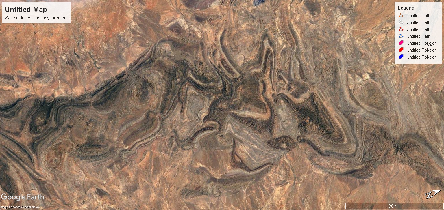
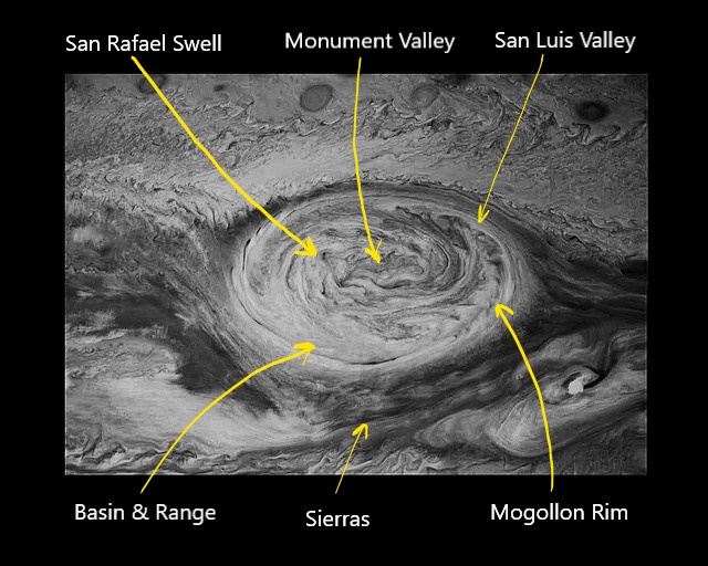
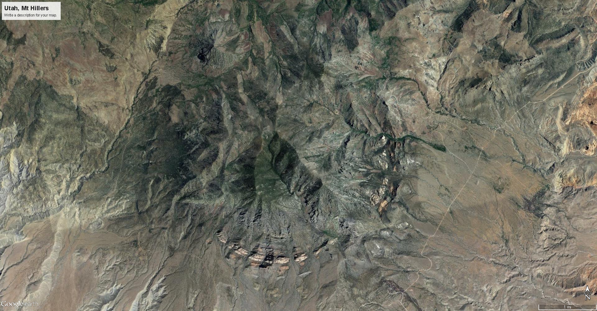
A similar, more complex interference pattern is described in “The Keystone Pattern“, “The Cross from Laramie” and “Granite Cauldron and the Boiling Boulders“; articles that present similar discharge patterns here on Earth caused by plasma storms. The Keystone Pattern, like the Crooked Smile, is caused by reactive currents surrounding a discharge current. Reactive currents are magnetic and electric field induction currents that are patterned by the E-M field as the discharge passes through a dielectric layer.


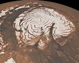
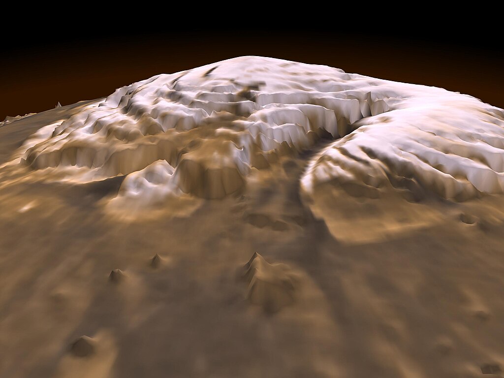
The appearance of Mars suggests an enormous EMP struck the north pole, which spread surface charge across the crust of the planet. This would have stripped away the original atmosphere leaving a dense plasma of charged dust particles and gases. It also left a charged layer of soil, which immediately sputtered – lifted off the planet into plasma winds by the coulomb force between the crustal surface and the electrified atmosphere. The winds deposited the dust surrounding the oppositely charged, southern pole. This is why Mars, like the Moon has regolith piled on one hemisphere and not the other.
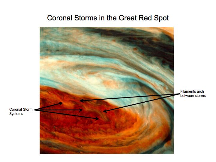
Charge spread both inside and outside the planet’s crustal layers to saturated capacity and ultimately overload. The explosive discharge left anodes – volcanoes; and cathodes – craters, where looping coronal discharge issued from the planet. The canyon and figure eight is at the center of this discharge, beneath the coronal loops, where filaments of magnetic induction were the strongest.
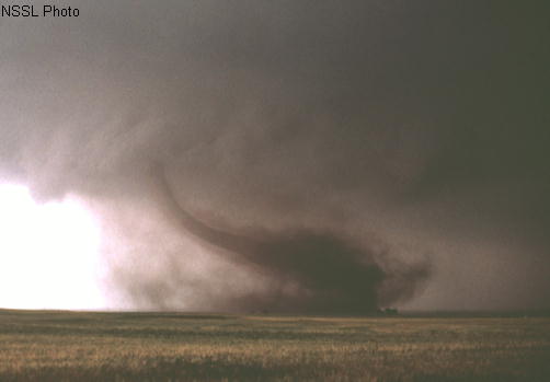
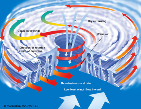
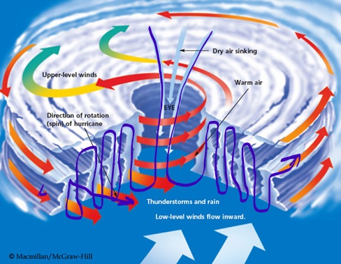
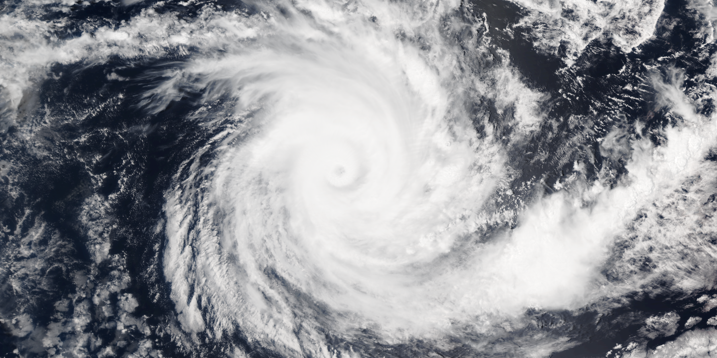
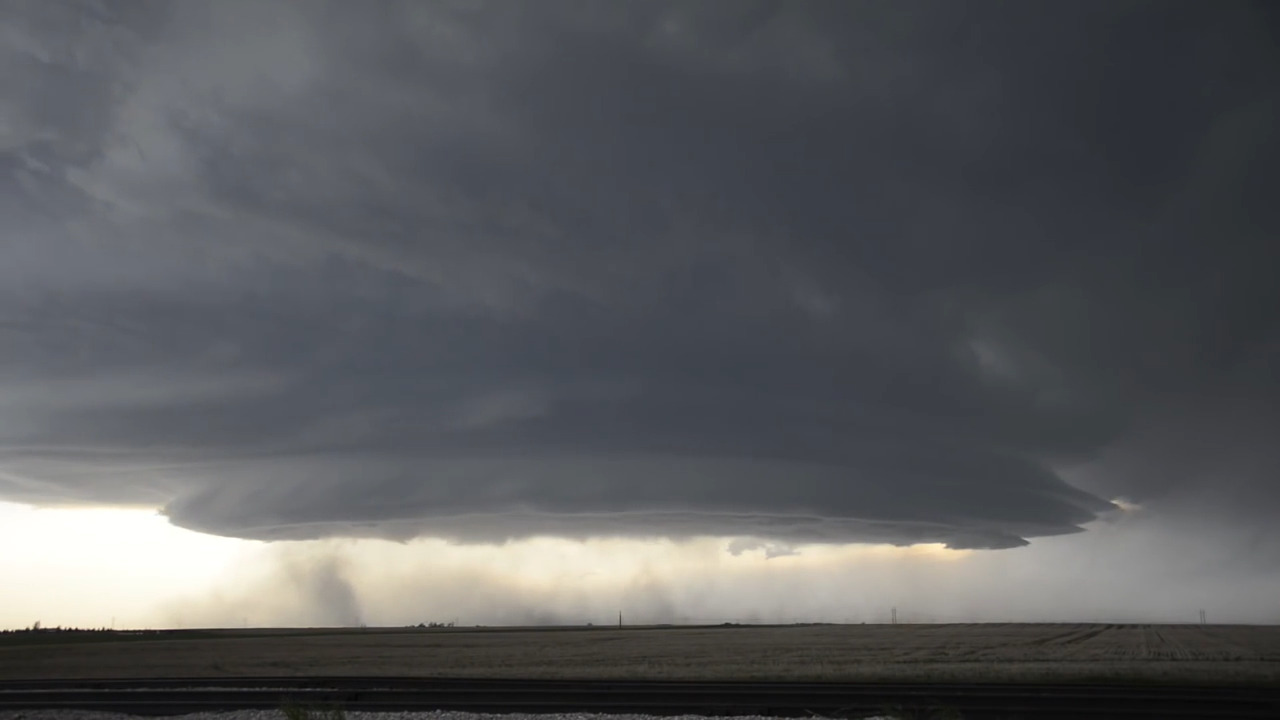
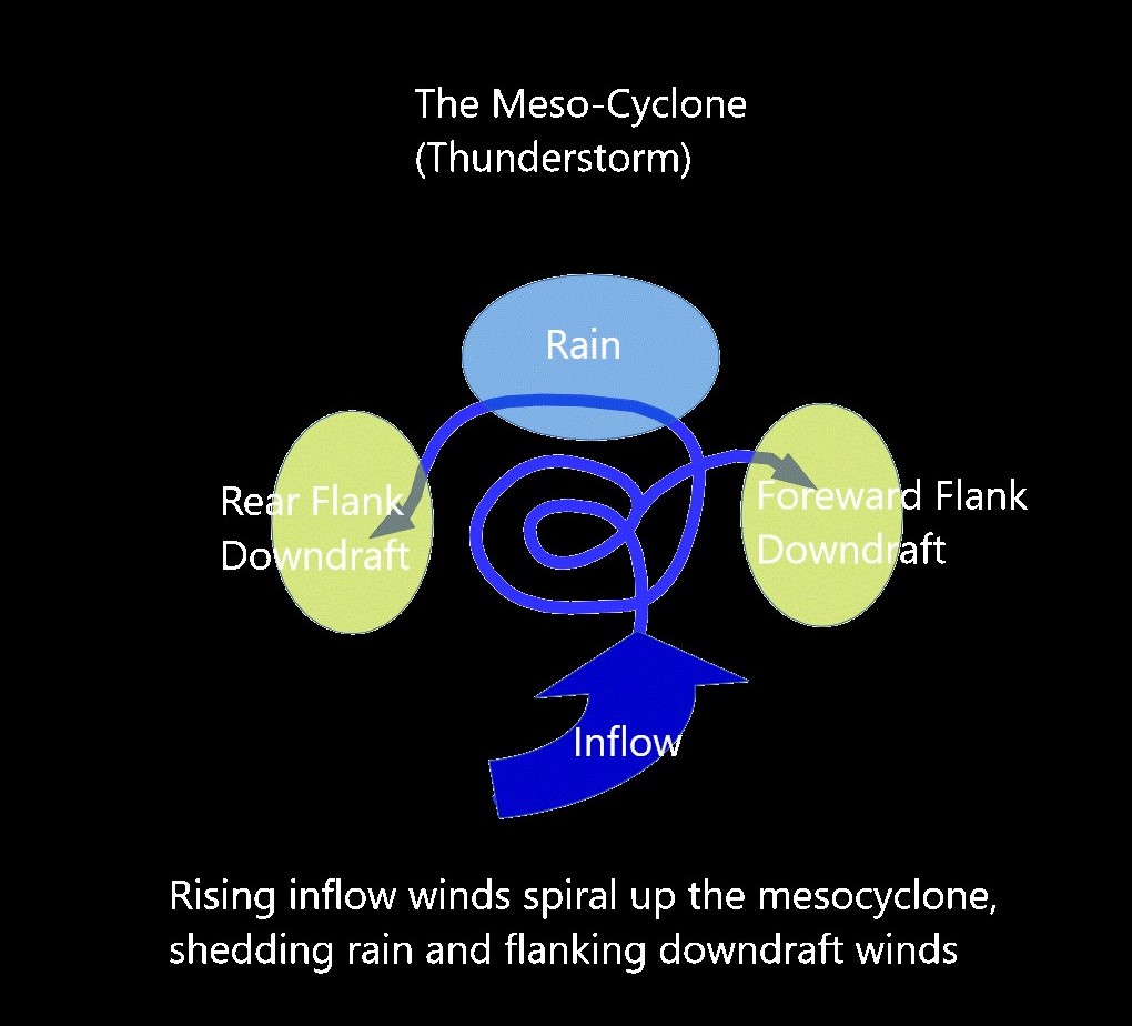
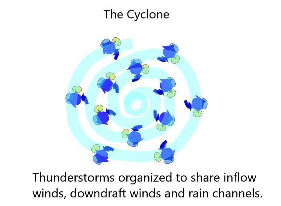
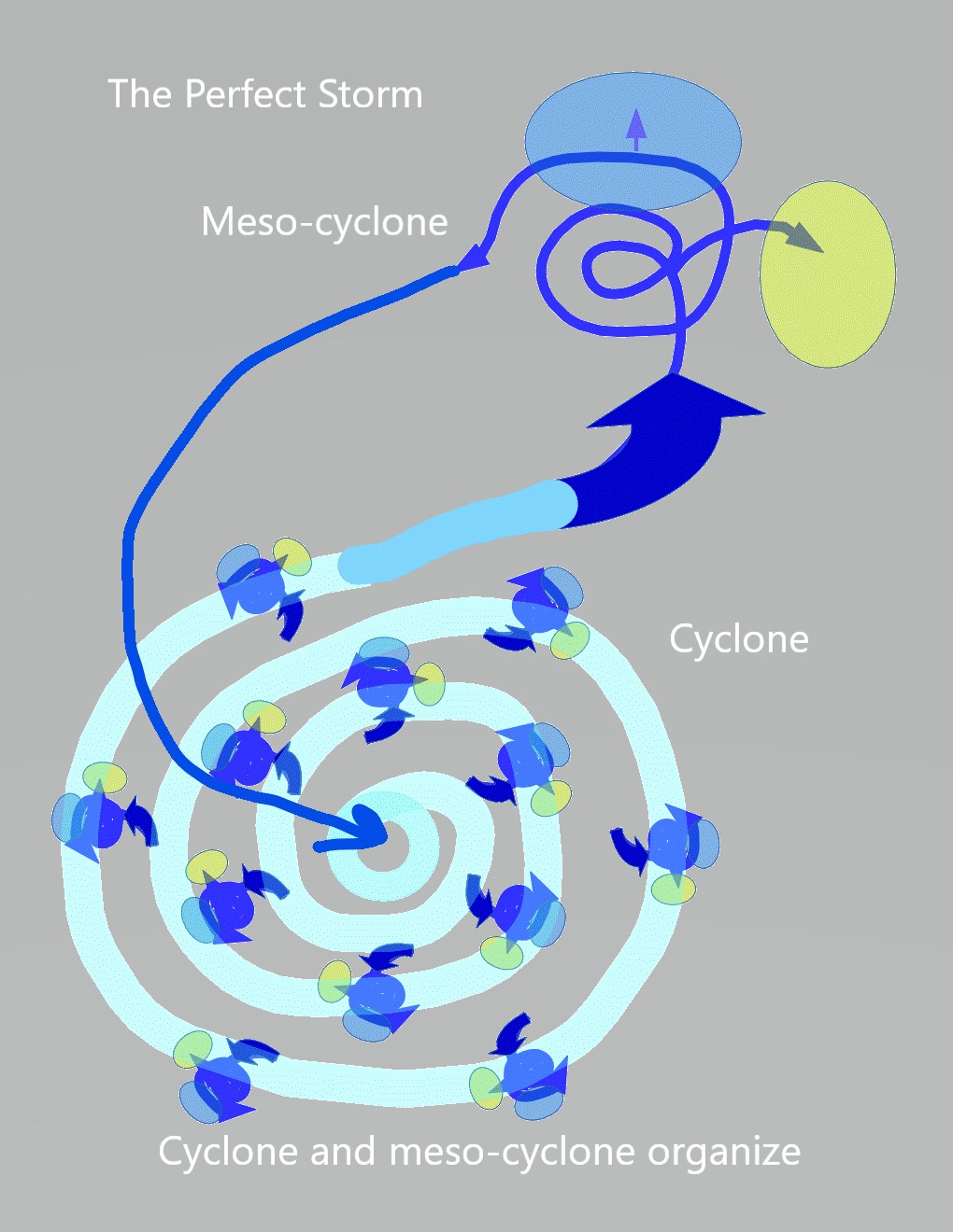
It’s what electricity does in a spherical capacitor – store away as potential energy and discharge as capacitance is reached – and Earth and planets with atmospheres are spherical capacitors because we can actually see, feel and hear Earth discharging. We see it on Saturn, Jupiter, Venus, Uranus and Neptune as well. Any thunderstorm will prove it. In fact any natural atmospheric phenomena you can name: aurora, clouds, lightning, hurricanes and tornadoes are the actions of a spherical capacitor inducting and discharging, as are earthquakes and volcanoes. One testable RLC mechanism explains how planets work. Climate models don’t account for this, which tells you how important it really is.
Electrically speaking, the Earth, stars and planets are RLC circuits inside an electro-magnetic bubble that create an internal electric field. That field is contained, like the pressure inside a bubble, inside the spherical layers of multi-junction capacitance created by the planetary crust, atmosphere and plasma-sphere. It doesn’t matter if the “crustal” layers are solid, liquid or gaseous plasma. They are dielectric layers that form capacitance in the circuit. They also reflect energy back into it’s interior, making the bubble a resonant cavity.
The internal electric currents respond to the currents outside the bubble the same way high-side transformer coils do, inducting a higher voltage inside the bubble than exists outside.


Induced currents inside the Earth is modelled by Hans Alfven’s Transformer Model of Earth. It is a model I agree with, but Alfven was only modelling the energy coming in. He did not include the circuitry of energy storage and discharge, which is the capacitor in the circuit. It’s a necessary addition to model the complete RLC circuit.
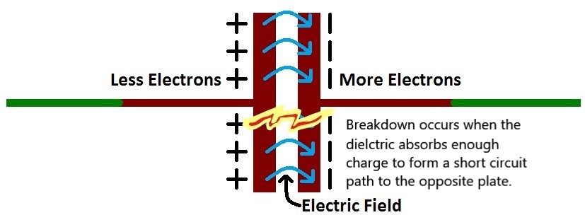
The Earth’s internal electric field radiates from its core to the sheath of the spherical capacitor, vectored in opposition to the external electric field of the Sun, which makes the planetary body an electret. Any electrical stimulation from outside elicits a higher voltage response internally – “As above, so below” – that resonates within the spherical cavity. This amplifies internal currents and excess energy stores in the spherical shells of the containment bubble, while releasing measured amounts of energy through the capacitor to maintain a steady state. At least up to the point where dielectric breakdowns occurs, when the internal electric field gets too strong and starts pushing energy through in a runaway arc-mode discharge.
This is what happened to Mars.


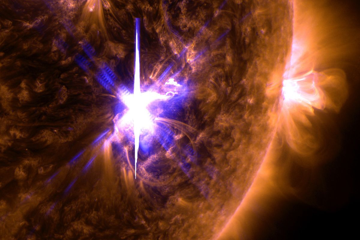
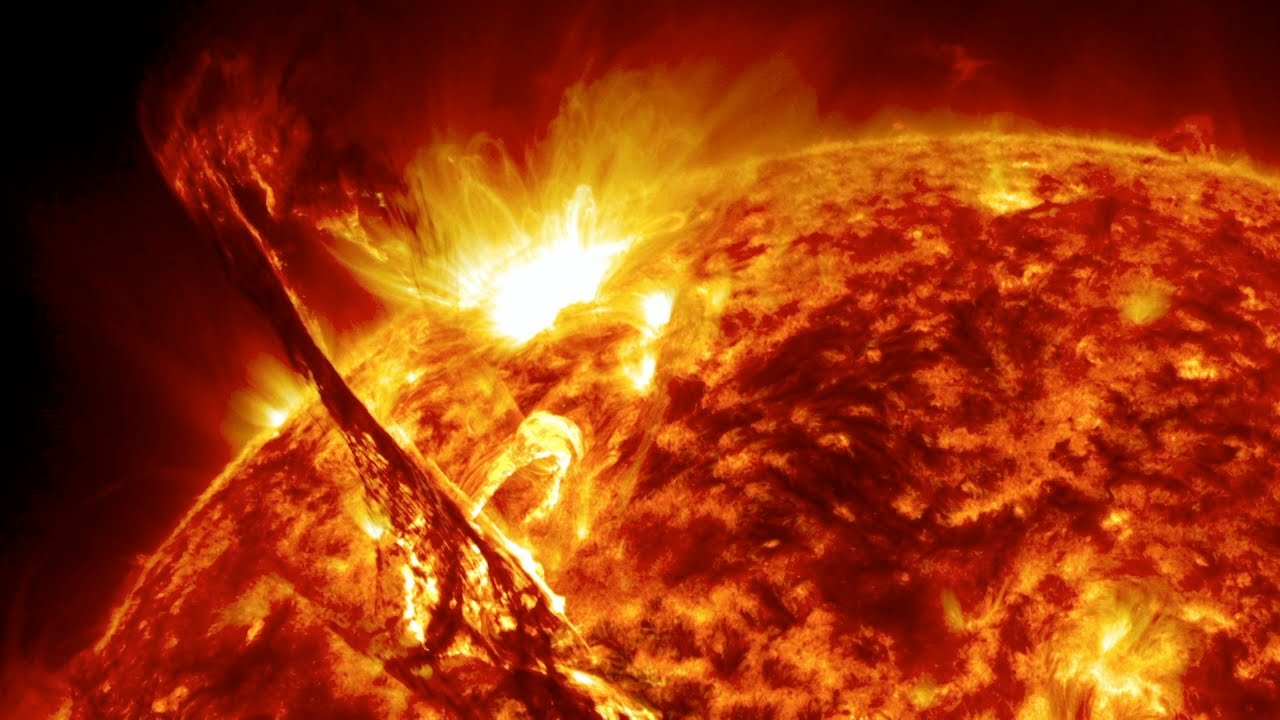
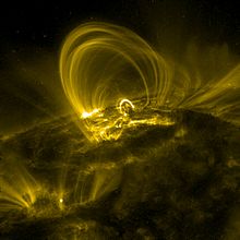
An X-class flare on the Sun is the electrical circuit equivalent of what happened to Mars. A breakdown of the capacitor’s dielectric layers and a violent, arcing discharge.
Spicules on the Sun are electrically analogous to sputtering discharges that made the smaller craters on Mars. The largest craters and volcanoes are the anodes and cathodes of magnetically induced coronal loop currents that extended across one hemisphere of the planet.


Although this is conjecture, myths like the Pawnee’s suggest Venus sent the EMP. If Mars were aligned in a linear orbit between Venus and Earth, orbiting Saturn, as Electric Universe theory suggests, Saturn the brown dwarf star, may have expelled a CME directly at the linear grouping, blasting them out of Saturn’s orbit. The EMP that struck Mars would have passed around Venus as a surface charge, leaving Venus a hot cometary body. Hitting Mars, it blew the circuit, leaving Mars stripped of it’s electro-magnetic sheath. People on Earth would have seen it. They also would have experienced what remained of the EMP after it passed around Mars, which might explain some petroglyphs and the transition from the first sun, Kronos to our second sun, Sol, as myth has it.
What else may have happened to Earth under this scenario? Besides myths, there should be evidence of electrical scarring on Earth as well. Perhaps we’ve even looked at some of it in past articles.
Conjectures about how it happened aside, Mars is a blown capacitor. That much can be empirically demonstrated.
Cheers,


 Arizona isn’t the first place people think of when Bigfoot is the subject. This is one paradigm people should get over. They are not isolated to the Pacific North-West; the Cascades, the Rockies, or this, or that…they are closer than you think.
 The term “
 My technique is simple. I go light and alone except for my dog. I hike straight up a path of tree leans, quickly and quietly. I choose trails that lead a short distance to a ridge, or peak, where there is likely to be evidence of their presence. There is also the possibility of an encounter.