Large Scale Wind Structures
In previous articles we established a link between the winds of Jupiter and land forms on Earth. In primordial times, Earth’s weather was like Jupiter’s, with raging plasma whirlwinds and segregated electric jet streams that attained supersonic speeds. Close examination of mountains and other land forms shows clear evidence of wind-blown deposition that layered the land, supersonic shock waves that shaped mountain flanks, massive lightning discharges that welded rock, and plasma vortexes that blow-torched the land.
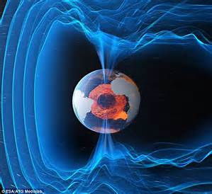
Jupiter’s winds are the result of capacitance between double layers in the atmosphere and the plasma sheath at the planet’s surface. We don’t know what the surface of Jupiter is, but it doesn’t matter – it still forms a plasma sheath – a double layer at the interface between crust and atmosphere. Electric circuits form the winds; by capacitance, inductance and magnetic fields. Surface and atmosphere are coupled by capacitance, and ongoing release of energy from Jupiter’s interior is what stirs the winds.
On Earth, dust particles, aerosols and the water cycle – evaporation, condensation, ice and rain – are the charge carriers, or the “wires” of the circuit. On Jupiter, it also includes ammonia and other species.
Regardless of the difference in chemistry between Earth and Jupiter, charge diffusion in Nature follows patterns. A lightning bolt on Jupiter is like a lightning bolt on Earth. It is a discharge between plasma layers that takes a fractal path as ionized filaments react in feedback with the magnetic field the current produces.
Fractal forms are generated by this feedback loop in any process of charge diffusion. They are not restricted to the Litchenburg pattern of a lightning bolt, but are evident in the helical path of field aligned Berkeland currents, the geometry of electro-magnetic fields, and drift currents reacting to far-field potentials.
So it should be no surprise at all to find the same fractal patterns in Jupiter’s winds as we find on Earth’s landscape, if indeed the landscape was formed by similar winds.
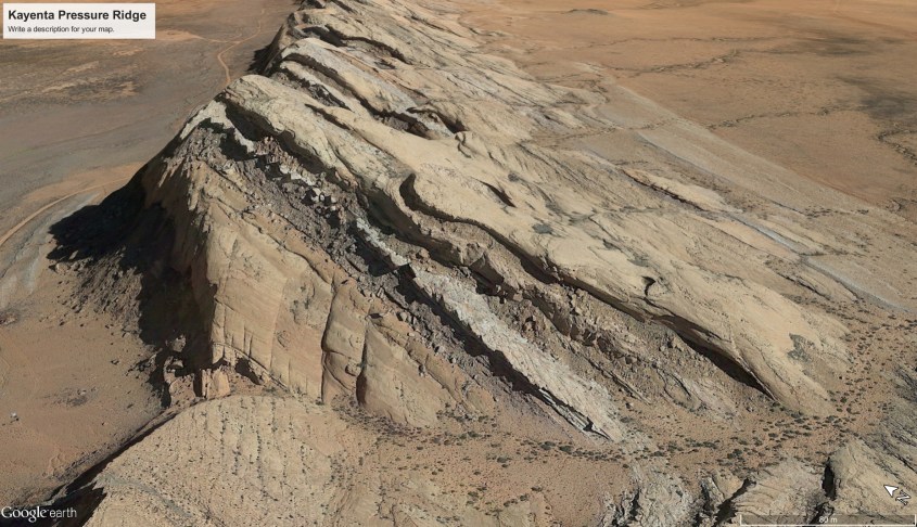
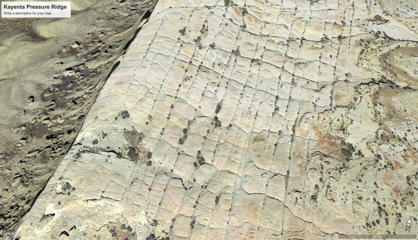
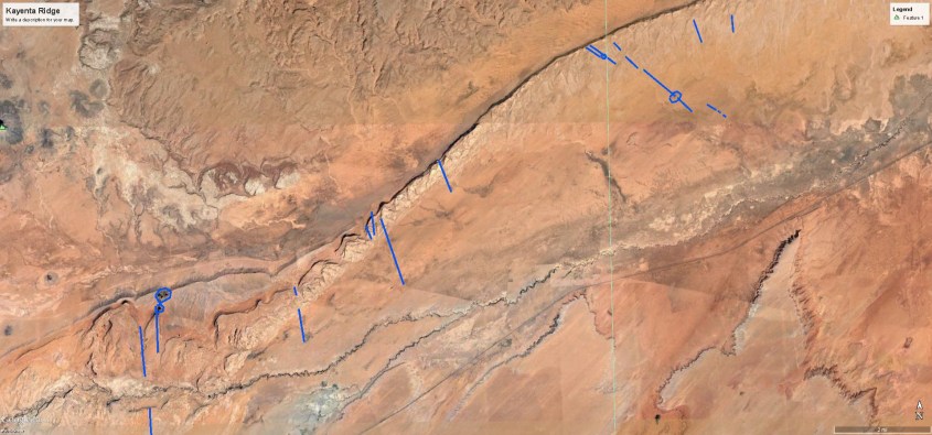
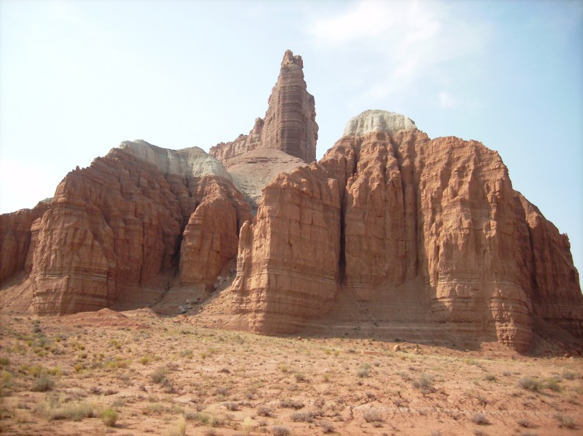
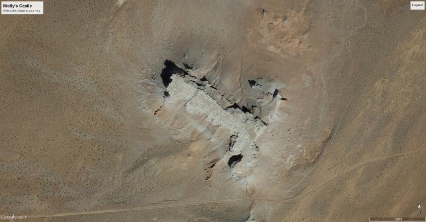
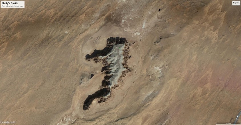
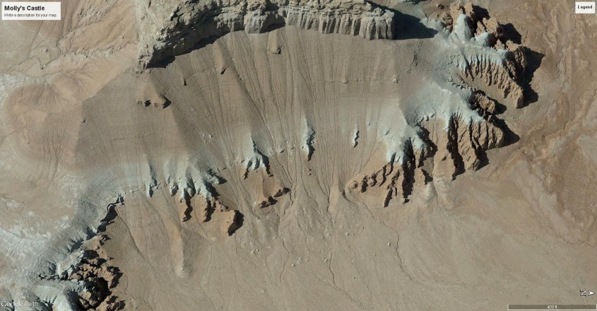
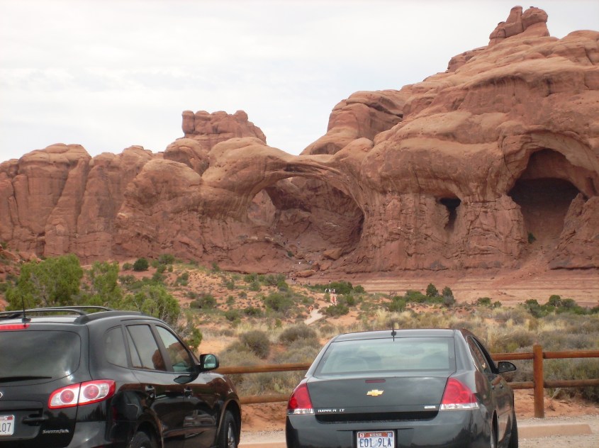
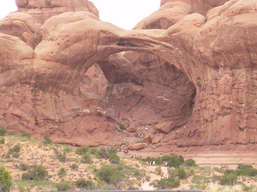
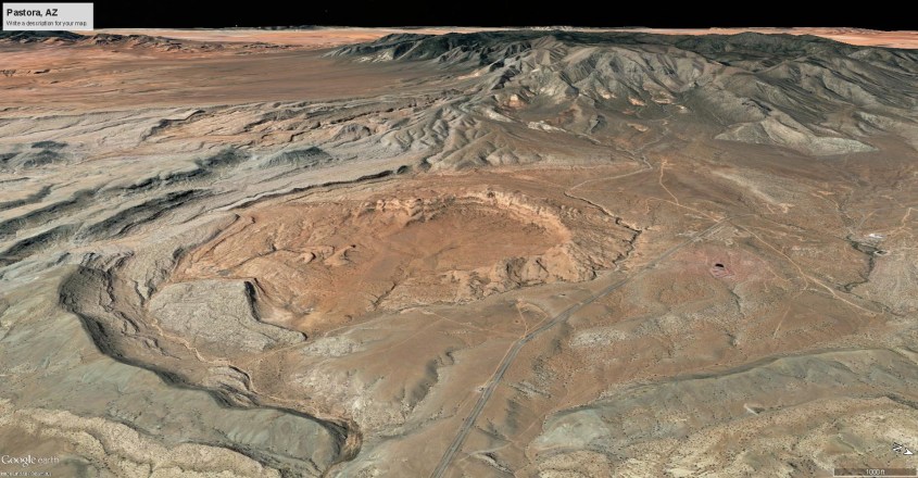
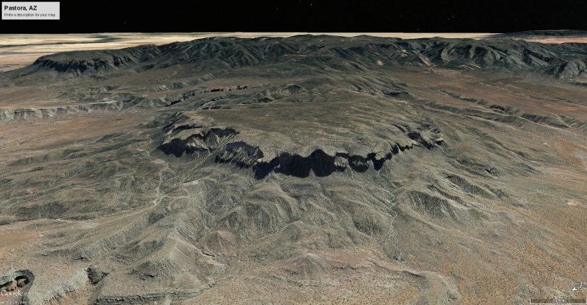
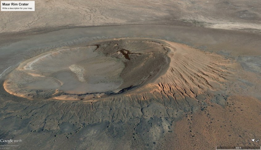
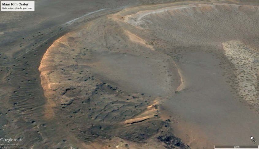
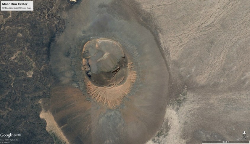
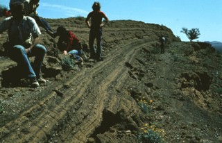
Boot Prints
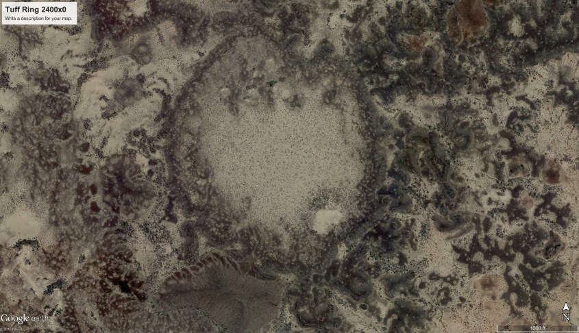
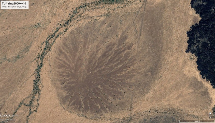
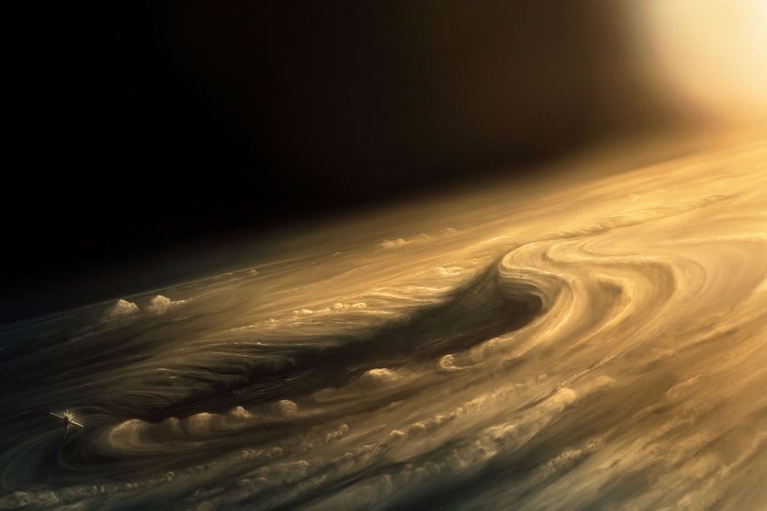
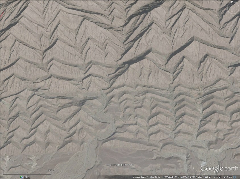
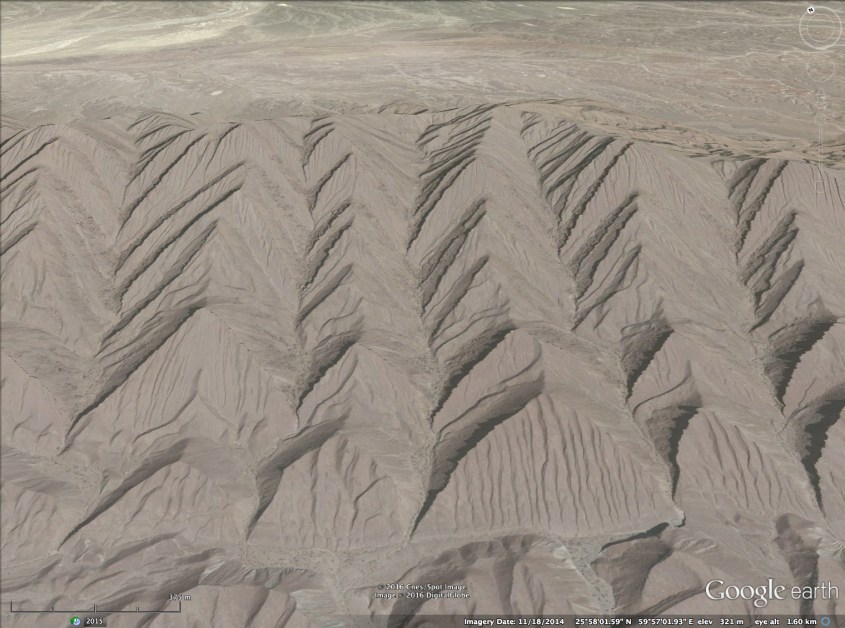
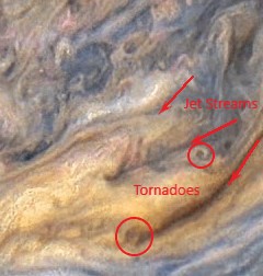
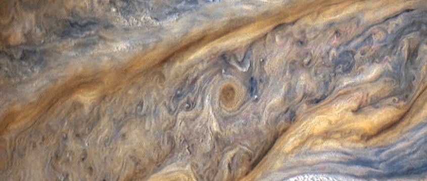
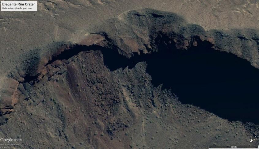
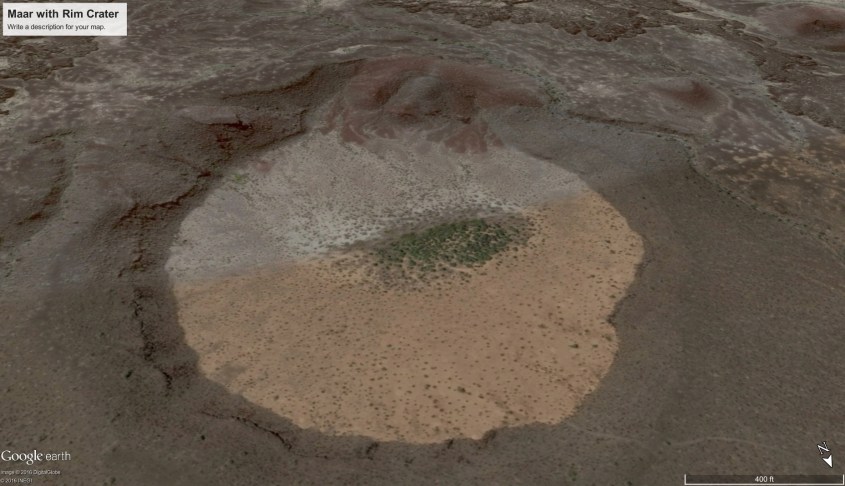
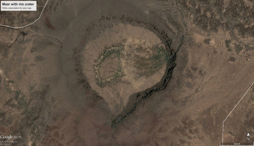
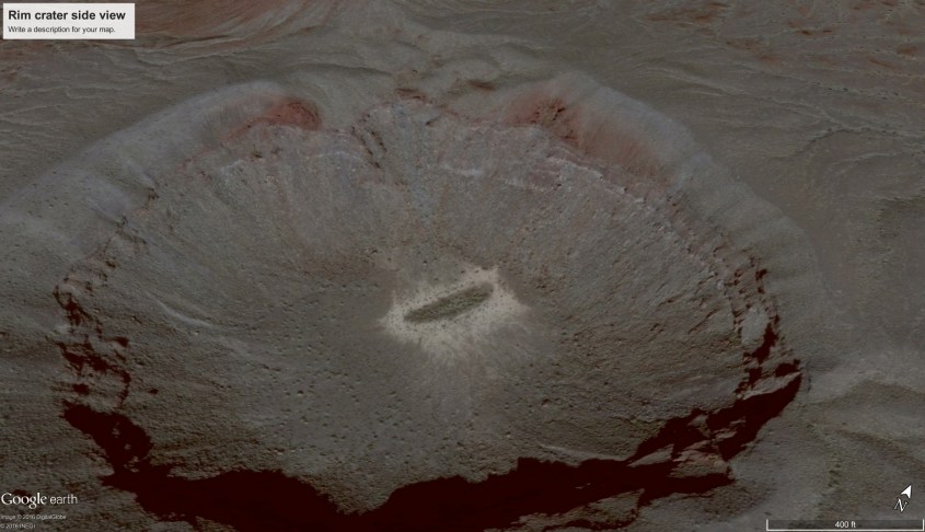
One spade-shaped feature is almost ubiquitous in Jupiter’s turbulence: the ‘boot print’. On Jupiter, the boot print is the down-drafting eye of a cyclone being pinched in the turbulent flow of competing winds. Like a hurricane, it is fed by billowing thunderstorms surrounding a whirlpool, which together forms a piece of a circuit – a ring current between the atmosphere and ground. The shape at the cloud tops is carried to the surface and reflected there, because the structure is a fractal, rotating filament of current reaching the surface.
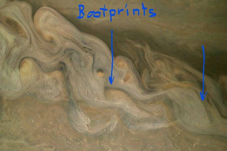
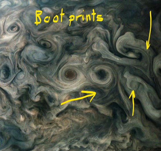
When Earth’s weather raged like Jupiter’s, Earth was in it’s formative age. The continents were being built, as layer upon layer of dust accumulated on a foundation of volcanic flows. Turbulent cyclones in Earth’s atmosphere produced boot prints identical in form to the boot prints on Jupiter. Boot prints on Earth are literally, the footprints of storms.
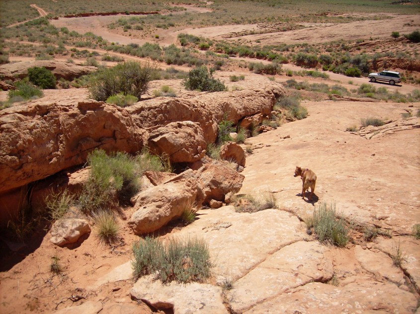
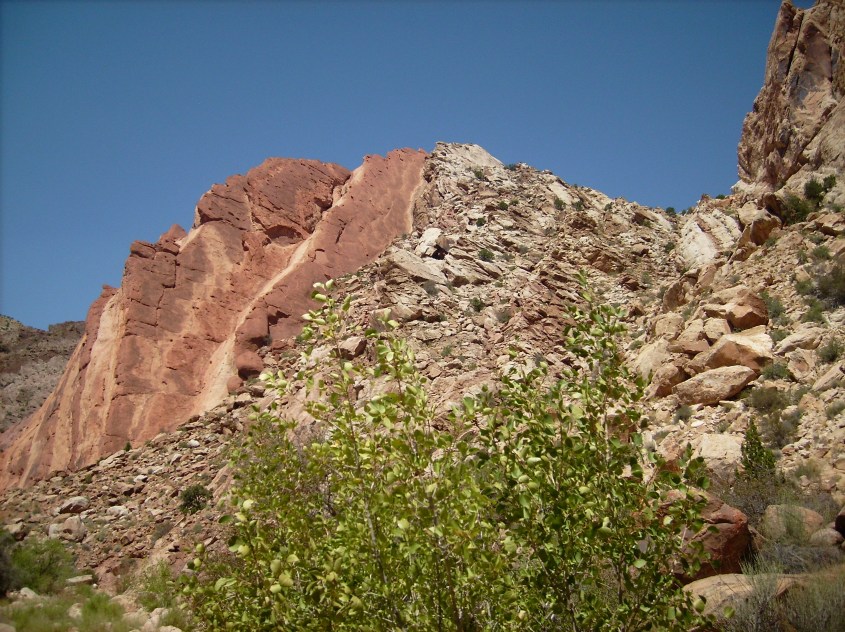
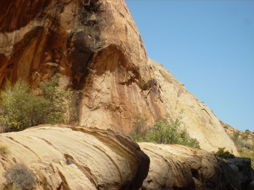
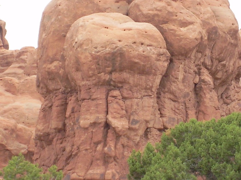
Boot prints on Earth are clear evidence of electric formation, because they display exactly what is expected in fine detail. The boot print is the consequence of a down bursting wind – a hot, ionized, super-sonic, dust laden wind aimed at the ground like a blow-torch.
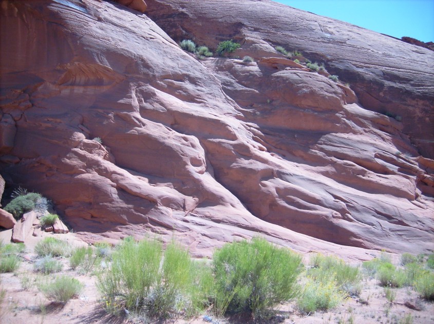
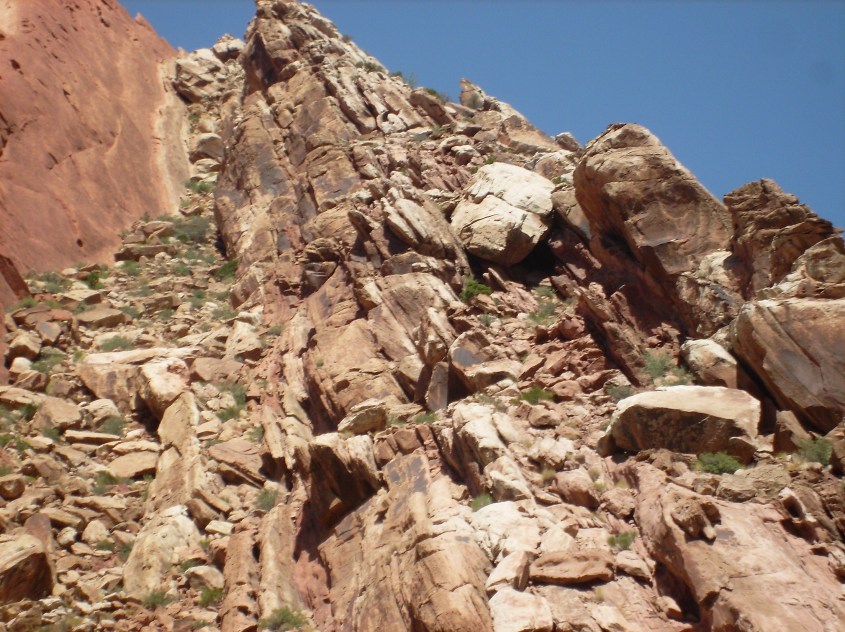
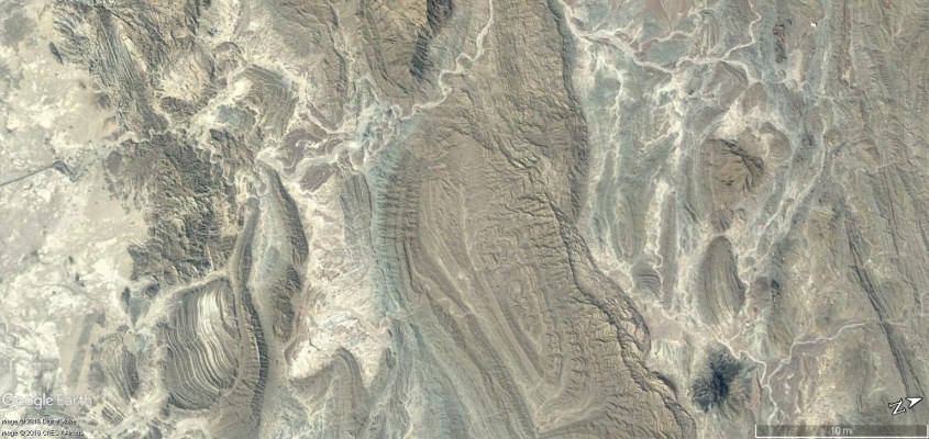
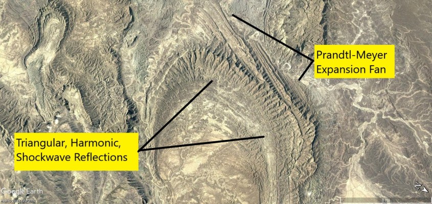
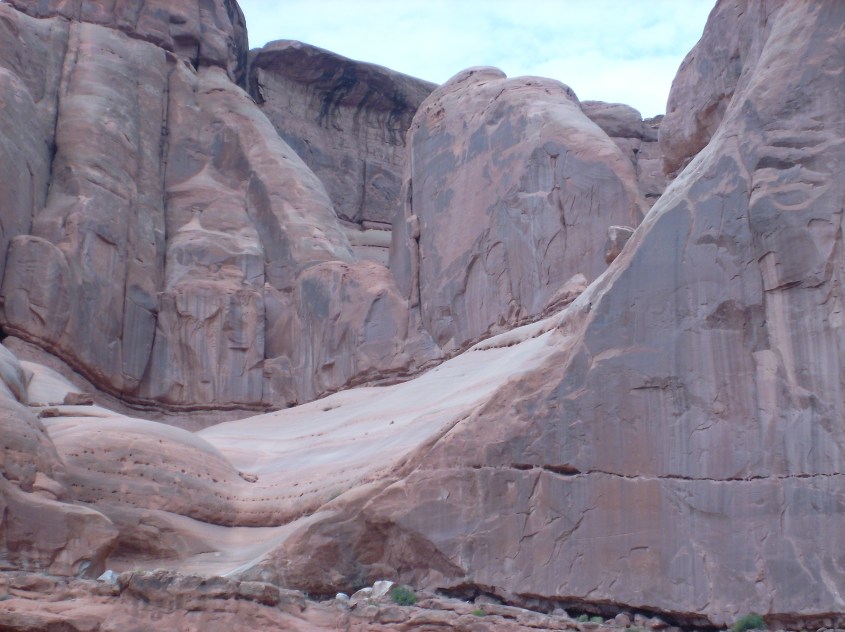
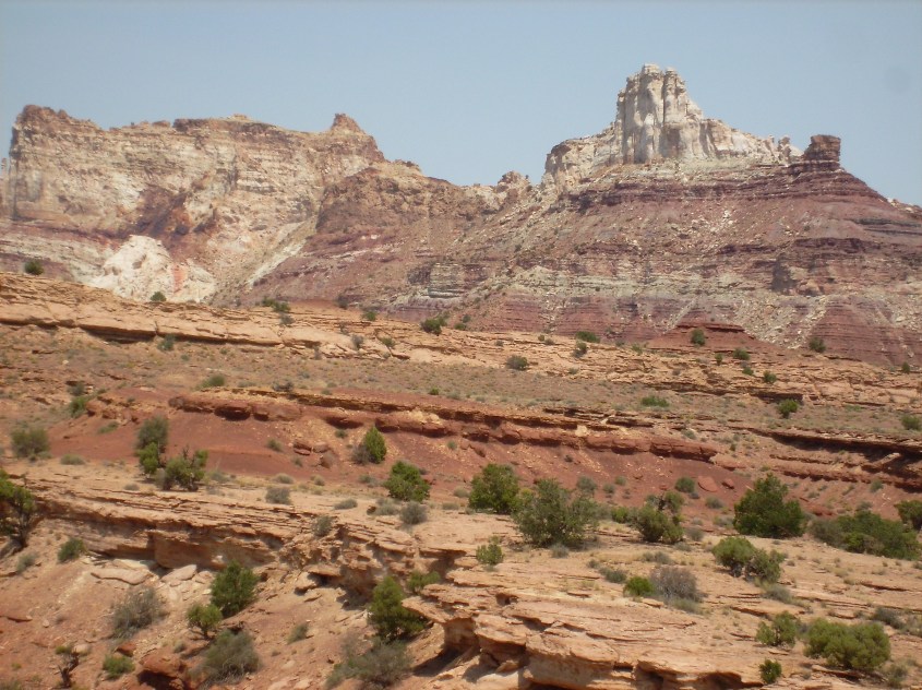
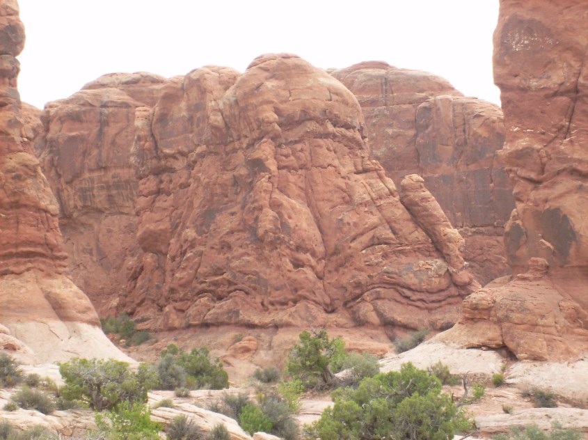
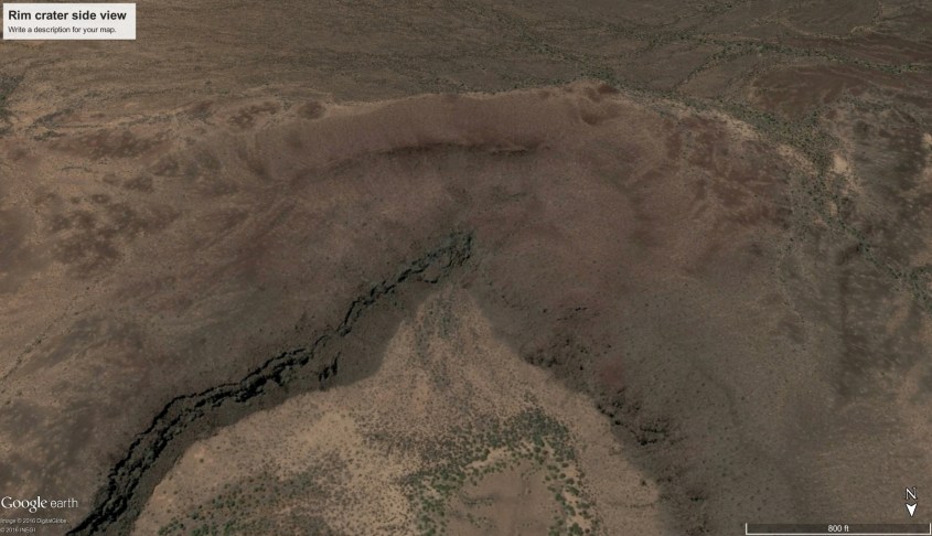
The mountain rim is the pattern of a standing shock wave. The repeating triangular layers on the inner flanks are impressed there by harmonic shock reflections, which channeled the wind at the boundary layer, and trapped dust in the low pressure zone of the triangular wave-forms.
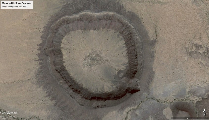
Shock waves produce triangular patterns of expansion and compression when a supersonic wind is deflected — like when it hits solid land.
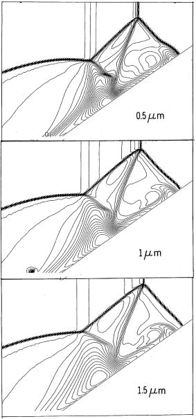
Just ahead of where a shock wave reflects, a low pressure region forms called the “Separation Bubble”. The separation bubble is in the shape of a tetrahedron, with a triangular face perpendicular to the wind at the same angle as the shock wave reflection – called the Mach angle.
As dust laden, ionized winds pass through the separation bubble, this low pressure region collects dust like a vacuum cleaner, and piles it in triangular layers. Therefore the rims, or mountains surrounding a boot print crater display these triangular layers.

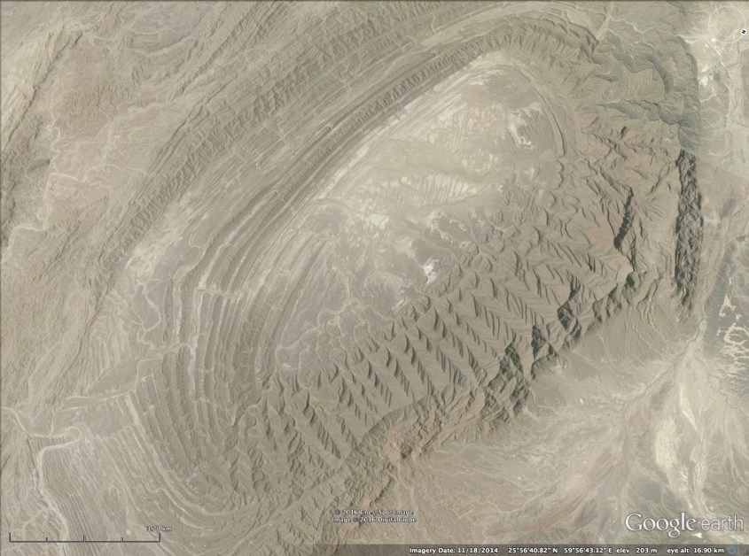
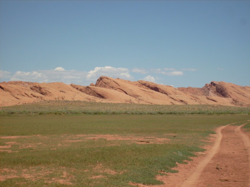
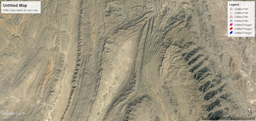
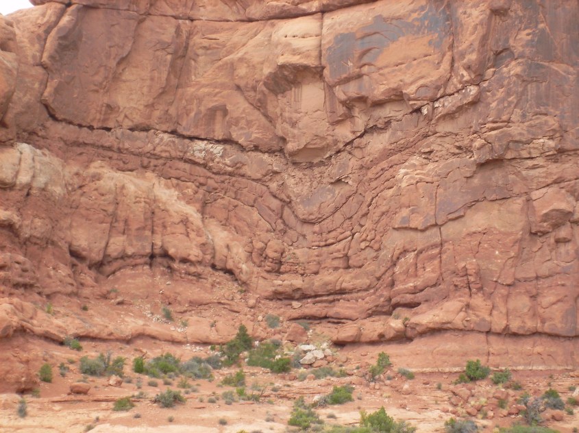
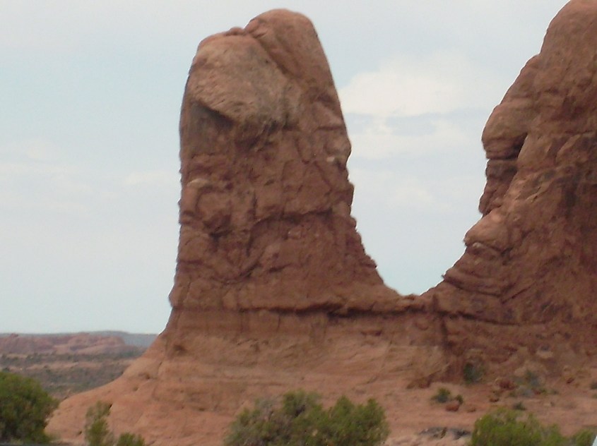
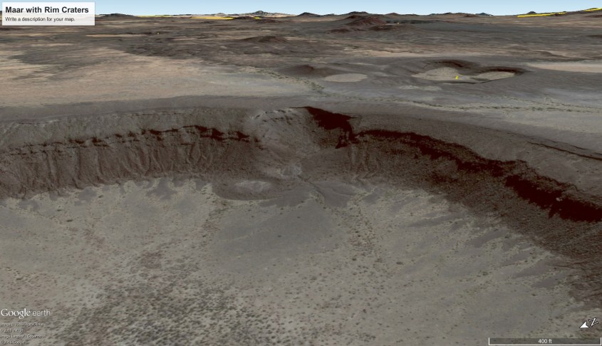
If a down burst wind strikes at an angle, rotates, or its mass flow is biased to one side, it will affect the shape of the crater it forms. Boot prints are often accompanied by a feature called a Prandtl-Meyer expansion fan. It is a series of standing shock waves that form linear rays of compression and rarefaction where the wind strikes and reflects off an object. This pattern implies the boot print is the result of an obliquely striking wind that rotated.
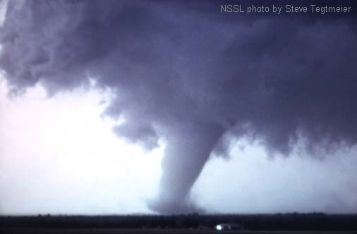
If you have ever watched tornadoes, you probably noticed they are rarely perfectly vertical. They contact the ground at an angle, and the rotating wind is lifted to one side, and grinds against the ground on the opposite side. That is precisely what has happened here to produce a boot print crater with an expansion fan.
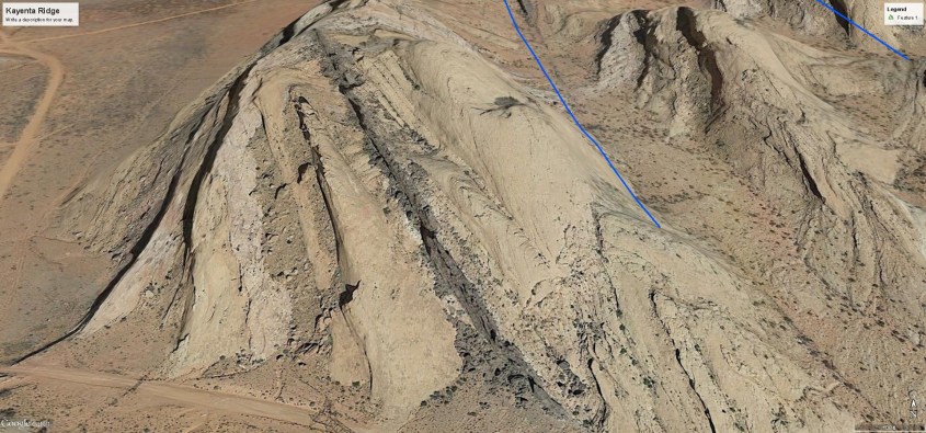
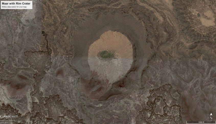
This single example is proof of my theory. Anyone with a supersonic wind tunnel can produce a Prandtl-Meyer expansion fan, tetrahedron shaped separation bubbles and triangular harmonic reflections – it’s been done countless times. But show a way to produce all of these together in a large scale coherent form by tectonic uplift, seismic vibration, slip faulting, erosion, or any other conventional geophysical means. Can’t be done. It is uniquely the result of supersonic shock. Nature provides rational, obvious proof, without need for computers or numeric models.
The pattern is not vague, like Jesus on a piece of toast. It is confirmed in every detail. The correlation is not only visual similarity, but also causation – vertical high speed winds, electrically charged and shaped by electromagnetic fields. Proof of the winds of Jupiter are in NASA’s data; proof of the ground effects on Earth are under our feet, and in decades of applied science in supersonic shock wave behavior. Proper interpretation of data and some wind tunnel testing would put the issue to bed.
But maybe I can do that with this next example.
California
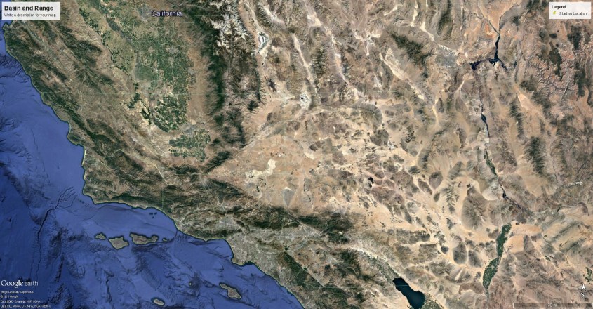
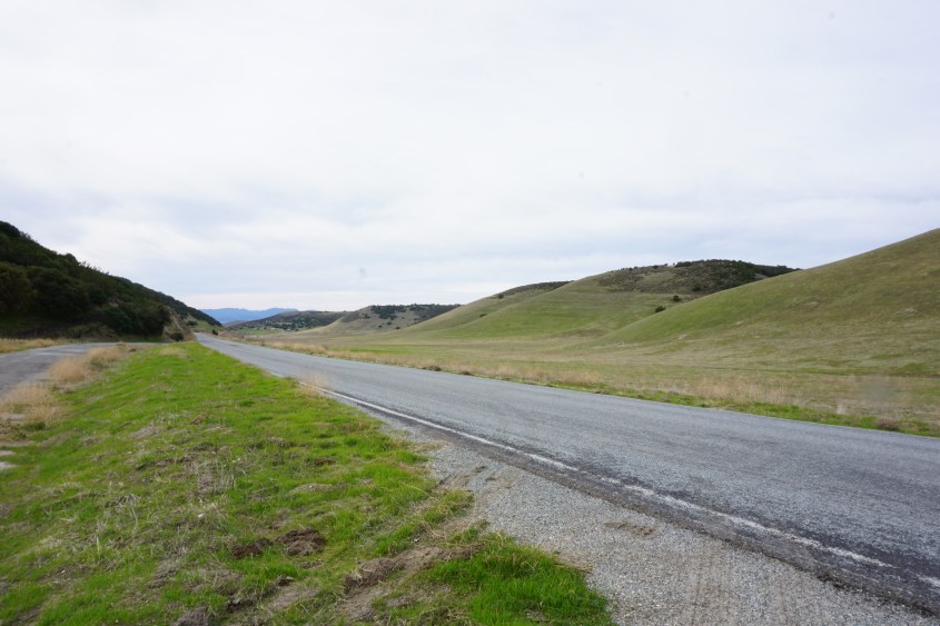
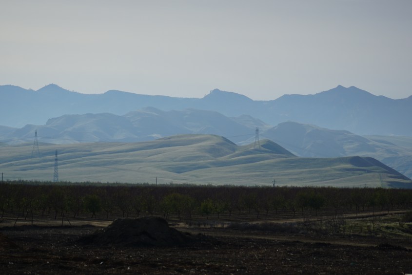
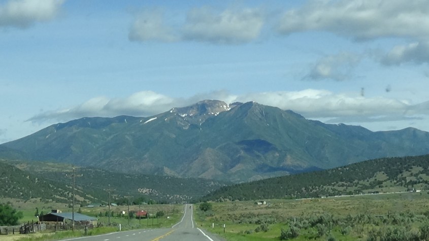
California’s most prominent feature is the San Joaquin Valley and it’s ring of mountains, including the imposing Sierra Nevada mountain arc and coastal ranges. Inside this bathtub, the floor of the valley is a long, flat plain, which at one time was an ancient sea bed.
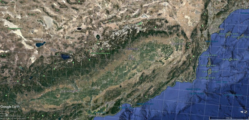
It was created by a storm like this on Jupiter. So, let’s look at some amazing details.
In this image, I indicate four specific areas we’ll discuss.
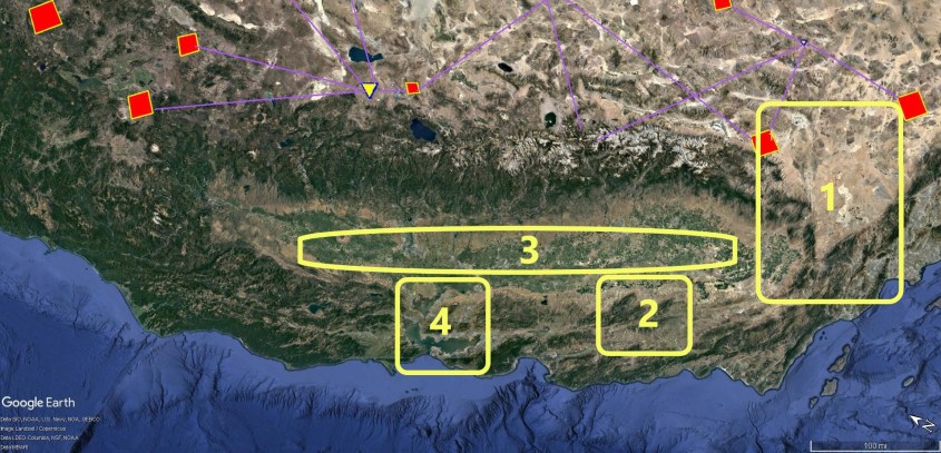
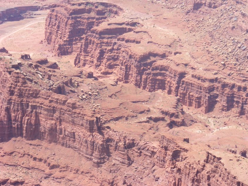
Area 1 – Mojave Desert
This almost perfect triangular plain of high desert is demarcated by the straight line of the Tehachapi mountains to the north, and the straight line of San Gabriel mountains to the south, which also, by the way, aligns with the San Andreas Fault.
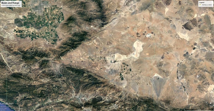
It correlates to the region of low level winds, tinted blue, at the cusp of the oval storm rotation on Jupiter. These winds are sinking winds – that is they are pressing against the ground in a Venturi effect as they speed around the cusp of the storm. The yellow-brown ring of the storm is a rising wind, forming what is essentially a continuous ring of thunderstorms. The sharp triangular demarcation between desert and mountain is the shear zone where shock waves formed between the low level horizontal winds and the rising winds of the rotating storm.
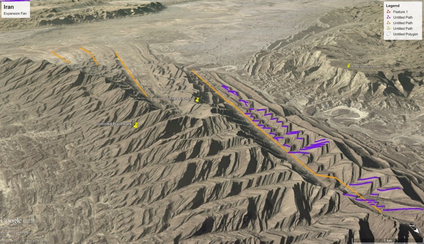
As these winds rounded the corner into the Venturi, they accelerated, gouging the deep Owens, Saline, Amorgosa and Death Valleys. Separating these valleys rise eleven thousand foot ridge lines of the Panamint, Darwin and Amorgosa ranges. They formed as sastrugi, parallel to the jet streams in low pressure interference zones between the laminar jet streams.
Lightning in this region was imposing. A plasma intensifies in a shear zone, meaning it generates ion content due to the shearing and extreme temperature and pressure differentials. Shearing supersonic winds bounce shock waves between them, generating high current density in jet-streams that extended for thousands of miles. Lightning discharge from these plasma streams focused on the piling mountains below with the capacity of a thousand mile long thunderstorm being continually fed new energy.
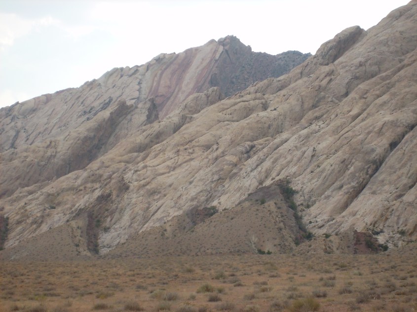
The current dumped in the strike zone didn’t simply flash a split second, here and there, but arced continuously, diffusing through the land welding granite from dust and sand. That is why the Sierras, in this southern portion of the range, have the most impressive granite structures: Yosemite, Mt. Whitney, it’s neighboring peaks, and the Domes. The granite of the Sierras lies atop sediments, which implies the storm(s), by either wind or tsunami, brought layers of dust long before lightning began to strike.
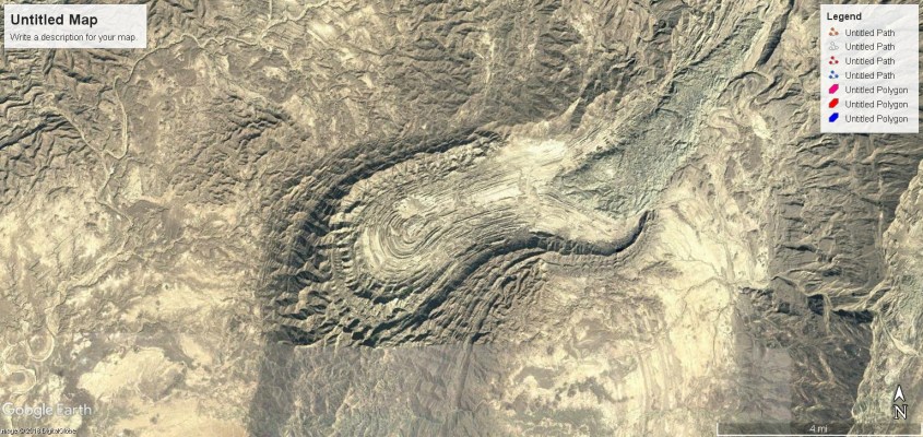
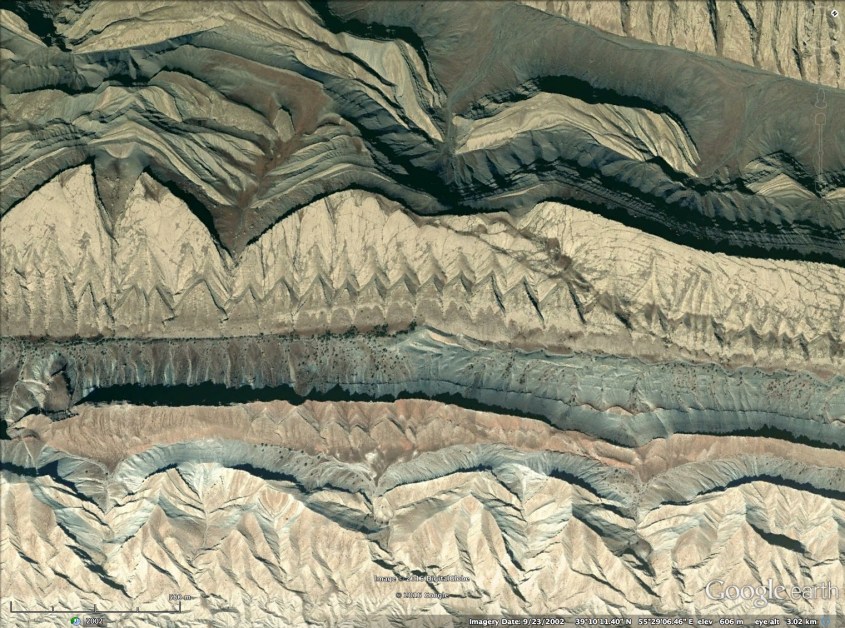
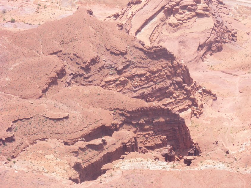
Area 2 – Coalinga
Coaling Station “A” was it’s original name. Coalinga, as it’s called today, is an oil patch town. The foothills that surround it are oil fields – anticlines of shallow sandstone saturated in heavy oil. Similar anticlines flank the western side of the San Joaquin Valley, from Coalinga to the end of the bath tub at Bakersfield. These anticlines compose some of the largest oilfields in North America.
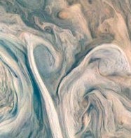
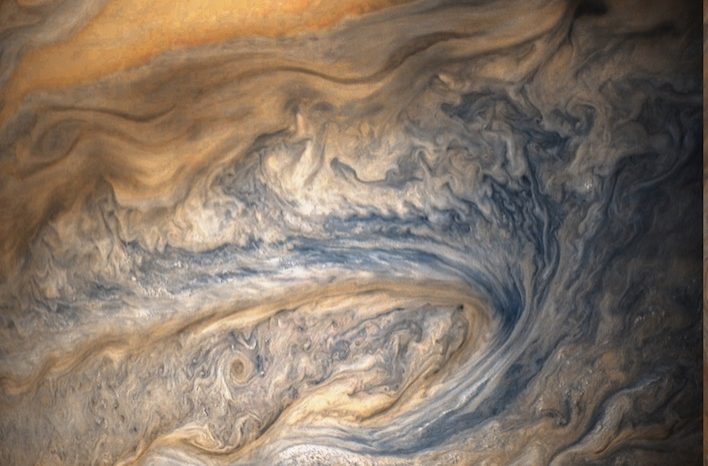
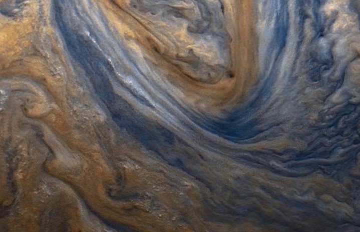
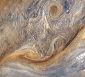
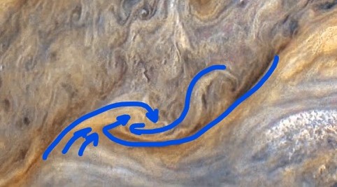
What created them was like this turbulent region in Jupiter’s clouds. The colorized image from NASA shows a crab-claw cloud structure, with high level clouds in yellow, and low level clouds in blue and black. There are several tornado rotations along the boundaries of opposing flows. There are also deep, dark, linear filaments.
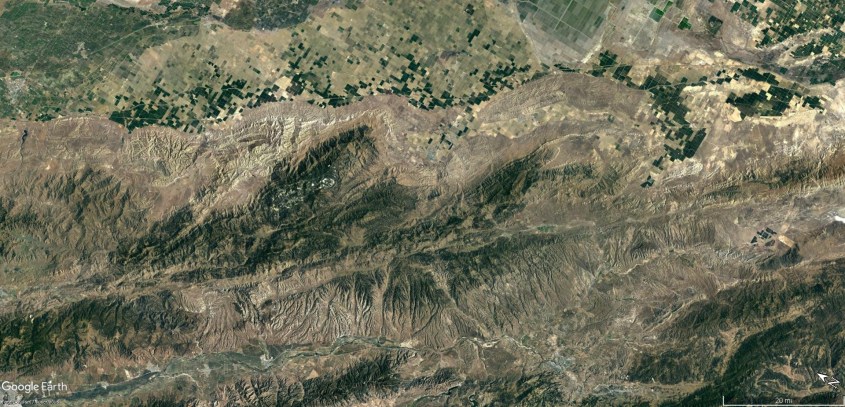
Now correlate the dark filaments with the deep cut, linear valleys near Coalinga. The dark filaments are ground level jet streams, which are what formed these valleys by preventing dust from depositing. Follow the filament in Jupiter’s cloud and it ends in a tornado. Follow the valleys near Coalinga and they end in hills with spiral features. In other words, the filaments are jet streams hugging the ground, cutting beneath the storm clouds to feed a giant tornado. Fascinating isn’t it?
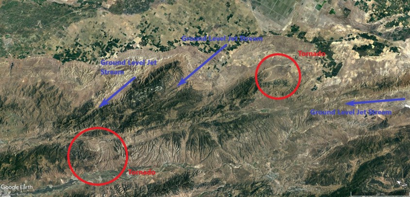
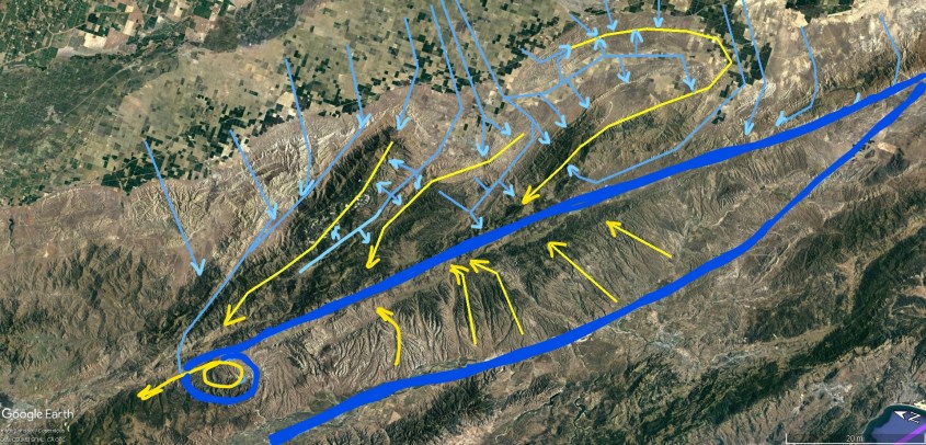
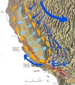
Blue lines in the wind pattern image represent ground level winds, combing across the San Joaquin Valley, and rising into thunderstorms. Yellow represents the higher level meso-cyclone winds which rained dust and rock. The blue winds approach the thunderstorms orthogonally, then rise in the updraft of the storm. Dark blue lines are the tornadoes and ground hugging jet streams.
A drive through the region shows the mountains are wind blown dunes that rise abruptly from the flat valley floor, and display exactly the wind patterns I describe.
It seems chaotic – winds criss-crossing in every direction. But it’s not. The overall wind structure is called a Kelvin-Helmholtz instability. It’s a fractal pattern that happens all the time if there is wind shear.
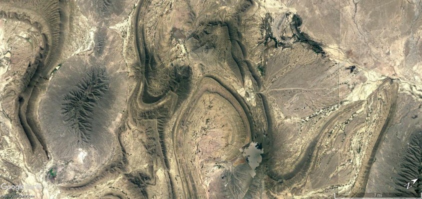
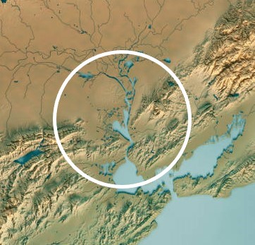
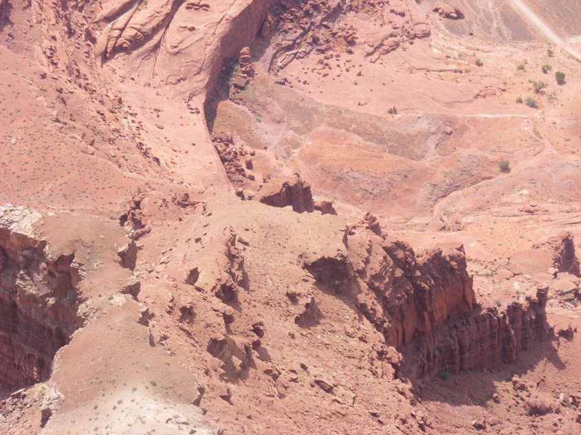
Area 3 – San Joaquin Valley
Look inside the yellow ring of thunderstorms, and see there are dozens of small vortexes. These are tornadoes, or perhaps water spouts, because the San Joaquin Valley was likely a sea at the time.
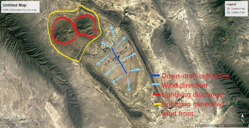
Among all the tiny whirlwinds is one giant tornado almost in the center of the storm. This feature correlates well with a circular region of the Sierra foothills at the North end of the San Joaquin Valley. If you have ever driven from Sacramento to Lake Tahoe on State Highway 50, past the town of Folsom where I once lived, you have climbed the Sierra foothills that constitute this feature. A distinct swirl is evident in the hills just above (to the East) of Folsom Lake.
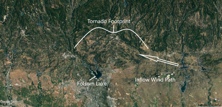
The swirl is fed by ground level winds entering the vortex from the left (South), whereas the top level winds in Jupiter’s cloud tops flow in from below (from the West on the Earth image). This indicates differences in flow patterns between double layers due to the rotational symmetry of fractals. Fractal rotational symmetry is when a fractal shape repeats, but rotated by 90, or 180 degrees. This indicates the wind clocks around ninety degrees at different layers of the storm. The same thing occurs in hurricanes and meso-cyclones on Earth, even today.
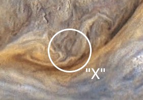
Area 4 – San Fransisco Bay
Here, you are literally seeing the drain in the bath tub. Follow the dark filaments in Jupiter’s clouds and they converge in a vortex.
Compare the dark filaments on Jupiter to the long, linear valleys leading to San Francisco Bay, and you see the same pattern. The dark filaments are ground level jet streams that scoured the land, while the light-colored cloud tops are thunderstorm anvils raining charged dust to form the mountains.
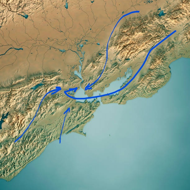
Look close at Jupiter’s clouds near the center of rotation and there is a dark “X” shaped feature. Then compare to the Sacramento Delta and you’ll see, the Delta is the top of the “X”. Again, it’s because the dark filaments are ground scouring winds, which in this case scoured the land to a depth below current sea level.
I hope these images provide unambiguous evidence of how the Earth was formed. Any one, or two matching features between the clouds of Jupiter and the Earth’s landscape could be coincidence. But overlay Jupiter’s oval storm on California and all seven features depicted here match in both shape and position, and the wind patterns not only look like, but explain the land features. At least they do if you apply electric circuitry, and ignore consensus science.
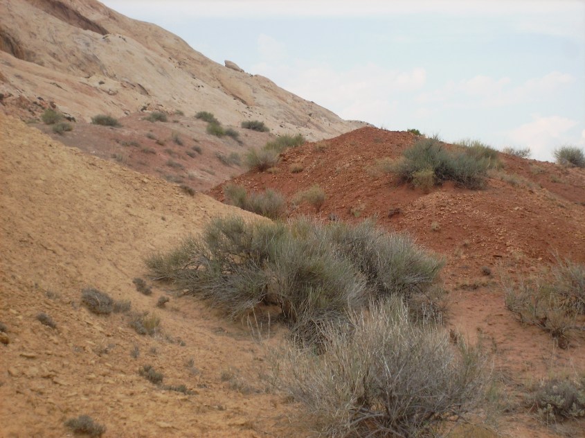
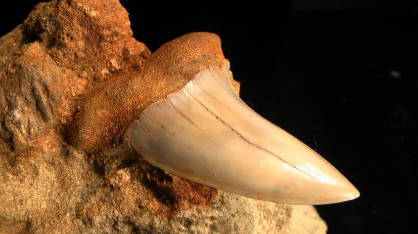
There is a host of interesting things to learn by understanding California’s true formation. For instance, a whirlwind formed hill in Kern County is full of ancient shark’s teeth fossils. These sharks date to the middle Miocene, roughly 15 million years ago by consensus chronology. I don’t trust consensus chronology, but it does place a bookmark in the fossil and geologic record. Oil sands in San Joaquin date from the Miocene and earlier, except for one shallow Pliocene sediment. The Miocene epoch that formed Shark Hill was likely the last time such a mountain building storm raged over California. But stratigraphy and the fossil record suggests there were many similar fractal storms in earlier epochs.
Thank you.

PLEASE, DON’T FORGET TO TIP.
$5.00
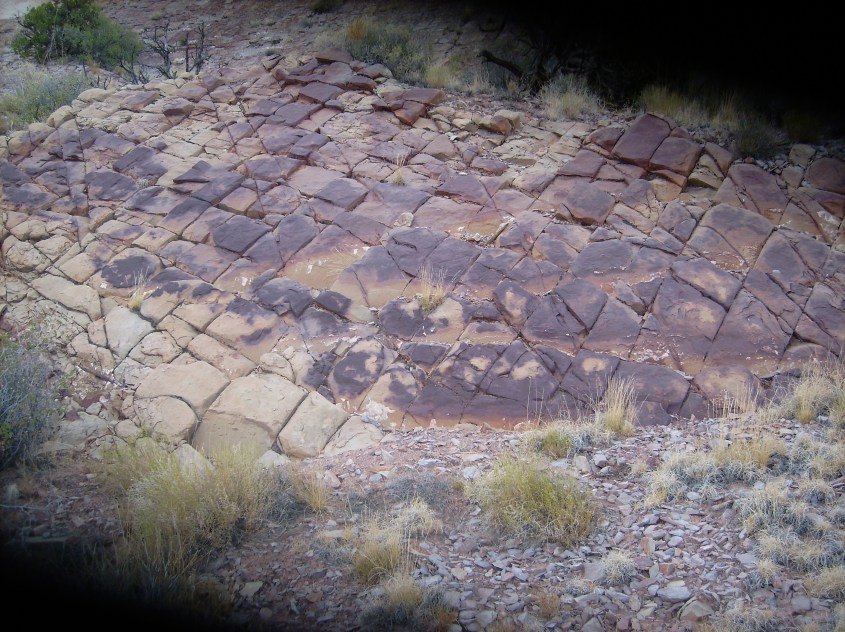

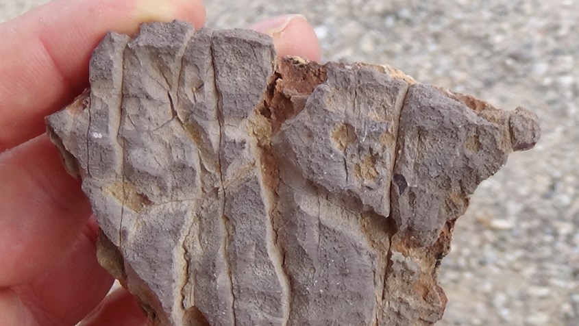

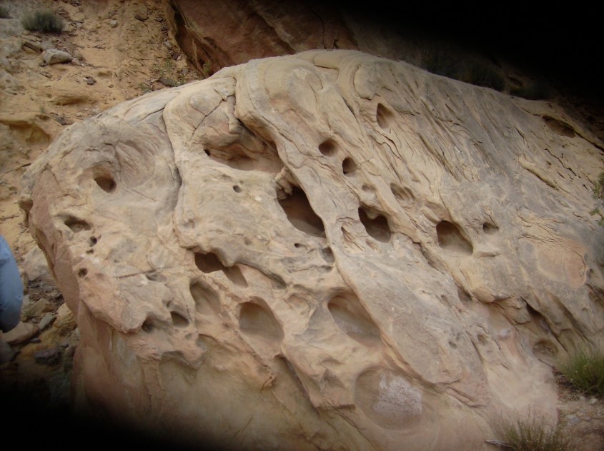
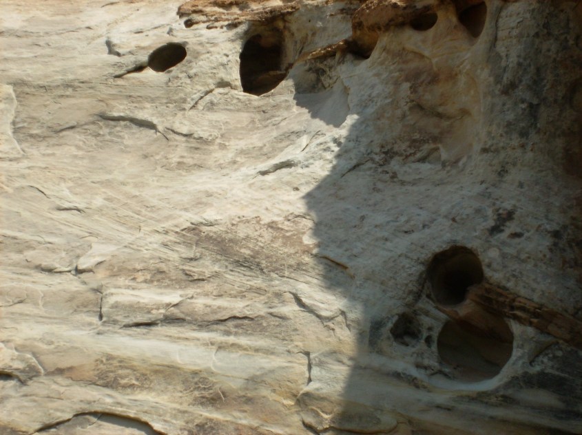
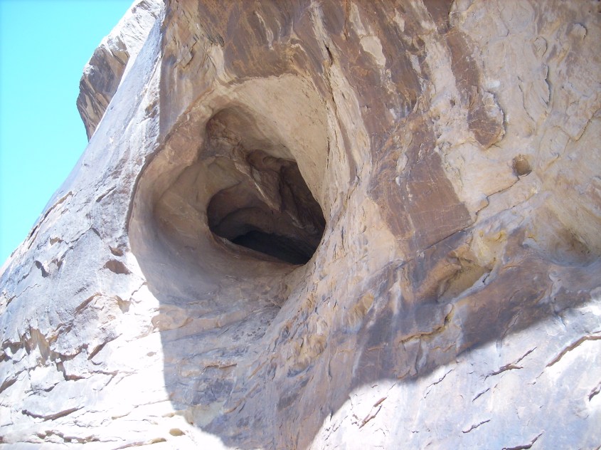
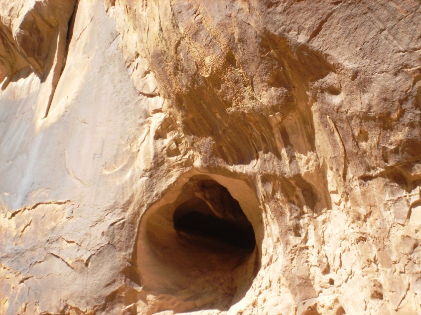
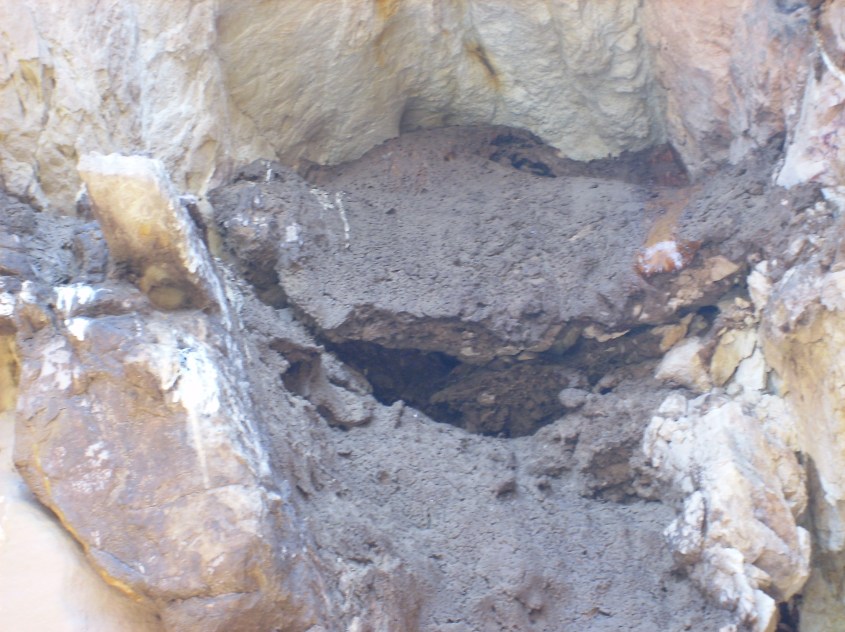
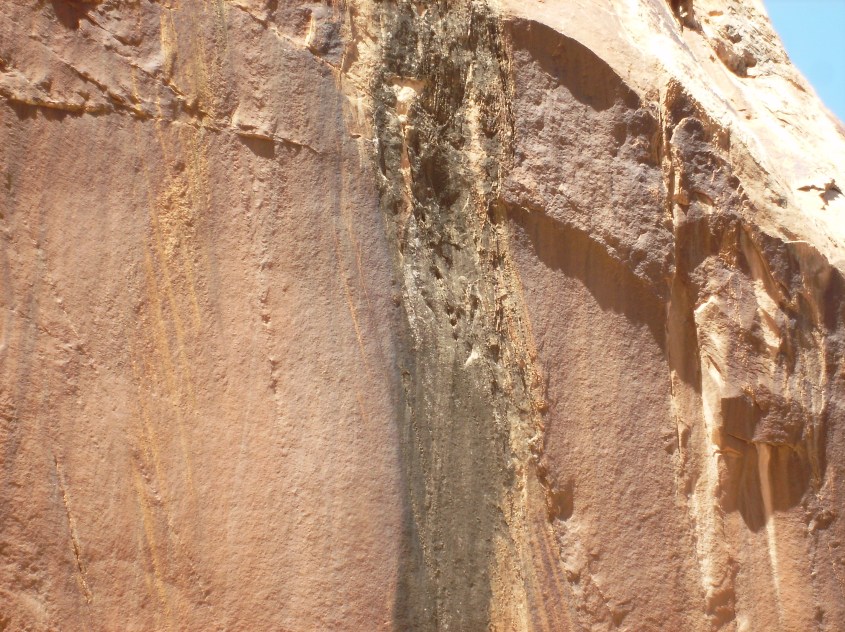
 This image shows why off-gassing bubbles are part of deposition, not sputtering. The bubbles are in the untouched surface rock above, while the scalloped break in the rock (from a cupping spall caused by sputtering) has no holes. The holes were already there when the canyon was sputtered, and are only a near surface feature caused by off-gassing.
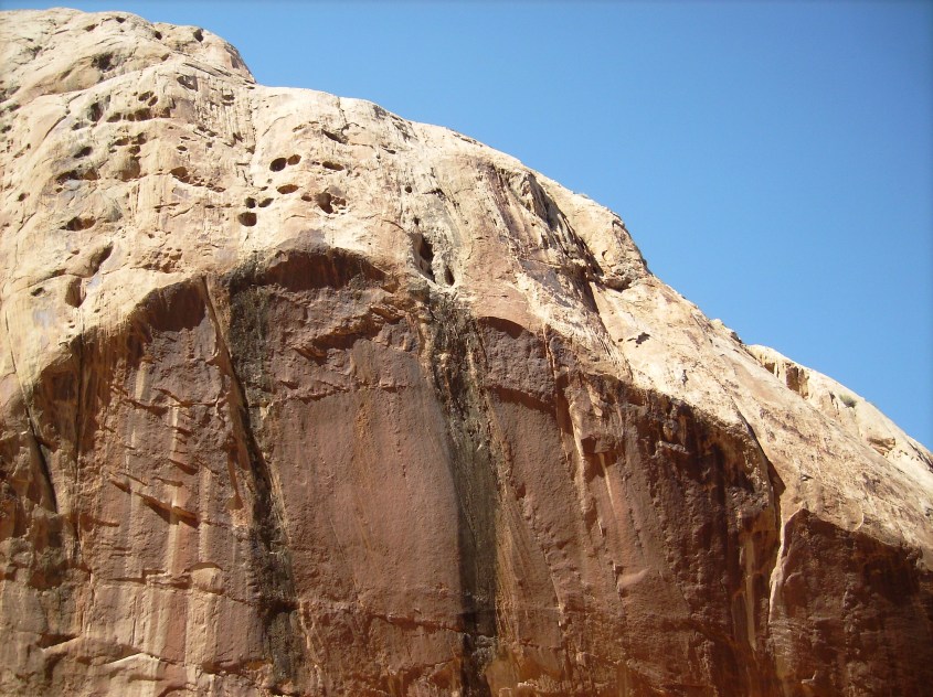


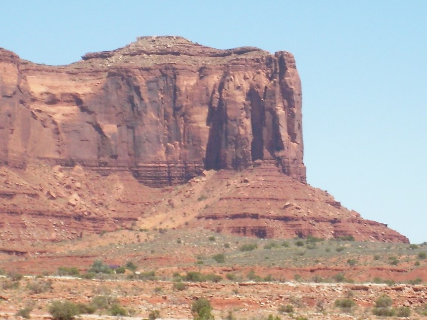
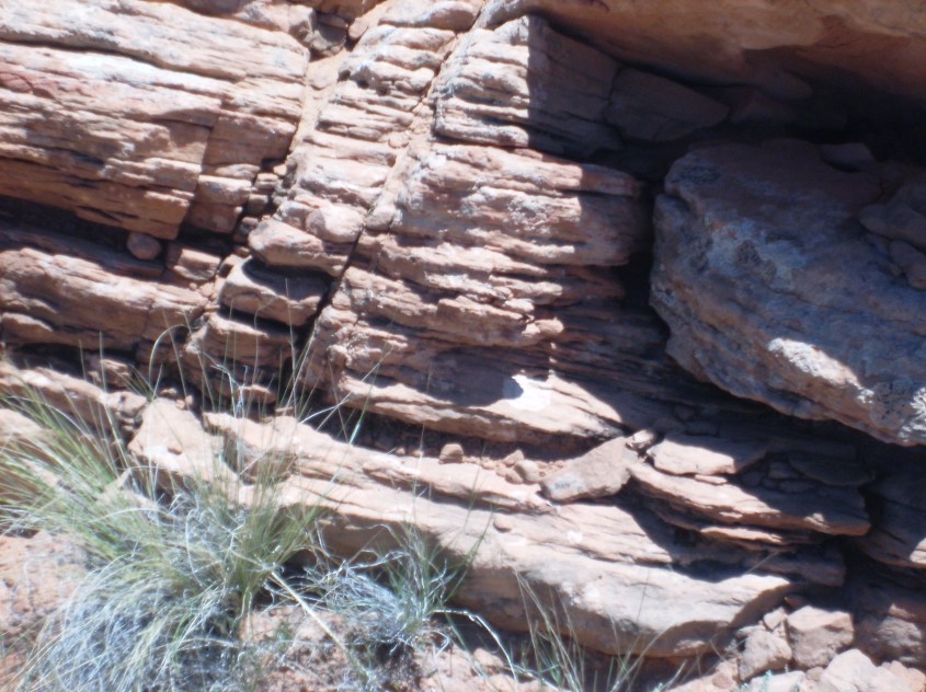
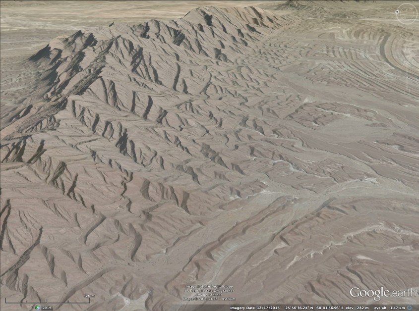
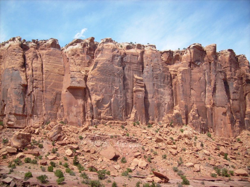
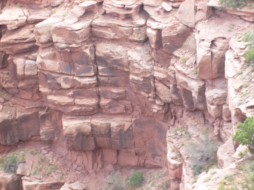
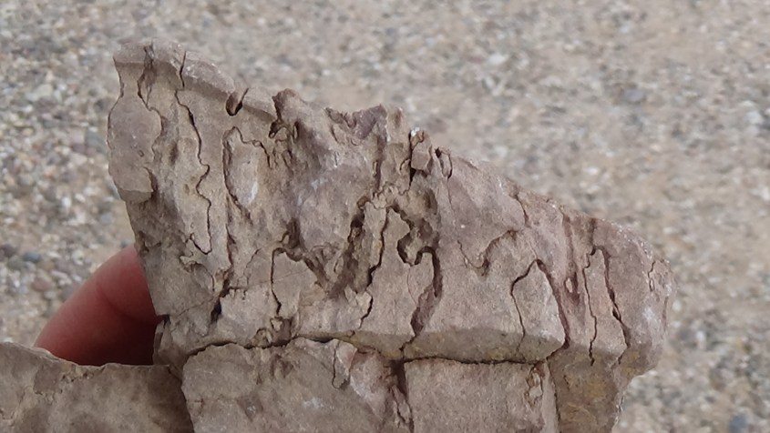
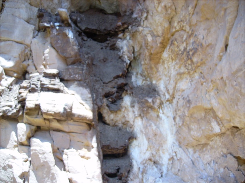
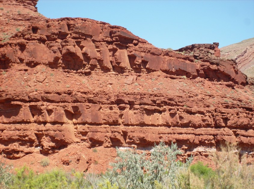
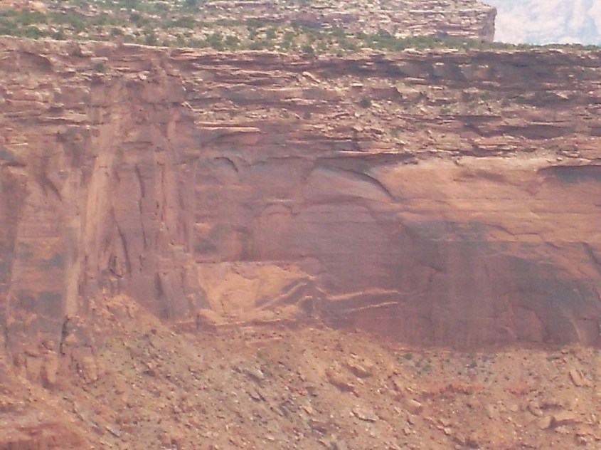
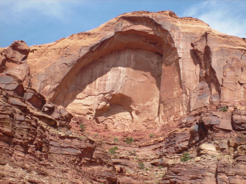
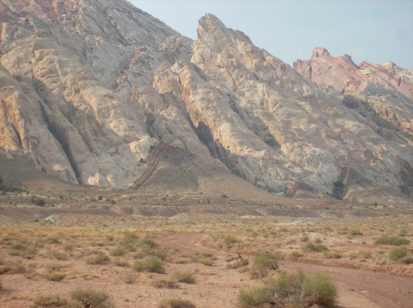
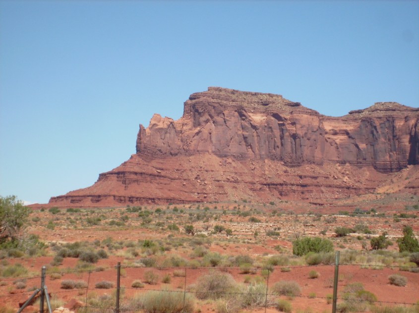 The step pyramid structure, or terracing on canyon walls and buttes is another evidence of sputtering. Each sedimentary layer has different compositions of minerals and moisture, differentiating the dielectric property of each layer. The zone of charge depletion under lightning strikes spreads out in a conical diffusion pattern, but the cone is stepped, or terraced, because there is a step voltage across each dielectric layer.
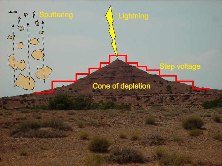 Where there are towering cliffs with sheer vertical walls, it is because it is a monolithic layer with a consistent dielectric, causing a single large voltage step.
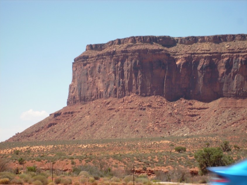
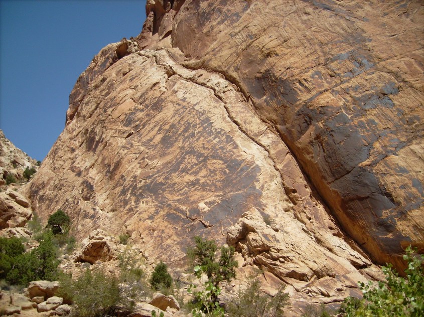
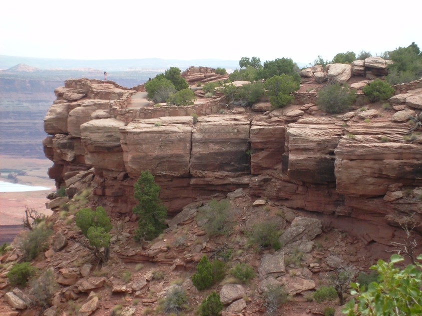
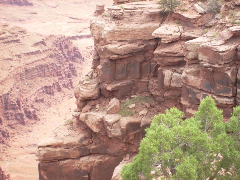
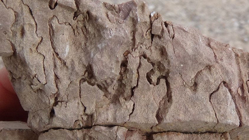
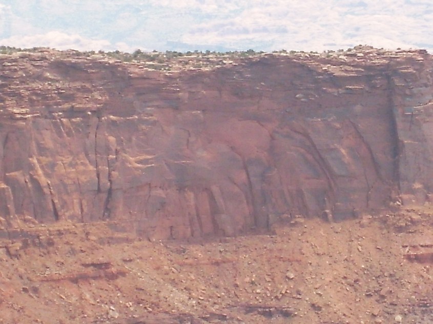
 Evidence of shearing is especially evident on monolithic walls. Sharp edged breaks are everywhere, leaving smooth, flat faces, hardly roughened, or rounded by any act of erosion.
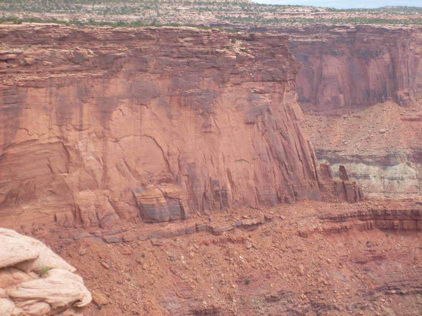
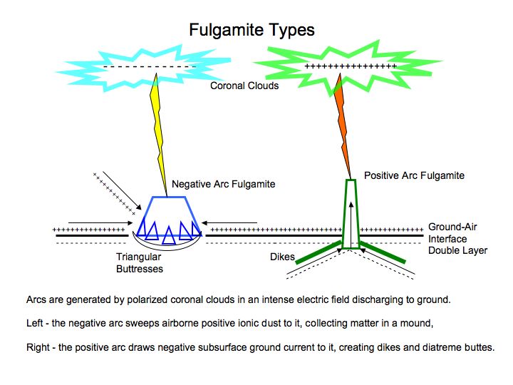
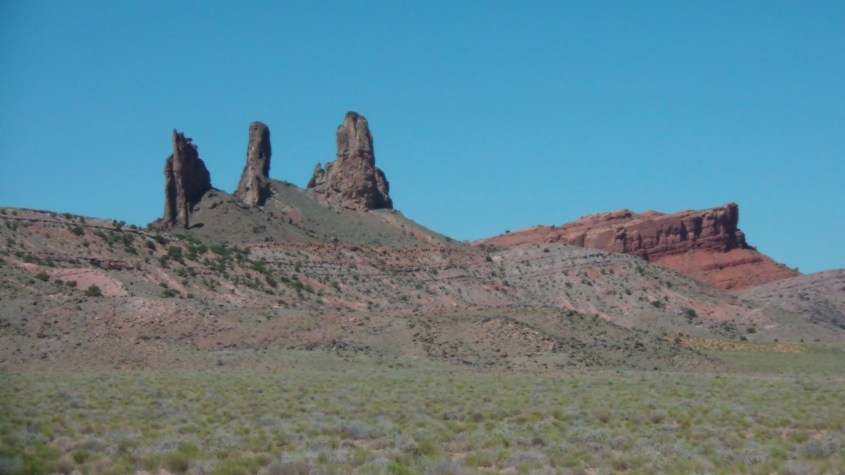
 Pinnacles in this region are of two types. Fulgarites, like the burnt shard of Agathla peak, are the direct result of lightning boiling up the crust of the earth in an electromagnetic blister. These types of pinnacles were discussed in
 More sustained, or potent striking begins to diffuse charge depletion outward, forming nodes, or star like breakouts.
 Still larger accumulation of strikes, diffuses charge further, and nodules break out into ‘wings’, or dykes of charge depleted rock.
 The shadow footprint grows as arcing continues, elongating charge depleted zones into wedges with dykes growing out the tips and edges. It’s actually the beginning of a fractal dendrite, as lightning bombardment soaks charge from the ground, diffusing outward in branches and creating a depleted zone protected from sputtering. If the process continued before the surroundings sputtered away, the dendrite nodules would grow and branch in ever smaller fractal repetitions, like branches of a tree.
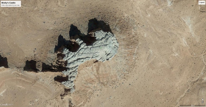
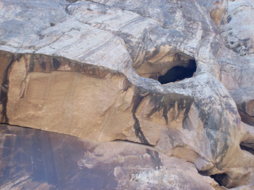
 As adjacent rock is struck, the depleted zones connect into networks of wedges, ridges and pinnacles.
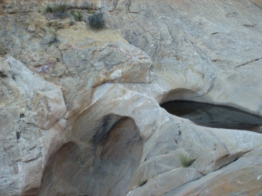
 Generally, the pinnacles and buttes left on a dome are layered flat, but in some areas buttes display a dip, indicating horizontal winds influenced the deposition. Sputtering follows the voltage gradient, and so carves away from the lightning depleted zone in alignment with the strata because the voltage gradient follows the dielectric layers, cutting at 90º to the dip angle, leaving a straight-edged non-vertical wall. If eroded by conventional notions of wind, rain and mass wasting, the rock would obey gravity and erode a vertical wall. It is in details like this that prove electrical formation.
 What we see in the stepped pyramids and terraced canyons is the result of two types of charge transport in a solid state matter. One is drift ionization caused by the external electric field of the storm, and the other is
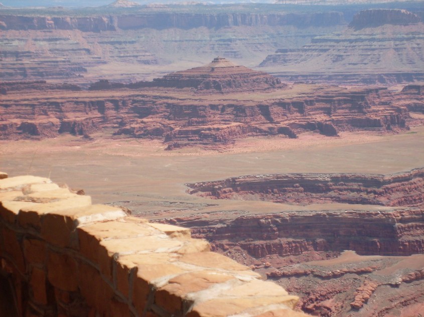
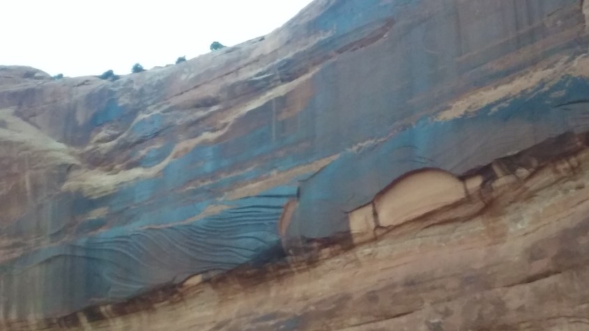
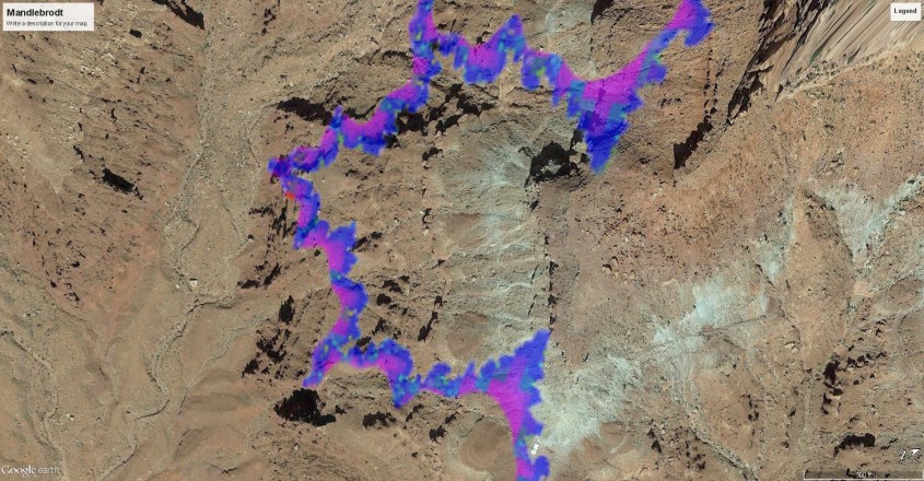
 Compelling evidence the scalloped and terraced walls are a result of charge diffusion is shown in this image, where the archetype of all fractal shapes emerges – the Mandlebrodt Set.
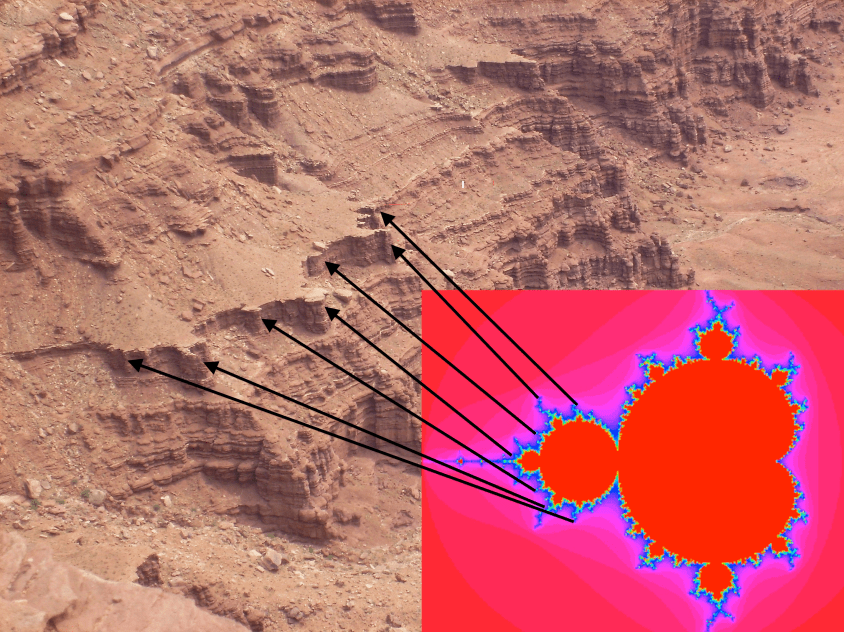


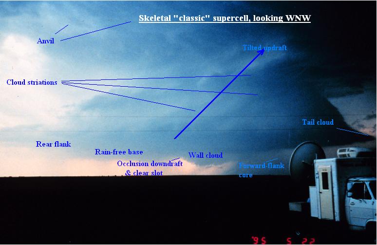
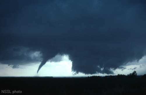 The funnel cloud doesn’t always emerge from the center of the wall cloud. The funnel often appears along the edges of the wall cloud, or from the surrounding clouds.
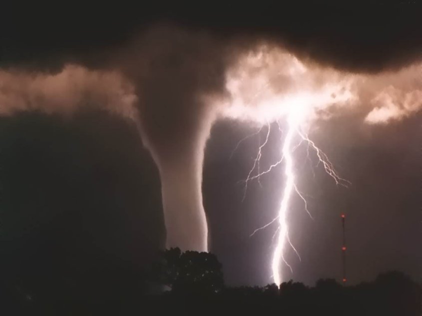
 So are hissing sounds from the base of the funnel. Funnel clouds and small tornadoes are known to produce harmonic sounds of whistling, whining, humming, or buzzing bees. As ozone is liberated it produces such a hissing sound.
 So what if there is no super-cell? How do all the other vortex phenomena form – landspouts, waterspouts, gustnadoes and dust devils, and how are they related.
 Thermo-couples are an instrument to measure temperature used in your car and home air conditioning and heating units.

 The many changes to the state of the air in the updraft changes the conductivity of the air in the column. The updraft column is electrically no different than a wire of changing conductivity, which in the presence of current, will exhibit a thermo-electric effect.
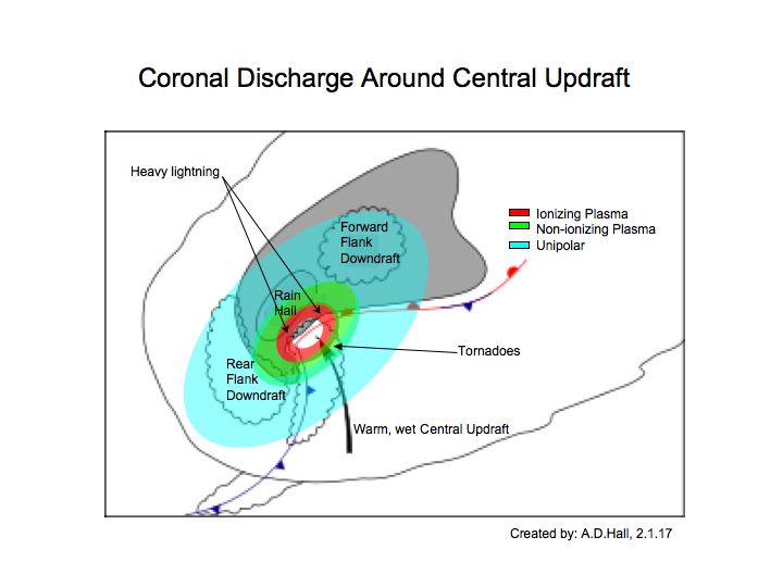
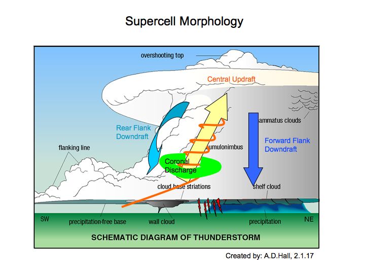
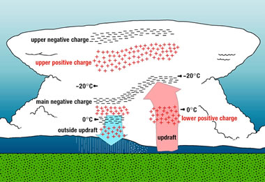 They actually have more complex geometry than a ‘sheet’. They organize into plasma coronas that actively spit out electrons and ions in channeled currents. Coronas have a geometry and produce effects that depend on the polarity of the charged species mix.
 The anvil top is another coronal expression where the water freezes to ice. The ionic mix here is different and a positive corona is the result. It has a different shape, being a broad diameter and less dense in terms of charge density.
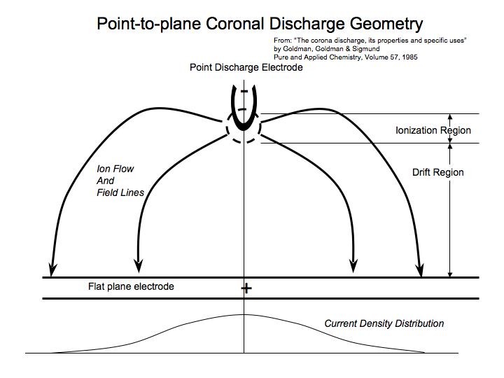
 In the diagram, a point electrode generates a corona opposed to a plate electrode connected to ground, with a gap in between. This is a similar circuit to a storm except the corona in the clouds would not have the geometry of a point electrode, but likely a flattened toroidal shape.
 Sudden and intense down-bursts and mammatus clouds are highly mysterious to atmospheric scientists and they attribute them to density bombs – pockets of dense heavy air that rapidly sink from the clouds. These violent downdrafts will slap airliners from the sky. They aren’t density bombs – they are unipolar winds and ionizing tufts from the anvil corona.
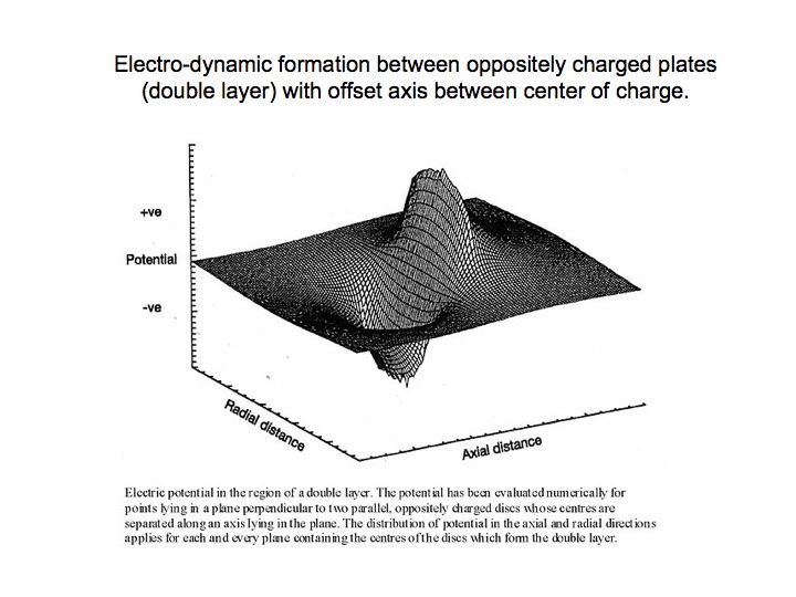
 So too, we have symmetry. Not the artificial symmetry of mathematical equations and categories consensus science keeps force fitting to Nature, but Nature’s true symmetry of nested harmonic repetition.
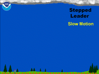 Free electrons continue the process of collision in what is called an avalanche. Avalanche is portrayed in the step-leader process depicted in the image, and is a witnessed precursor to a lightning bolt.
 Updraft winds don’t produce much lightning until they reach 10 to 20 mph. Then strike frequency escalates with updraft speed. From 20 to 50 mph wind speeds, lightning frequency might be 5 to 20 strikes per minute, whereas above 90 mph, the flash rate can exceed one strike per second.
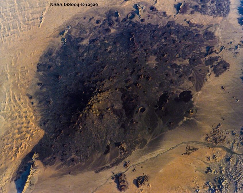
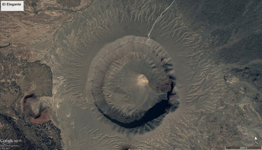
 It’s location in the desiccated Altar Desert of Sonora is the reason it has remained pristine. As Edward Abbey wrote of the Altar: “This region is the bleakest, flattest, hottest, grittiest, grimmest, dreariest, ugliest, most useless, most senseless desert of them all. It is the villain among badlands, most wasted of wastelands, most foreboding of forbidden realms.” In other words, it was one of Abbey’s favorite places.
 Its many lava flows and tephra beds portray the Pinacate as the result of three volcanic periods. First it developed as a shield volcano, raising the mountain that gives the field its name.
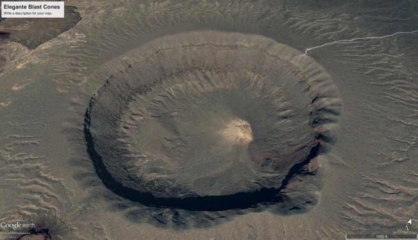


 The study indicates updraft winds won’t produce much lightning until they reach 10 to 20 mph. Then strike frequency escalates with updraft speed. From 20 to 50 mph wind speeds, lightning frequency might be 5 to 20 strikes per minute, whereas above 90 mph, the flash rate can exceed one strike per second.
 Consensus science has concluded there are two forms of volcanic lightning. Researchers led by Corrado Cimarelli, a volcanologist at Ludwig Maximilian University in Munich, Germany, studied
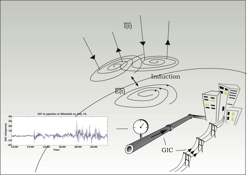
 GIC may not be the only source of electrical current on and under the ground. After all, the rush of lava and gases through vents in Earth’s crust would seem to require a lot of things rubbing and colliding. It seems necessary this would build static charge and cause discharges deep within the earth, even by consensus reasoning.
 Deep craters at the polar regions of the moon never see sunlight. Within these eternally dark and frozen craters, cosmic rays are bombing the surface, creating a double layer of opposite charge, because it is theorized, electrons penetrate to the subsurface, while positive ions hit and collect at the surface – it’s always the collision thing.