Electric Universe has long contended that some mainstream theories of geology may be wrong because they have excluded electricity as a cause for geologic processes. How can a theory be considered a proper theory if it does not consider, from the outset, all the possibilities of causation? Geologists have concluded gravity is the primary cause without even considering electricity.
Gravity may dominate the actions of stars and galaxies (or not), but here on Earth, electricity is the dominant force. You don’t see gravity spontaneously exploding in lightning bolts that kill, do you? No, because gravity is so weak compared to electricity. Oh yes, if a piano falls on your head because of gravity, it can kill you, but that still doesn’t compare to the energy in a lightning bolt.
Electricity is what chemistry is. Chemistry pretty much dominates the world we live in. In a perfect world, chemistry would be named molecular electricity. So it’s hard to say it’s influence in geology isn’t recognized. It most certainly is at the scale of molecular reactions. But I am talking about the atomic sale, where charge diffuses and recombines to create the molecular structure.
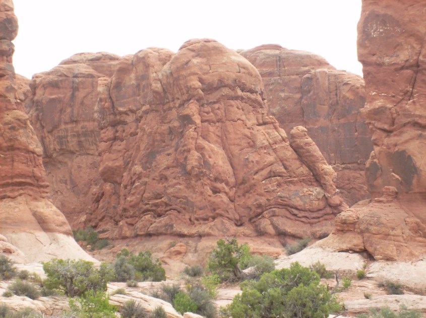
Diffusion in a rock
I once pointed out a rock to a geologist. The rock had a pretty blossom of purple color that was obviously diffusion of some reactive species into the rock matrix. I said see, here is evidence of electricity. He said, that looks like chemical diffusion to me. Of course, we were saying the same thing, but he thought he was correcting me because he didn’t equate chemistry with electricity.
This is what I mean. Even when they include electric processes, they fail to recognize what they are. Instead, geologists claim gravity is the first, and primary cause. That is, rocks are made over time scales of millions of years under intense pressures and temperatures deep under ground, sometimes a hundred miles under ground, where gravity squeezes them into lumps of rock.
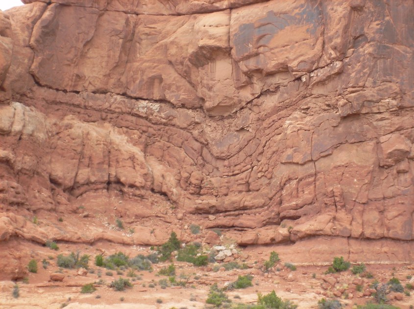
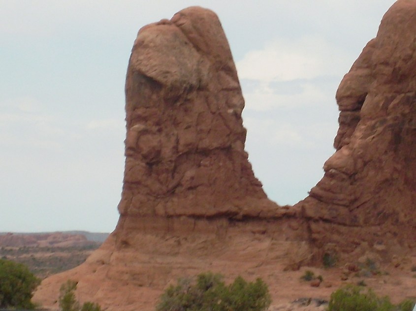
Instant rock – formed while it was still bubbling.
If electricity is considered, temperatures, pressures and molecular bonding can produce the conditions to melt, mix and crystallize rock in a matter of hours, minutes, or even seconds, right on the surface of the Earth where we actually find the rocks. If this happened, it eliminates millions of years of implausible crustal dynamics required to form rocks below ground and then raise them to surface. It would change our entire understanding of geology.
And why shouldn’t it be considered. After all we know Earth’s formation involved violent actions. We know there remains magnetic signatures in the rock that attest to exposure to moving currents. We know Earth’s present existence relies on it’s huge electro-magnetic field, otherwise Earth would be as barren as the moon. We know mountains are pummeled with lightning, and that it breaks and disperses rocks the size of school buses. In fact, it’s becoming apparent lightning may be the largest influence on erosion.
In other words, we know without doubt that electricity courses through the Earth and the atmosphere, and plasma-sphere that surrounds it. Electricity is available, and capable, so it should be considered in the process of elimination one needs to go through to identify true causes. That is what science is supposed to do.
That hasn’t been done though, which leaves a gaping hole in geologic research and undermines the credibility of most geologic theories. Watch this film, and see electrical rock formation. Then go watch a thunderstorm and consider: should you trust the science of people who don’t?
Telluric currents, or simply ground currents, are electric currents that diffuse through the Earth’s crust, influencing what happens on the surface and in the atmosphere. They control where storms brew, the direction of jet streams and flood waters, even where mountains form.
It’s cause is capacitance, and the resultant effect of charge and magnetic fields in motion: inductance. Where current flows in conductive paths beneath Earth’s crust, the atmosphere ‘mirrors’ the pathways with currents of ionized wind – although, because of electromagnetic influence, it is a ‘fun house’ mirror effect. Just as we’ve traced the effects of winds on the landscape and mapped their turbulent route, we can also map major ground currents.
We can only speculate on the nature of subsurface currents, because we can’t see them, other than to say they are hot and electric. We don’t know the conductor they travel in, but we can say they are “surface conductive”, meaning the currents flow in a particular layer, or regime of layers under the crust.
Current flows in surface conductive layers where ionization occurs most readily. Capacitance induces charge to collect at the boundary between layers of different material, because each material has different properties. Surface tension has to form at the interface of layers, which places higher charge density at the interfaces to form a double layer of capacitance induced, opposing charge, and a voltage drop.
The troposphere is example of such a regime above our heads, where atmosphere ionizes, brewing thunderstorms and cyclones. Ground currents flow under the crust, deep in strata we can only imagine and decipher through sonic echo. But we can also infer their paths from surface expressions.
They express themselves where magnetic fields pierce the crustal layer, creating a path for current to discharge. These are volcanoes. So, briefly let’s look at how volcanoes form as a result of ground currents.
Static field of a magnet.
To understand the Electric Earth, one must understand that everything is in constant flux. Nothing in the electrical circuit is static.
Moving current in Nature generates magnetic fields that are dynamic, pulsing and undulating; contracting and expanding in feedback to charge density and momentum in the current that creates it.
Nature’s invisible magnetic fields are mobile, responding to waves of current.
The magnetic flux of a moving current rings around the current according to the “right hand rule”. It also filaments, like electric current, forming tubes of magnetic flux.
Eddy current is induced to flow in a helical path along these tubes. Where these filaments penetrate the crust, a channel forms as heat builds from resistance to the induced current, melting and drawing up magma. A blister forms on Earth’s surface where current, heat and trapped gases push through and escape.
Study volcanic cinder cones, and you’ll find they often – not always – display a perceptible counter-clockwise twist to their form which is a result of the upward spiraling current induced along the magnetic line of flux.
So let’s define two types of ground currents:
Primary Ground Currents – primary currents are large snaking veins of subsurface current flowing pole-to-pole, creating what is perceived as plate boundaries. Indeed, they form the continental plate boundaries, mid-ocean ridges and deep rift zones. But it’s not because the plates are broken and rolling over each other in the consensus theory of “subduction”. Ridges and rift zones, volcanic chains and islands are the magnetic signature of the primary subsurface currents, where the crust is broken, softened and hot.
Then there are secondary current filaments that form ring currents that loop away, perpendicular from the primary current. One obvious secondary ring is on display in the deep ocean trenches and island chains in the Caribbean. This image shows the ring current that loops through the Caribbean from the Eastern Pacific Rise portion of the Ring of Fire.
Surface evidence of a ring current beneath the Caribbean Sea.
Where the secondary current connects to primary, the juncture is called a “triple junction”. Triple junctions occur at the plate boundaries. For instance, the Rivera Triple Junction is where the Rivera Plate meets the Eastern Pacific Rise (EPR). The Rivera Triple Junction is also where the Caribbean secondary loop connects to the primary. Triple junctions are known hot spots for volcanic and seismic activity, and magnetic anomalies.
The point is that there is correlation between secondary loops and fractures in the crust. Fractures are electro-mechanical signatures of the ground currents, and triple junctions indicate the juncture of secondary loops.
Another reason we can infer this ground current loop is the string of volcanoes along it. From Jamaica to where it hooks south to the coast of Venezuela, volcanic island chains are magnetic expressions of the Caribbean current loop. Islands appear to the inside of the loop, and deep trenches appear to the outside. The “right hand rule” tells us current direction is north in this loop, inducing hot current to well-up left of it’s path, and pulling down the sea-floor to it’s right.
There is also evidence the current moved, snaking south to form the Cuban island chain before locking it’s position in a straight line. Where the current dives beneath Central America to the Rivera Plate in the Pacific, a volcanic lineament shows its path.
Volcanic Lineament in Southern Mexico displays current loop.
Lateral current movements of this type can be found all over the world, making ground current mapping fun. The momentum change in the current produces distinctive arcs of deep depressions, lakes, mountains and volcanic island chains, as the current first bends into sinuous paths before snapping straight. The sinuous curves show the resistance to compression, like a steel spring being squeezed.
The arrows in these images point the apparent direction of the lateral movement. Note there are a few arrows pointing both ways, meaning I’m not sure which way it went.
One of the reasons currents make these lateral moves is because each side of the loop flows in opposite directions, creating dipolar attraction that narrows the loop. Volcanic activity and faulting is greatest at the curvatures in the loop, because it is where charge density and change in momentum is greatest, producing the strongest electric fields.
If we apply this same basic morphology – that triple junctions are connections between primary and secondary currents, that secondary currents raise volcanoes and create depressions, and that lateral current movement occurs where these features are most prevalent, we can use this to infer a secondary current beneath North America.
The Great Attractors
Now let’s examine North America, and the epicenter of the storm over the Colorado Plateau. Thanks to Jupiter, we understand it’s wind patterns, how they correlate to the plateau, and we can now correlate those with the significant volcanic lineaments in North America, adding another layer of information to analyze.
The Ring of Fire is the most obvious path of a primary polar current. Along North America, this portion of the ‘Ring” defines the plate boundary and a lineament of strato-volcanoes from Alaska to Central America.
If you connect the volcanoes like dots, this portion of the Ring of Fire forms two lineaments, or straight line features down the west coast of North America.
The volcanic chains are the expression of induced current rising through the crust, and faulting is from electro-mechanical down force. The volcano lineaments are east of the faulting, implying a south directed current according to the “right hand rule”.
There are three other major lineaments in central North America’s interior. Yellowstone super-volcano is one end of a curving lineament of volcanoes in a trend that forms a part of the Snake River Valley across southern Idaho.
To the south, is a string of volcanic fields called the Jemez Lineament. The Jemez Lineament extends diagonally from the Pinacate Volcanic field in Sonora, Mexico, northeast across Arizona, to the border between Colorado and New Mexico.
It’s bisected by a northwest-to-southeast lineament of volcanoes that include the San Francisco Peaks and the Uinkaret volcanoes on the North Rim of Grand Canyon.
With all of these plotted together on one map, a pattern begins to emerge that implies a secondary current loop beneath North America.
Consider volcanoes an electrode poking through the surface of the crust. Plotted, the Jemez and San Francisco Peak volcanic lineaments produce an almost perpendicular cross pattern, juxtaposed symmetrically across the Colorado Plateau from the volcanoes of the Yellowstone complex, and aligned with the Ring of Fire.
The Jemez lineament aims directly to the Guadalupe micro-plate to the southwest, and to the arc of the Great Lakes to the Northeast
The loop appears to circle the Great Lakes and points back to the Black Hills in South Dakota, which appears to be an inflection point. From there it points to the Juan de Fuca plate in a direct line through Yellowstone.
It has a similar shape and size to the Caribbean current loop, with the base of the loop wider than the tip.
Similar to the Caribbean Loop, there is a significant depression at the tip. In this case the Great Lakes, but they reside on the inside of the loop, whereas ocean trenches are outside the Caribbean Loop.
And where the Caribbean Loop has volcanic islands inside the curve of the loop, the North American Loop has maar craters (see “The Maars of Pinacate“), forming a series of circular lakes surrounding the arc of the Great Lakes. Only a few circular, or circular lake formations are highlighted here to show the trend.
Maars are volcanoes created by steam and other gases exploding from heat instead of spewing ash and lava. Smaller such expressions are known as karsts and breccia pipes. They are all forms of diatremes, and are often mined for uranium and precious metals, which the eruption leaves behind in the throat of the tube. The surface result is a crater instead of a cinder cone.
Further east there are long linear lakes, forming striations in the land normally attributed to glaciation. They may well be from glaciation, but the direction and orientation also suggest they could be from a contracting current loop passing below.
There is a large body of evidence for glaciation, and Electric Earth theories do not dispute, or conflict with the evidence. However several landscape features attributed to glaciation may be misinterpreted. These cuts are a possibility.
The implication is that the loop current lies below aquifers that erupted in steam, creating the maars. And that the volcanic expression is to the outside of the loop, depressions to the inside, so current circulates north-to-south in this loop – opposite to the Caribbean Loop.
The shape of the Great Lakes, especially Lake Superior, show the sinuous shape of ground current movement. It appears the loop narrowed, or swung to the south, until the southern leg aligned to the Jemez Lineament.
The Yellowstone volcano lineament is a half circle, and also appears to be from ground current movement. In this case, the movement is north from the Monterrey Micro-plate, to the Juan de Fuca triple junction. This widened the base of the loop, with the pivot point of the shift at the Black Hills of South Dakota.
Tertiary Ground Currents and Surface Dipoles
Two like charge electrodes – either cathode or anode, have electric fields in opposition.
Since we regard volcanoes as electrodes poking through the crust, they should also be considered anodic, as they expel ionic matter. This charged matter is current in a circuit, and electric field lines between two anodes don’t connect – they repel each other. A circuit has to go somewhere, so there also must be cathodes to provide a sink for the currents.
The volcanic anodes spit ions into the atmosphere, so the circuit has to complete through the atmosphere, back to ground. We know how this happens. It’s called lightning. Specifically, “negative lightning”, which you may wish to review in “Nature’s Electrode“.
Where negative lightning strikes, it burns and blasts the land, initially causing a crater. But the return stroke draws positive ionic matter to it, leaving a mound. So a volcano is an anode spitting matter into the atmosphere, necessarily connected to a cathode, which is a lightning spitting thunderstorm drawing in-flow winds and matter to it.
Negative lightning gathers positive surface ions to it, piling-up a mountain. It often produces winds in excess of Mach speed, producing tetrahedral shock features on the flanks. They come in a variety of forms, depending on the severity of the discharge and the material on the ground it affects.
Two prominent lightning fulgamites are juxtaposed, either side of Yellowstone, creating dipolar alignments. The Black Hills to the east, and Sacajawea Peak, in Eastern Oregon. The ground current runs straight through this alignment to the Juan de Fuca plate.
Black Hills, S. DakotaSacajawea Mountain Complex, Oregon
Note that both are very large mountain complexes, with multiple peaks. They form roughly circular mountain lobes surrounded by river valleys, like a moat around a castle.
Two opposite charge electrodes form a dipole, and the electric field is strongest in a straight line between them.
There are several more of these large fulgamites throughout the Colorado Plateau. Actually, there are millions of them, but most are small and are in proximity to the largest. Mapping the most prominent, along with the most prominent volcanoes, yields a picture of where tertiary ground currents flow.
Remember we have Primary and Secondary ground currents. Now there is a Tertiary current flowing close beneath the ground between anode and cathode spots.
Since we know an electric field between an anode and a cathode – a dipole – produces a field pattern with the maximum voltage gradient directly between them, we can connect volcanoes and their most proximate fulgamites with straight lines and get an approximation of the electric field at ground level.
If you’re having trouble picturing this, think of the electric field as a blanket held in the hands of firemen. The anodes and cathodes are where their hands hold the blanket. Presumably, they are going to catch a victim of a fire jumping from a high window, so they hold the blanket very tight. All the tension in the blanket is between their hands – single lines of tension, like ropes. The rest of the blanket is slack. So, just by knowing where the “hands are” – the anodes and cathodes – you know the basic topology of the blanket.
Now, consider that each of these lines of tension in the ground is just the bottom half of a loop that arches through the atmosphere. One leg of the loop is a volcano spewing, and the other is a raging thunderstorm of biblical proportion, it’s lightning and inflow winds building a mountain beneath.
Through the center of the loops flow jet-streams of induced current plasma. It is simple electromagnetic induction for a current loop to draw a plasma wind through it. So ground-level, horizontal jet streams pour through at ninety degrees to the loop. Consequently, we can draw ground winds perpendicular to the violet lines denoting major dipoles and create a wind map.
Wind map from electric field lines on the ground inducing current paths in the atmosphere.
And this wind map is eerily similar to the wind map generated from the pattern of tetrahedrons on wind-blown mountains and up-draft dome/down-draft crater pairs mapped in “Eye of the Storm – Part 4“.
Wind map from physical features on landscape indicating wind direction.
In fact, they produce virtually identical wind maps, except for the fact the electric field model cannot show high level winds. It only shows ground hugging jet-streams.
Mapping up-draft domes and down-draft craters with a true understanding of thunderstorms and cyclones is the only way to find vertical winds and understand the full, three dimensional current path.
So what does this mean? It means the firmament was formed by volcano, wind, lightning and electric fields due to Earth’s capacitance.
The wind is displayed by physical features, such as shock wave patterns that cannot have been formed seismically, or by erosion.
The Laboratory
The wind is displayed by ground current paths that produce dipolar nodes of volcanoes and fulgamites.
The wind is displayed by the footprints of up-draft domes and down-draft craters that portray the vertical dimension.
And we have an ongoing, observable laboratory experiment to compare with right here in this Solar system.
Thank you. Please hit the “like” button, if you liked it. Leave a comment, if you dare. Leave some money, regardless.
Quick Tip
The Daily Plasma is free to read, but the cost of publishing isn’t. Please leave a tip to show appreciation, and help defray expenses.
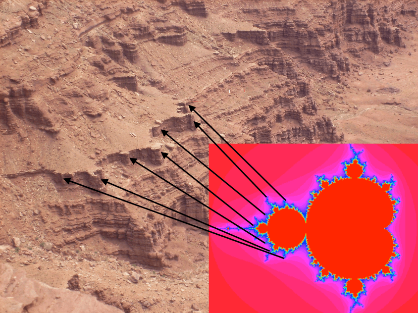
If you study Earth’s surface and look at details in it’s form, there are obvious patterns. Arcing patterns of mountain ranges and island chains, strange swirls and looping cracks on the ocean floor, and on close inspection there is harmony in the shape of mountains and other terrain. Sometimes it’s geometric, with triangles, arcs and star patterns, but usually it’s more fluid, like a crazy paisley.
Consensus thought is this results from a series of unrelated events that occured over billions of years, driven by the slow churn of Earth’s crust sub-ducting the continental plates, and the constant wear of erosion. EU thinks it didn’t happen that way. We think it was caused by electricity, and the patterns we see make more sense if viewed in the context of our theory.
The face of the Earth was shaped by three primary means: volcanic eruption, lightning, and wind. It occurred in primordial storms which ionized the atmosphere, charged the ground like a battery, and discharged energy the same way we see today: earthquakes, volcanoes and storms. Only these storms were beyond biblical. They occurred before Man arrived. What we are talking about today are the storms of creation, which shaped the face of the planet.
Because wind played the biggest role in laying and piling the sediments we live on, its effects are most visible. The evidence is in supersonic shock waves imprinted on the land. Once you start recognizing the characteristics of wind-formed topography, it becomes impossible to ignore.
To identify wind direction, look at mountains. Mountains (not volcanoes) are all essentially wind blown dunes. With exceptions for shifting wind conditions, a mountain’s shape will show a windward and leeward side like a dune. The leeward side is generally steep and slab sided, and the windward side dips at shallower slope.
Typical sand dune formation.
The windward side actually portrays the shape of the wind itself, as pressure waves undulate across movable sands and mold them.
If the wind reaches Mach speed, standing shock waves reflect from any protrusion in the wind’s path, causing a sharp change in wind direction. Distinct patterns form at this crease, where the wind direction changes abruptly. The reflected standing shock wave forms a fan-shaped interference pattern of compression and rarefaction. This pattern can be found on most mountain forms, including cordillera mountain arcs, continental divides, lone inselbergs and basin and range.
The angle a shock reflection takes depends on it’s mach speed and vector relative to the reflective surface.
Shock wave reflections form diamond patterns of compression and rarefaction.
Dust deposits in a tetrahedral dune with a flat triangular face to the wind.
Dust laden supersonic winds deposit their heavy cargo where the crease in the wind forms. A tetrahedron-shaped zone of rarefaction (low pressure) develops at the root of the standing wave, called a “separation bubble”. Wind-born dust collects in this bubble as the wind deflects upward with the shock wave.
As material deposits in the separation bubble, it forms a new barrier to deflect the wind, which moves the standing shock reflection backwards, into the wind. The separation bubble migrates into the wind with the shock wave, causing new dust to overlay the old in layers that stack into the direction of the wind.
A protrusion in the wind changes the wind vector and angle of reflection, and forces the shock wave to grow backward into the jet stream. This deflection of the wind creates low pressure at the leading edge of the protrusion which deposits buttresses in the shape of the triangular wave-form.
The shock wave is a discontinuity in density, temperature and ionization. Remember, we are talking about a primordial storm where much of the atmosphere ionized. So, standing shock waves reflected from the ground, back into the clouds, providing a path for discharge. The separation bubble is not only a pressure sink, which collects heavy matter, it is also a current sink, being the lowest potential region connected to the high potential current in the reflected shock wave. It therefore draws current to bake, compress and fuse the deposited dust.
It creates a distinct pattern on the windward side. Dragon’s teeth – triangular buttresses, sometimes called flat-irons, formed by the sonic, ionized shock waves of supersonic winds. They rise and fall in amplitude and wavelength, and display harmonic frequency shifts, as well as many, many other features which could only be produced by the sonic effects of supersonic winds – see the “Arc Blast” and “Monocline” articles for more detail.
The Mexican Kink
Understanding how winds form these shock patterns, and examining the result on the landscape reveals a wealth of information. Let’s consider this very simple dune, called El Guaje, in the Sierra Oriental mountains of central Mexico. The shock pattern of triangles is very apparent on it’s windward side.
A pressure ridge in Mexico formed by supersonic winds.
The next annotated image of El Guaje highlights four consecutively formed pressure ridges that are visible. The first (green) is almost buried by later deposition and only the tops of it’s buttresses are exposed. The second (yellow) is a minor ridge caused by a period of weaker winds. It is also partially buried by the third, and largest ridge (red).
Four pressure ridges can be seen. Wind flow denoted by blue arrows, dark blue denotes supersonic speed.
Large triangular buttresses at one end of the large (red) ridge shrink in amplitude with geometric progression until they almost vanish, indicating the jet-stream velocity transitioned from supersonic to near subsonic velocity along the wind-front of this dune. The faster jet-stream region advanced the growth of the dune, depositing material faster and pushing the shock-wave into the wind. It advanced the ridge line into the wind (violet) and built this portion of the mountain thicker, taller, with large amplitude reflected shocks forming bigger buttresses.
Each layer of the buttresses is formed by a new shock front from winds impinging on the last layer. New shock fronts formed as the winds gusted, piling new layers on the old. A final diminishing wind created a fourth shock front which deposited a small pressure ridge (purple) along the foot of the mountain. The highlights obscure natural features, so please contrast all annotated images with the first, naked image.
The winds that created these ridges were like any storm, just quite a bit more violent. They stiffened as the storm grew, reached a crescendo with electrically charged, gusting blasts at Mach speeds, and then ebbed away. Their formation precludes any notion that the winds that created them were caused by meteor or comet. A large impact might produce supersonic, dust laden winds, but they would crest with the first shock wave and then dissipate, not slowly build to a crescendo.
Take a look at the surroundings of El Guaje ridge, and it becomes even more apparent how it was made. It is part of a larger structure – an oblong crater, two hundred feet deeper in the center than outside the rim. The pressure ridges, including El Guaje, form the rim of the crater.
It wasn’t made by an oblong meteor. This is the result of a down-burst wind. The pressure ridges are the rims of the crater, with triangular buttresses showing the wind direction as it blasted the Earth, like a blow torch, and blew out radially, depositing dust along the standing shock waves it created. The outward blast is interfered at the top end by two, round mountains formed by lightning discharge which altered the wind flow around them.
Taking another step back reveals this entire mountain region in Mexico is shaped by a turbulent shear zone in the wind. These mountains were formed by uni-polar winds, screaming from the south, and mixing into plasma storms along the shear zone with opposite polarity winds screaming the other direction. It is eerily similar to the turbulent shear zones adjacent to the Great Red Spot, creating kinked circulations that have a crab-claw shape. I call this the Mexican Kink.
Craters formed by downdraft winds in a turbulent flow region in Mexico. El Guaje is at the very top of the frame, just right of center.Crab-claw shapes of up-and-down turbulence near the GRS.Crab-claw shape of downdraft craters in Sierra Oriental, Mexico
Turbulent winds fold back and forth to make these kinks, but they also fold up and down and twist into tornadoes, blowing and sucking at the land. In turbulent zones, the downdrafts form cyclones that are often stretched out-of-round into oval, polygonal and U-shaped structures. The winds are electric currents, so these turbulent kinks are semi-steady-state, keeping their form a long time, molding the land.
Downdraft turbulence also means updraft turbulence. So next to downdraft craters in Mexico are mountains formed by updrafts. Updraft wind will create a dome or ridge of layered deposit with a rim around it also, but the inflow to the updraft leaves triangular buttresses from shock waves on the outside of the mountain, pointing inward.
Linear ridges formed by updraft winds.
The updrafts deposit linear and lobe shaped mountains around and between the downdraft craters. The turbulence is in a shear zone, so deposits occur in narrow lanes between conflicting winds. Updraft deposits are composed of more material than craters and have the triangular patterns of shock wave reflections on the flanks.
As it relates to clouds on Jupiter, a long, rising column like the one highlighted below would create such linear mountains. One can see the dark depths of the hole in the clouds from which the updraft column rises. The winds roll upward from the ground and curl over, leaving a broom-swept linear ridge on the land below.
The roiling updraft, flanked by downdraft cyclones (black regions) creates an “S” shaped fractal form, and raises a narrow mountain beneath it.
The turbulent kinks are fractal forms, so taking another step back reveals the fractal crab-claw shape emerging at a larger scale. The smaller feature with the crater shown above is nested within this larger repetition of the wind pattern shown next, aligned along the same axis. Nested fractals are very evident in Jupiter’s clouds as well.
Shear zone turbulence between conflicting, ionic winds.
The similarity between Mexico’s mountains and Jupiter’s clouds is due to capacitance in the planetary circuits. The strongest winds are vertical winds driven by the electric field.
Following is a sample of images taken from the southern leg of storm centers that molded South America, Australia, Africa and Eurasia. The winds pushed and pulled on the land with electric force, literally molding it from wind action above and volcanic action below.
The fluid shapes are a dead giveaway for magneto-hydro-dynamic forces. But deeper levels of evidence are there, in Mach speed sonic shock effects, arcing effects and sputtering effects that provide a holistic electric picture of everything that happened. Look close at the following images and note patterns of stratification and liquid deformation evident from waves of heat and pressure.
Turbulent winds lifting off the land, arcing across the sky, and returning in downdrafts were filaments of plasma that varied in charge density in cross section. Take note how a tornado is a coaxial circuit, with the outer wall of the tube being the fastest, most dusty region, and the inner core often a clear draft. The plasma filaments of primordial storms varied in dust content, charge density, and velocity in cross-section, as well.
Outer and inner walls of a tornado on display.
The result is stratification of mineral deposits vertically, where rock morphology and mineral composition discretely change from the core of the feature, to the walls of the feature and then to the outer surroundings.
The following images show where the storm pulsed and ebbed with current, stratifying layers of dust with different composition from inside-out, where coaxial up-and-down draft winds created domes and craters.
Layers of varying mineral composition are particularly evident where winds abruptly changed direction, from horizontal to vertical at the rim of craters and the buttressed flanks of mountains. There, charge densities in the shock waves and the effects of magnetic pinch were greatest.
Shock formed buttresses in Peru display mineral layering from winds of different composition.Similar layering is evident in Utah.
The stratification of species within the electric winds of Jupiter matches the pattern of stratification in land forms. They are coherently layered from the inside-out of each turbulent kink, or vortex, unmixed by the turbulence, in accordance with charge densities in currents primarily moving up and down.
Colored patterns don’t mix, but remain stratified in layers according to charge densities and magnetic fields primarily around up and down draft winds. Note color changes define the center, edges and surroundings of vertical turbulence, which is the result of current flows.
That electromagnetic fields sort species and recombine them is predicted behavior in plasma. We use a multitude of techniques in manufacturing based on this fact. Different materials respond to magnetic fields differently. The electric field responds to charge density, so shapes itself around conductive flows of material, and vice-versa. The result is stratification, and it’s apparent the stratification on Earth’s landscapes matches the stratification in Jupiter’s winds.
JupiterEarth
Some mountains do not conform to the wind-blown dune shape, exhibiting triangular buttresses on both flanks of the mountain, or not conforming to the windward/leeward angle of slope. This does not mean they are not dunes, but indicates they were formed subject to shifting, or competing winds.
In some cases, mountains formed as sastrugi, or linear deposits parallel to the wind in the shear zone between channels of wind of different velocity.
Sastrugi form parallel to wind flow, in shear zones between different speed winds, especially where turbulent winds laminate in a “bend” – Sierra Oriental, Mexico
So, it is possible by looking at the land to deduce wind patterns. Following this method, the next image shows the Colorado Plateau with wind formed pressure ridges annotated by blue lines. These are pressure ridges formed perpendicular to the wind. Each line is drawn parallel to a pressure ridge, and perpendicular hash marks indicate wind direction. Red lines indicate pressure ridges formed parallel to the wind, at shear zones between conflicting winds.
This provides one layer of dimension to the storm. To add another layer, we can look at the domes and craters formed by updraft and downdraft winds.
Red areas are updrafts, yellow are downdrafts, blue are precipitation footprints. Adding this layer of information to the map of pressure ridges, produces a wind map of the Colorado Plateau and Rocky Mountains that looks like this:
To describe this storm, there are two jet streams from the north. One poured through the Snake River Valley, arcing east towards Yellowstone. The other jet stream swept into the Great Basin rippling Nevada with rows of windblown mountains. An “S” shaped range in central Nevada defines the center of rotation, as this meso-cyclone scraped the ground like one incredible tornado. It down-drafted in two streams. One pressing down on the Uinta Valley, Utah; the other sweeping northern Arizona, forming much of the Mogollon Rim.
The Great Basin thunderstorm also spun air south, bypassing the rotation to help define the Sierra Mountain arc, and scour Owens, Amorgosa and Death Valleys. The Sierras were formed by winds from the west (not shown) which pressed against the Great Basin rotation, and the winds bypassing south.
From the south, winds collected and then split, forming the Mexican Kink, and the El Guaje mountain. They reformed in a ground hugging laminar flow near Four Corners, sweeping across Colorado, Utah and northern Arizona, laying the foundations of the Colorado Plateau.
The southern wind fed a multi-vortex cyclone over the plateau, were it divided it’s path to feed thunderstorm updrafts. These winds threaded up and back down through meso-cyclone-cyclone pairs in looping currents, like lacing a shoe. The updrafts are defined by San Rafael Swell, Utah, and Monument Valley and Black Mesa, Arizona.
Winds from the south also circulated eastward over the Great Plains, to be sucked into the cyclone through thunderstorms that built the eastern face of the Rockies. These down-drafted, forming huge craters in the mountains, like San Luis Valley, Colorado.
Each of these features – the Great Basin meso-cyclone, the multi-vortex cyclone over the Colorado Plateau, with arching colonnades of meso-cyclone/cyclone pairs can be identified in the Great Red Spot on Jupiter. It’s because the shapes and actions of the wind are driven by the fractal process of charge diffusion in the planetary circuit. The difference in chemistry, and thermodynamics of Jupiter’s atmosphere compared to Earth’s doesn’t make much difference, because circuits are the forcing mechanism in Nature.
So this completes the view of winds at the very eye of the storm. The Colorado Plateau received the hottest plasma torching in North America. Surrounding areas were also ravaged by storm, but none so severely. In fact the whole Earth was wrapped in storms. So, we’ll look closer at some of those regions, as well as more details on North America in the next installment.
Quick Tip
The Daily Plasma is free to read, but the cost of publishing isn’t. Please leave a tip to show appreciation, and help defray expenses.
On Earth, hurricanes and typhoons are called cyclones and occur over the oceans. The cyclonic storm develops an eye in the center of rotation, where high altitude, dry air is drawn down the center. The thing to know is that the eye of a cyclone is a downdraft wind.
The center of a cyclone is a downdraft
Over land, we see a different effect. Super-cell thunderstorms develop a rotating meso-cyclone that rises in a tower that spreads an anvil cloud. The thing to know is that the center of a thunderstorm is an updraft wind.
Thunderstorms’ central meso-cyclone is a rotating updraft.
If you look at these different storms from above, the cyclone blows at the ground, and the thunderstorm sucks at the ground. The pattern of wind in each type of storm is due to capacitance in the electrical circuitry of the Earth.
The thunderstorm as a circuit…
The electric winds of a thunderstorm can be likened to a rope. Generally, the rope winds up the towering meso-cyclone to a cap, the anvil cloud, and unwinds from there to non-rotating channels of rain flanked by downdraft winds.
The mature storm forms a circuit – a current loop from ground through the meso-cyclone and back to ground – as rain.
The very pattern of a super-cell betrays it’s identity: It is a stack of dielectric layers through which a current flows. Condensing, and then freezing moisture in the updraft sheds ionized matter into cold plasma currents that produce rain, lightning and tornadoes.
A massive, cold plasma halo in the sky acts like a live electrode hanging over the ground, with an air gap between. The updraft current is from ions swept from ground level. It loops through a negative plasma low in the cloud where condensation occurs, and continues to a positive plasma in the anvil, where ice forms. At each level, the recombined matter – the rain and ice – are shed and return to ground. Flanking down-draft winds are excess currents of uni-polar wind that complete the storm’s looping circuit to ground.
Three Dimensional Jet Streams
Charge densities are responsible for the geometry of storms. As negative charge builds in the bottom wet layers of cloud it strengthens the local electric field and draws winds to it. Above, in the cold icy layers at high altitude, a positive layer of charge accumulates to balance the charge below, and it spreads out in a huge disc.
Thunderstorms central core sucks wind up and diffuses laterally in an anvil cloud.
Likewise, on the ground below the cloud, positive charge accumulates to balance the cloud charge and feed the central updraft. Lightning arcs contribute to balancing the charged layers, dissipating charge at points of highest potential.
But the build-up of charge density around the core of the storm also means there is a secondary vector in the electric field running horizontally through the cloud layers. As ionic matter is drawn to the storm by updraft and concentrated, it depletes charge from the far field region of atmospheric layers, creating local electric fields which draw current horizontally, transverse to the electric field at the core of the storm.
Charge diffuses horizontally, as well as vertically, and the visual evidence is in the symmetry and coherence of the tightly wound meso-cyclone. The base of the storm which draws charge to it – and the spreading anvil cloud which disperses charge away.
Consensus science says the green glow of a meso-cyclone is light reflecting from water in the clouds. Yet the rain curtain, which is water, doesn’t glow green at all. In fact rain clouds that aren’t in a meso-cyclone don’t glow green either, though they are saturated with water too. The green glow is coronal discharge.
Everything about thunderstorm morphology speaks to layers of capacitance in a point-to-plane circuit that loops through an air gap to ground.
Thunderstorm is patterned on point-to-plane discharge geometry
Channels of wind, sputtering and arc mode discharge match channels of coronal discharge
Consensus science has attributed the electrical charge build-up in thunderstorms to “static” charge from colliding rain and ice. One flaw in this idea is: there is nothing static anywhere, at anytime, in any place in a thunderstorm. Everything moves – and that means charge, too. And that means one undeniable thing: electric current. To not model a thunderstorm as such flies in the face of reason.
Fractal Progression
In a hurricane the airflow is very different from a thunderstorm. Consider the wind-flow again as a piece of rope: the rope enters whole down the central vortex, and unwinds into several threads of vertical up-and-down drafts flowing radially away from the storm’s eye in rotating currents.
It’s almost the inverse of a thunderstorm, which has a rotating updraft that unwinds into threads of non-rotating downdrafts and rain.
The cyclone’s rotating updraft bands are made of thunderstorms, which electrically, suggests the entire cyclone is a next-level fractal expression of the thunderstorm, in which the independent loops of thunderstorms’ maintain their form, but have organized together creating loops within loops, and vortexes within vortexes – fractal repetition of form.
In fact, thunderstorm cells interact as looped currents all the time, even when not part of a larger cyclonic system. One storm cell can arch it’s anvil cloud over another, and suck the life out of it by absorbing its energy. One can witness this as squall lines of thunderstorms develop.
Comparing the characteristics of thunderstorms and hurricanes (northern hemisphere) shows the similarities and polar opposite characteristics that naturally develop in this fractal progression:
Attribute
Thunderstorm
Hurricane
Surface Condition
Over land
Over ocean
Central Core Wind
Wet, hot, rotating updraft of condensation
Dry, cold, non-condensing, non-rotating downdraft
Outer Winds
Non-rotating, dry downdraft winds flanking a rain curtain
Circumferential rotating wet updraft winds and rain bands
Rotation
Counter-clockwise central updraft meso-cyclone, wall clouds and tornadoes rotate in the core of the storm
Counter-clockwise, outer winds and rain bands rotate around the central downdraft core of the storm
Discharge modes
Vertical winds, lightning and tornadoes
Rotating wind. Cyclones produce very little lightning and comparatively weak tornadoes.
In a hurricane, thunderstorms organize like synchronized swimmers swimming in a circle, creating a whirlpool down-draft in the center. The organized entity has more power than a meso-cyclone, but it’s diffused over a greater area and creates less tension in the electric field.
Vertical winds of thunderstorms in the rotating bands dominate the structure of a cyclone.
Super-cell thunderstorms are small in comparison to cyclones, but create a higher electrical tension that produces far more lightning and powerful tornadoes.
One reason a cyclone is different from a meso-cyclone is that cyclones form over water. The electrode spot on a featureless, homogeneous surface of ocean diffuses charge broadly and evenly. On land, there are mountains, mineral and water deposits that ‘focus’ the electric field, by providing greater conductivity, or increasing charge density at elevations.
A similar relationship exists between thunderstorms in mountain regions and the super-cells on the plains that produce horrendous tornadoes. Mountainous regions rarely produce tornadoes because high points and mineral deposits collect charge, increasing the electric field tension to draw arcs of lightning. The diffusion of ground charge on flat plains allows discharge between ground and cloud to spread out, which favors spinning Marklund plasma currents instead of intense bolts of lightning. The tornado is a more diffused, slower, less intense discharge than a lightning bolt, but still a fractal element of discharge within the thunderstorm.
The cyclone is a fractal step-up in scale from the meso-cyclone. It isn’t just a bigger thunderstorm, it’s a whole new entity composed of the old entities, re-organized into a higher level of complexity. It’s like striking one octave above a note and finding harmony – two notes in resonance that create a new sound, more complex than the sum of each note.
The cyclone is the next level of storm complexity, where the thunderstorm cells act in harmony and begin to share lanes of updraft and downdraft winds, manifolding together and developing a coherent rotation. Ultimately this forms an eye with a downdraft in the center, and a cyclone is born.
But a cyclone is not the most powerful level of fractal progression for storms on Earth. The next fractal level of plasma form is when a cyclone and meso-cyclone organize. This creates the most destructive storms of all, at least that we see today.
A “Perfect Storm”
In our historic period we don’t see storms that exceed the level of the so called, “Perfect Storm”. Like the famous book of that name, which described the last voyage of a fishing boat caught between such storms, where a hurricane and nor’easter met.
When meso-cyclone and cyclone come together, they produce a loop current. It’s fractal progression of the thunderstorm current — updraft to downdraft and rain. Only one big meso-cyclone connected to a cyclone makes one big current. Outflow at ground level from the cyclone feeds the meso-cyclone, and discharge from the high level anvil feeds the cyclone’s eye. Coherency emerges from plasma actions expressed at every level of the storm in greater and greater complexity.
In our present climate on Earth, “The Perfect Storm” is as bad as it gets. But we are only seeing an echo of the drama of primordial storms. Even though we see lightning and devastating three hundred mile-per-hour winds – violent enough to destroy our matchstick homes – it does not scour us with supersonic winds, hot plasma tornadoes and electric arcs that shape mountain ranges.
But it did, at some point long ago. Updraft winds of meso-cyclones and downdraft eyes of cyclones became supersonic jet-streams. An energized geomagnetic field amplified the magnetic flux in coronal loops generating co-rotating storms that sucked and blew at the land, leaving vast craters and domes. The ring currents multiplied, too, generating smaller harmonic repetitions – more intense fractal repetitions that produced hot, probably glowing plasma tornadoes and incredibly huge arcs, large enough to boil a mountain from the earth.
As fractal evolution progresses with the application of a larger electric field, thunderstorm cells multiply and their downdrafts grow to cyclones, until multi-vortex systems spin within multi-vortex systems, which are within a multi-vortex system. Nested fractal repetition of form.
We sense winds as horizontal. We describe them that way: nor’easter, westerly, windward and leeward. We rarely think of vertical winds unless we are right under them, and then it is considered an unusual and often catastrophic event. Down-bursts, tornadoes and related vertical effects; lightning and storm surge, are the most destructive elements of storms. Vertical winds impact smaller regions, but are far more violent than horizontal winds.
In primordial storms, vertical winds literally blow-torched the land, and sucked at it like a vacuum hose. We can see this in the geology.
Australia
The Solar Example
Strip away the hydro-dynamics of a dense atmosphere, fully ionize the environment to see the raw electric currents in a hot plasma, and it’s like an x-ray view of a storm.
Sunspots are Solar Hurricanes
Sunspots are Solar hurricanes. The central core is a downdraft wind diving beneath the chromosphere. The filaments radiating from the core are coronal loops, attached at one end to the core, and the other to plasma “thunderstorms” – the updraft leg of the loop, which are positioned in a circumferential ring around the core, feeding it filaments of current.
Coronal loops are current discharges along magnetic field lines feeding the core downdraft of a sunspot. The loops are currents trying to break through the Solar atmosphere. When they do break through, it becomes a Solar flare.
Capacitors are used in electronics and power supply systems to control current flow. They are composed of two conductive plates facing each other with a gap between. The gap is filled with a dielectric material that resists current flow. In its intended operation, current does not pass through the dielectric. Current results from charge build-up and discharge from the plates on either side of the gap.
The hows and whys of a working capacitor are fascinating, but what we are interested in for this discussion is how a capacitor fails. A capacitor fails when current actually flows through the dielectric. It’s termed dielectric breakdown, and occurs when the voltage applied to the capacitor exceeds it’s capacity to store charge on the plates. The dielectric fails to resist the electric field across it and it sparks. That is what we see when lightning strikes – the dielectric breakdown of the layer of air between a cloud and ground. An ionized channel develops in the dielectric and the built-up charge on the plates suddenly dumps through the channel.
Coronal loops form as current tries to break through the Solar atmosphere.
We see the discharge as almost instantaneous, but in reality there is a prior period when the dielectric absorbs charge and builds the ionized channel. Charge has to diffuse through the dielectric before the channel forms and connects the plates. The diffusion of charge through a spherical capacitor, like the Sun’s atmosphere, creates current loops within the dielectric. As charge is absorbed by the dielectric, it forms currents that loop from one plate into the dielectric, and back to the same plate, because they have no path yet to reach the other plate.
As voltage increases, the loops grow (absorption) extending the ionized path further and further, until it breaks through the atmosphere and discharge occurs.
Solar flares occur when the current breaks through.
In storms on Earth, the same looping current flows are in the form of weak plasma winds because the atmosphere is only partially ionized. Cold plasma is mixed with neutral species, so thermo-electric and hydro-dynamic effects come into play, raising complexity, but the underlying electric circuit is the same.
On Jupiter, the same electrical process can be seen occurring, and current loops, or coronal loops can be identified in the Great Red Spot. They appear as Roman colonnades of arches in the cloud, which rise in towering pillars, arch across the sky, and downdraft into the eye of doughnut-shaped cyclones.
Unadulterated view of the The Great Red Spot.
The arching clouds portray the current loops in a multi-vortex coronal storm. They march around the inner rotation the way thunderstorms circulate the eye of a hurricane. Each doughnut-shaped cloud at the base of an arch is a cyclone of giant proportion with a downdraft through its core. The other end of the arch is the towering updraft of a thunderstorm, and the filament that arches between is the anvil cloud following current flow along a loop connected to a dielectric surface below. They are the tops of vertical ring currents – coronal loops – that are so intense they sculpt the anvil clouds in the shape of the current flow.
NASA can detect these jet stream winds. They are aware of the complex patterns and the violent up and down drafts in the Great Red Spot. Unfortunately, they don’t understand electricity, and so are scratching their heads over the obvious.
The colorized NASA images shows two rows of updraft/downdraft loops riding along the outer circulation of the red region. The entire red region is the giant hurricane with concentric rings of thunderstorms. At the bottom of the red region, the pattern of a double row of arching clouds continues, but the arches are stretched by the rotation of the entire system.
Above the red region is a white shelf cloud that itself has a single, large, counter-clockwise rotation. This is the anvil cloud of a singular giant thunderstorm, and together with the giant cyclone, form one ultra-large “perfect’ storm”.
On Earth, at ground level, these kind of looping currents of cyclone/mesocyclone produced supersonic updraft and downdraft winds that created domes and craters on the land. The jet-stream winds rode up and down these current loops like a yarn crocheted, up and down, through and around, but always folding into an ambient rotation counter-clockwise.
So, with this in mind, in the next installment of Eye of the Storm, we’ll look at a wind map of North America, and see the evidence of Earth’s electric winds.
Jupiter is our largest neighbor and generates the largest electromagnetic field in the Solar System except for the Sun. It has a thick, turbulent atmosphere, with swirling storms producing winds of supersonic speed, and lightning arcs that dwarf the puny sparks we have on Earth. So right off the bat, we see attributes of electrical processes like the processes we are exploring in Earth’s primordial past.
Nothing exemplifies the electrical nature of Jupiter more than its bands of counter-flowing winds, and the giant swirl known as The Great Red Spot.
Jupiter has an enormous electromagnetic field. If we could see it with the naked eye, it would appear larger than the Moon.Alternate bands of wind circulate the planet in opposite directions, producing amazing transient whirlwinds, and the inexplicably stationary Great Red Spot.It’s just plain spooky. Notice the winds just above the oval eye split in two directions!
Electric winds occur when an electric field potential exists that motivates ionic species in the air to move. Positive ionic species are drawn in one direction, and negative ions and free electrons are drawn in the opposite direction, as dictated by the polarity of the electric field. The ions may be only a small percentage of the bulk mass of air, but electrically they form a current – moving charge – that will drag neutral molecules with it.
The result of these opposing motions are uni-polar winds. A positive wind from one direction, and a negative wind from the other, attracted to, or pushed away from the “electrodes” in the circuit.
If the wind occurs in atmosphere surrounding a planet, the winds will circumnavigate the globe in alternating bands in a direction transverse to the magnetic polarity of the planet. This is the effect on display in Jupiter’s atmosphere, as well as other planets in our Solar system with strong electric fields.
The “electrodes” are nodal regions where current flows through the planet’s atmospheric sheath and crust. That is why they appear at certain latitudes. At these “electrodes”, uni-polar winds mix in whirlwinds. The mixing of ions results in a plasma, where, with much condensation, violent arcing and swirling, they electrically adhere to form molecular bonds and precipitate. This is what we know as a storm.
The primary electrodes in a planetary circuit are around the magnetic poles, and the evidence of the electric field strength is in the glow-mode currents called aurora.
Aurora provide visual evidence of electric currents coursing through Earth’s atmosphere.
Another type of “electrode” is an accumulation of charge density from volcanic eruption, where discharges internal to the crust expel huge volumes of charged pyroclastic dust into the atmosphere, and spread hot magma across the land.
Another “electrode” is where the planet’s electromagnetic field produces regions of high flux from comic rays, driven by stellar winds (or perhaps some other motivating force). Charged particles spiral down magnetic lines of flux and charge the crustal surface, creating electrode spots.
In every case, discharge follows the geometry of a plasmoid Earth, where the “Blue Marble” we live on is just a bubble, or drop of matter encapsulated in an electric circuit. The plasmoid circuit is what matters – what controls everything – and it flows through the atmosphere and crust to create the capacitance that motivates weather, earthquakes and volcanoes.
Uni-polar winds are drawn to the electrode spots, like water flows to an open drain. Only a solid crustal surface provides no hole to sink into. The winds are constrained by the vacuum of space above and the solid crust (or ocean) below. They circulate in induced vortex currents to mix in a plasma storm, recombining charged species into neutral matter that rains to the surface.
Storms are evidence of currents induced by capacitance in the layers of atmosphere and crust of the planet. It does not matter if it is Earth, Jupiter, or an exo-planet yet to be discovered. A planet with an active electromagnetic field will form a spherical layer of capacitance in it’s atmosphere and crust, through which loops of magnetic flux will induce ring currents to flow transversely through the layers.
Earth’s currents have many loops passing through the atmosphere and crust producing ring currents.
A ring current is the simplest form of circuit. In Nature, where there are no insulated wires to guide current flow, ring currents form naturally. Unlike a Berkeland current in space, where current flows from one body to another along the electric field between them, a ring current simply circulates on itself.
Model simulation of molecular level ring currents inside a benzene ring.
Ring currents rule the universe – not gravity. It’s because magnetic fields are closed fields – they form closed loops between poles, and magnetic flux induces current to flow along these loops – the induced current follows to form ring currents. Nature can’t stop itself forming ring currents. They exist at the atomic level, the molecular level, the planetary level, the stellar level and the galactic level of our cosmos.
Current is induced along magnetic field lines.
Because Earth’s ring currents have no end, they are infinitely long conductors that induce current from the Solar Wind. Because they are infinitely long, there is no limit to the current they can induce. The currents form a winding, that, like a transformer inside the Earth, raises potential in the circuit. The result is an internal electric field in opposition to the ambient electric field of the Solar System.
Earth’s crust and atmosphere is the ‘almost’ neutral boundary – the dielectric plates between the internal and external fields that seek a charge balance.
Any change in the external electric field causes a response internally, because the internal electric field acts like a mirror, reflecting a feedback response. The mirroring effect is caused by capacitance, because if charge builds on one plate of a capacitor, the other plate responds by building an equal and opposite charge. So change takes place both internally and externally, and the neutral balance between – where we live – is disrupted, until the internal and external fields come back to equilibrium.
Of course, there is never an equilibrium. Because Earth is a sphere, each capacitor plate of the sphere has a bigger area, as a function of radius, so there can never be two layers with equal charge density across equal areas. Layers of earth and atmosphere are always building charge and discharging. It is physically impossible not to.
This is the wisdom of the ancients, which today we confuse with mysticism: “As above, so below” has a simple, classical scientific meaning. It refers to the capacitance in Earth’s circuit and the feedback (or reflection) inside the Earth caused by whatever is going on in the Solar System.
To see this in action, one need only look at the extremely intense current loops that form on the Sun. These are called coronal loops, and are produced by the same kind of capacitance in the circuitry that causes weather on Jupiter and Earth. The difference isn’t in the circuitry, the difference is the plasma state the atmospheres are in. The Sun is almost completely ionized, whereas Earth and Jupiter have partial plasma atmospheres. The ionized atmosphere of the sun produces ray-gun like currents, whereas partial plasma atmospheres like Earth and Jupiter produce more diffuse hydrodynamic currents we see as wind and clouds.
Coronal Loops are current discharges along magnetic field lines.
The rings are currents of excess charge the Solar circuit is shedding. As in the sun, the interior Earth layers have less area, so as charge accumulates by induction, it develops greater charge density in the ground and must shed current outward, through the atmosphere.
In a storm on Earth, the ambient electric field reverses, from a 200 kV “clear weather” current flowing outward, to a 500 MV current aimed at the ground. The Earth beneath a storm becomes positive to a negative sky, as accumulated charge finds a path to discharge.
Ring currents also produce a magnetic field inside them that is stronger than the magnetic field outside. Basically, it’s because the geometry of a ring causes magnetic flux to disperse in a greater area outside of the ring than inside. Therefore, there is a stronger magnetic flux inside the loop that induces a secondary current flow, perpendicular to the coronal loop. Current flows through the atmosphere and crust both in the vertical columns of the loops and horizontally in current induced by the loops. These currents travel through layers of atmosphere and Earth’s crust.
Magnetic field of an induction coil.
Another property of ring currents is very strange and counter-intuitive. When we look at a ring current generated in a looped wire with a battery – generating, say, one amp, any two points in the loop will measure a current of one amp. But if we generate the same amount of current in the wire by induction, by passing a magnet through the ring, the current at any two points may be different, even though the sum of all current in the wire still adds to one amp. The induced current may be different where the wire’s contact with the magnetic field is weaker, but elsewhere in the ring the magnetic field will be diametrically stronger and generate current that makes up the difference.
The result is that current density may form in one part of the ring and not in another, or one part of the ring may even flow backwards – a current of opposite polarity. Coronal loops on the sun display this. NASA imagery shows plasma bolides shooting through rings at varying speeds, and sometimes reversing direction.
On Earth, current rings formed by the geomagnetic field also display this inductive behavior, developing a severe storm at one leg while doing nothing at the other. It also allows direct current inputs from induction to become alternating currents, as currents in a ring will oscillate as charge stores and discharges in the capacitance of the system.
Ring currents form along Earth’s magnetic field lines. Secondary current is induced through and around loops where they pass through layers of the atmosphere.Currents in the atmosphere induce currents in the ground along magnetic field lines.Induced current patterns Earth’s surface with regions of varying electric potential.Ring currents – coronal loops – govern weather patterns across the globe.
Weather forms where currents pass through the atmosphere and crust. A whirlpool of mixing plasma forms storms where current draws-up channels of air and positively charge ions.
Coronal loops generate winds as ionic matter follows electric fields, dragging bulk air mass with it. Ultimately, the winds form jet-streams that must thread in three dimensions through the inflow/outflow, updraft/downdraft regions formed by coronal loops, like rope wound into a knot.
If you look at the last image, of an electromagnetic wave in a double layer, you can see, first, how a double layer of charge – a capacitor – will produce waves of electromagnetic peak and trough, like a rogue wave on the ocean.
If one also includes spherical geometry, as in the capacitance of planetary circuits, then it becomes simple deduction that the geometry results in higher charge concentration inside Earth than outside and will produce these kind of waves. It cannot “physics-wise” be otherwise. So waves like this form naturally, consistently and unavoidably. And that results in ring currents – coronal loops, magnetic field lines inducing current – call it what you like. It’s electric.
In Part 3 we’ll see how ring currents produce storms on Jupiter and Earth, and how they progress in fractal elements from a common thunderstorm to The Great Red Spot on Jupiter.
Earth’s geology and weather is a result of capacitance in Earth’s electric circuit. Forget anything you’ve been taught about geology. It’s wrong – provably wrong – from evidence you will soon see.
Geology we are taught to associate with billions of years of “tectonic forces” is actually the result of capacitor discharge across Earth’s atmospheric layers. The Earth’s own electric circuit electroplated, etched and arced to form the land, patterned by the Earth’s electric field.
The first evidence of Earth’s electrical formation is provided by the landscape – all one need do is look at it. In this article you will be shown features created by electric winds. The challenge is to believe your eyes and take a serious look at the theory behind it, or to hide yourself in the consensus.
The following images are just a teaser. An explanation and even more dramatic evidence will take some explaining, but first, look at these basin and range mountains and contemplate what caused them..
They look as if a blow torch blasted the land, don’t they? Admit that they do. They are coherent flow patterns formed in concentric waves, and this is undeniably so. Just look.
This is a visual coincidence according to consensus geology. According to accepted scientific explanation for these fluid curves in mountains and basins, that rise and fall in coherent fashion, requires a long sequence of unrelated events.
First, the rocks have to be made at some depth, miles below the surface under millions of years of heat and pressure. Then the ground has to roll in an unproven act called “subduction” which stretches and heaves the land such that the rocks come to surface as mountains, and deep basins form between.
The rocks have to push up by faulting from earthquake. And with this violent up-heaval, huge slabs of rock do not get broken, or crumbled to dust as would be expected, but remain largely intact, somehow always ending up in horizontal shelves of rock at consistent dip angles.
Then much of it has to erode away, sand grain, by sand grain, over millions of years of rain and wind, which strangely sharpens the angles of what remains and produces slab-sided triangular buttresses on just one flank of each mountain.
Remarkably, after all these chaotic processes of stretching, lifting, falling and eroding, for millions of years, instead of a pile of rubble, coherent forms of parallel rows of ridge lines, and oval, round and swirling structures of repeating fractal forms emerge. It makes one wonder at the marvelous coincidence of it all. How does a mix of ad-hoc “theories” – guess-work really – and very poor guesswork at that – add up to anything as coherent as these structures. The answer is they don’t.
At least, not in the Electric Universe. Coincidence isn’t a scientific explanation in EU Theory. These features are easily identified as coherent wind-blown features created by winds of primordial times, when Earth was in a different Solar environment. The entire process of their formation will be explained.
The environment was not unique, and that is why it can be explained. It exists today on another planet in this solar system. So, we can look at these bizarre features on Earth and see that the same winds that shaped this land, are very similar to the winds that we see on Jupiter today.
Take a close look at all the features, because they aren’t just similar, they are almost identical. You have just looked at – in a half dozen pictures – more conclusive evidence than any other theory about Earth’s Geology ever presented. Now let’s expound.
The cyclones on Jupiter produce violent downdraft winds like tightly rotating hurricanes. The “craters” on Earth are the result of super-sonic downdraft winds, as would be produced by such powerful cyclones.
Not only that, but on close inspection, the mountains that form the rim of these “craters” display clear and indisputable sonic shock wave patterns, as described in previous “Arc Blast” articles. These features were indeed “blow-torched”.
The reason these land-forms on earth and the clouds on Jupiter are similar is no coincidence. As will be shown, they trace to the same electrical formation endemic to planetary circuitry. That is capacitance.
The sustained storm called the “Great Red Spot” (GRS) is electrically analogous to primordial weather here on Earth. In fact, so similar is the Great Red Spot on Jupiter to the storms that once raged on Earth, we can visually correlate features. Why that is so, will be explained in the course of these “Eye of the Storm” articles.
The Colorado Plateau
Let’s focus now on the Colorado Plateau, because this high desert plateau and mountain region in North America has a special structure that makes it very easy to understand. It’s easy because, it was the eye of a storm where specific types of winds occurred that can be identified on the land. This will be shown as the result of three simple processes in Earth’s electric circuitry,
Capacitance
Inductance
Ring Currents
Electric storms produced the Plateau, the Rocky Mountains, the Great Basin, and the Sierra Mountains. Storms like hurricanes and thunderstorms we experience today, but of primordial origin, when Earth’s place in the Solar System was a different environment.
It was the electrical environment that was different. The electric field in the Solar System affecting Earth was very different, and it caused the voltage potential between ground and sky to go off-the-charts, rising to trillions of volts. It produced storms that covered the Earth with erupting volcanoes, lightning arcs, winds and tsunami’s that changed the face of the planet.
Winds screamed at Mach speeds, volcanoes erupted country-sized sheets of magma and shrouded Earth with ionic dust. The land became charged with electricity. Arcs erupted from Earth’s interior and scoured it’s face with bolts of surface conductive lightning. Pools of mineral and moisture ionized below deposits, and lifted mountains of earth away in drift currents, in a powerful electric field, the likes of which we have never experienced in our time.
What caused Earth’s electric field to jump to a state of hypertension, and generate the kind of storms that drifted mountains into form – as if made of whipped cream – is out of scope right now. I will explain this in the future … oh yes I will, but for now let’s stay on Earth.
There is evidence of layers upon layers of successive events. It’s apparent that storms of varying magnitude recurred over time, just as they do today. What formed continents and blew mountains into shape was the culmination of many cycles of creation that left the thin veneer of surface geology we now observe.
The geologic onion must be peeled one layer at a time, and looked at with fresh eyes and electricity in the geophysics tool kit. We now look at the outermost layer. Evidence that Earth’s geomagnetic field amped-up to ‘electroplate’ this layer is obvious everywhere, so we start with that evidence and follow where it leads.
Where it leads today, is an overlay of the Great Red Spot of Jupiter, onto Earth, that shows the approximate shape, location and proportion of the multi-vortex storm that created the mountains and high desert plateaus of North America.
The storm left its imprint on the land: it’s vortex outline, it’s internal turbulence, it’s vertical and horizontal jet-stream winds and lightning arcs. The Great Red Spot is, as will be shown, the single most important key we have to understanding weather, geology and our ancient past on Earth. I will, in these articles, put NASA and the rest of academia to shame. This will take some explaining, though. So please be patient and pay close attention.
Before we compare, and explain, the features of the Great Red Spot, and the Colorado Plateau, bear in mind the evidence of electricity in geology and weather that we have already looked at. Each past article features an expression of the primordial storms we are discussing now, and should be understood in that context.
In “Arc Blast Parts 1 – 3”, and “The Monocline”, we looked at triangular, harmonic wave forms on mountain flanks created by supersonic winds and reflected shock waves.
In “The Maars of Pinacate”, we looked at volcanoes, and discussed evidence of their cause being electrical discharges within, or beneath Earth’s crust, and how blossoms of violent eruption drew cinder cones to them by in-flowing, rising winds similar to an air-burst nuclear explosion.
In “Lightning Scarred Earth, Parts 1 – 3″, we looked at craters, pinnacles, dikes and buttes formed by lightning, and how the combination of lightning arcs and ambient winds form mountains.
In “Sputtering Canyons, Parts 1 – 3”, we looked at how dust laden electric winds deposit plateau’s, and how an electric field can diffuse charge through the landscape and cause sputtering to eat away layers of those deposits.
And in “Summer Thermo-pile”, “Tornadoes – The Electric Model”, and “Nature’s Electrode”, we looked at electrical models to explain the form and behavior of lightning, thunderstorms and tornadoes.
The Electric Earth Approach
Each essay presents hypotheses for how electricity is the common denominator in every phenomena. The formula is quite simple. First assume electricity is the one true force in Nature. In other words, accept that acoustics, thermodynamics, fluid dynamics, chemistry – all are emergent properties of electricity acting in different phases of mediums. Ignore the emergent effects and identify the underlying electrical process – the wave-forms and circuitry involved.
In every case, an electrical circuit can be found. The emergent effects simply fall into place. In the atmosphere, thermal layers and convection; wind-flow and condensation; high pressure and low; all of these macro-properties follow the thermo-electric properties of air and water vapor in a circuit. They form patterns of plasma currents diffusing as a result of capacitance in the earth and atmosphere.
Virtually every field of physical science; nuclear physics, geophysics, fluid- and thermo-dynamics, chemistry, climate models, you name it – critically rely on mathematical models based on known electrical processes, such as charge diffusion, harmonics and feedback. These are common denominators found in every large scale, time dependent, coherent feature of Nature – which consensus science arbitrarily and incomprehensibly attributes to chaos. The “chaos” is not random, or arbitrary, and actually belies it’s underlying, non-chaotic electrical make-up.
Also, to see the underlying, non-chaotic electrical make-up of Nature, one must recognize electricity is a fractal phenomenon. How current diffuses in a medium, whether plasma, liquid, or solid, takes form in fractal elements that repeat in harmonic scales. So … their form can be identified.
Charge diffusion, whether a z-pinch discharge like a lightning bolt, partial plasma discharge like flames and vertices, or solid state diffusion as in semiconductors, takes form in scalable, harmonic, fractal patterns according to the laws of classical physics, until it’s charge is neutralized in atomic and molecular bonds. The patterns can be seen at every scale, from tiny crystals of silica to continental mountain arcs, and properly identifying them and their cause is the first-level proof of electrical formation.
Geologically, neutralized matter takes form as rock. Ionized dust deposited by electric wind carries excess charge that must either find a bond, forming crystalline rock, or migrate along the electric field in currents until it finds a place to bond, and neutralize its charge.
If you need laboratory proof, look at any welding process, crystal fabrication, or electro-chemical process where slag is produced. Rocks are manufactured without millions of years of pressure and temperature if electric current is applied. Electricity, even in small currents, can produce temperatures and pressures that exceed that of the Sun. Rocky outcrops, boulder fields, quartz veins, gravel beds, sweeping slopes, triangular flat-irons, volcanic fields, canyons and river beds, all display the effects of electrical diffusion and the secondary effects it produced.
Stone spheres are evidence of electric storms. They were not formed in the ground subject to gravity, nor were they carved by giants. The spheres were formed by dust drawn into lightning channels and fused in the atmosphere like hailstones, which accounts for the spherical shape. Why they appear at or near beaches will be discussed in future articles.
In the atmosphere, it takes form as clouds. Clouds should be regarded as aerial crystals, because electrically, they form identical to crystals, with a nucleation, aggregation and diffusion process that expands condensation in the atmosphere the same way crystals grow.
The liquid crystal growth of clouds will organize into rotating storm systems as a result of capacitance in Earth’s circuitry. In effect, Earth stores energy as a build-up of charge in it’s layers of crust and atmosphere. Then it dissipates the built-up charge in violent winds, lighting and downpours. Storms are predictable phenomena of capacitor charge build-up and discharge across a partial plasma layer. Vortex winds, updraft winds and down burst winds; anvil clouds, mumatus, meso-cyclone, and tornadoes; all are displays of energized cold plasma in a capacitor’s electric field.
Channels of wind, sputtering and arc mode discharge match channels of coronal discharge
Thunderstorm is patterned on point-to-plane discharge geometry
Because these forms are fractal, they repeat their predictable forms wherever the electrical process that forms them is present. What changes from case to case are the elements in the circuitry – impedance, dielectric, voltage, degree of ionization and polarity of plasma. Just as no two snowflakes ever match, they still follow identifiable patterns of crystallization which is fundamentally a process of charge diffusion. Likewise, the variables in the environment create chaos that never produces identical results; but the electrical processes, circuits and fractal patterns they form remain the same and are identifiable.
So, fractal patterns should appear everywhere, including other planets. And that is exactly the case with the Great Red Spot on Jupiter, because it is also a capacitor induced storm. In Part Two of “The Eye of the Storm” we’ll explore the electric winds of Jupiter and discuss how they work.
In Part 1 of Sputtering Canyons, we discussed Arches National Monument, and evidence it was formed by a complex sputtering discharge process. That process involved a thermal spiking, barrier discharge in a layer of wet sandstone.
In Part 2, we looked at how charge and charge depletion disperses through rock by the combined mechanisms of current drift and diffusion. We looked at evidence of diffusion patterns in the landscape and evidence of mechanical shear caused by sputtering discharge.
In Part 3, we’ll look at some secondary effects from electrical deposition and sputtering on the Colorado Plateau. These features involve processes besides sputtering discharge and lightning bolts, however. These features also involved the winds of the storm.
In the primordial, plasma typhoon that layered the dome of the Colorado Plateau, winds were mobilized by the Earth’s electric field. Ionic species of opposite charge were pushed in opposite directions. Positive and negative species segregated into streams of unipolar winds that circled the Earth in bands moving alternate directions.
The electric field gradient was from pole to pole, or at least where the poles are now, so the winds circled north to south and south to north. The effect was the same as the counter-rotating bands of wind on Jupiter. Where they met was the anodic hot spot where super-volcanoes belched ash and flame, and the bowels of the Earth spilled forth molten rock.
Between the super-volcanic maw of Yellowstone and the strato-volcanic cones on the Mogollon Rim sits the Colorado Plateau, where the winds mixed in a plasma cyclone. The meeting of the unipolar winds was the earth-sized equivalent of the Great Red Spot on Jupiter – a sustained and violent storm, charged with electricity and bent by magnetic fields – a storm beyond any Biblical description.
Like Jupiter, the winds screamed at several hundred miles per hour. Mach effects, like standing shock waves and supersonic shear created extreme pressure, density and temperature differentials. Vast updrafts and downdrafts developed, tornadoes spun-up fifty- to one-hundred miles across, and all of it carried electric current.
Where shock waves form, electric current flows. This is known phenomena. The whole idea of an EMP weapon – an electromagnetic pulse that can knock out transformers and electronic systems, destroying the grid and communications, is based on this fact. Explode a nuclear bomb in the atmosphere and it will send out a shock wave. The shock wave carries the electromagnetic pulse that spikes current suddenly and wipes out electronics and power grids.
There is no battery in the nuclear bomb that creates the EMP. The EMP forms naturally in the shock wave. There are several effects that cause this. First, the shock wave is a sharp discontinuity in density. Where the density is higher, of course there is more matter, so a higher concentration of ambient ions are there, naturally raising charge density in the shock wave. The temperature is higher too, so that causes ionization in the shock wave. There is higher pressure, so particle collisions are more frequent, again ionizing the shock wave. And the bomb itself sends radiation with the shock wave.
So all these effects add up to a large electric current in the shock wave, and it is self amplifying. As ionization frees electrons to roam, they knock away more electrons in a runaway chain reaction. The process is related to the diffusion of charge discussed in Part 2, but in this case, the current diffusion is contained by the shock wave. The shock wave and electric pulse are coherent with each other.
Any place a supersonic wind hits an object, or is forced to change vector, or where it shears against winds moving at a different velocity, a shock wave forms. A projection, like a mountain, would create a standing shock wave that creased the wind, and generated current. In a plasma atmosphere, that current would grow very large.
Another feature of shock waves is they reflect. Like any wave, a light wave, an ocean wave; when it hits something, some of it’s energy echoes. When it does, it reflects in harmonic relationship to the wave that made it. Shock waves can reflect off each other, or align with each other and vibrate in harmonic resonance.
Every lightning bolt, every belch from a volcanic vent, sent new shock waves to reverberate through the air and echo from whatever they hit. Every sheet of current in them altered the electric field around it, and the atmosphere vibrated with charged waves, stiffened and resonating with feedback from the energy of the storm.
Some traveled at the speed of sound; while standing waves, reflected from stationary objects exposed to wind, stayed in place. They crossed, interfered and canceled each other. In the chaotic turbulence of the supersonic electric storm, shock waves literally patterned the atmosphere. Because the shock waves carry current, and magnetic fields result, the right hand rule forces waves into a cross-flow pattern with 90 degree angles.
Consider how ocean waves can form a coherent pattern in a cross-current sea, as shown in this photo from Ile de Re lighthouse off the coast of France.
Shock waves formed a similar effect, only carrying electric current. As the layers of the dome built the Colorado Plateau, they scarred the land with these patterns.
Harmonic reflected shock wave patterns in Utah. Angles at 90 and 45 degrees.
This shock wave fracture pattern is almost universally found in the rim rock and cap rock of sputtered canyon walls, buttes and pinnacles. The fracturing takes the form of parallel joints, or checkerboard blocks. The blocks are sometimes deeply cut and look like broken teeth.
Electro-sonic shock cuts deeply in monolithic layers.
In other cases, they are straight, evenly spaced, parallel fissures. Razor thin shock waves created the fractures in the cap and rim rock as the dome was deposited, while it was still hot and plastic. Thermal contraction during cooling, and the tearing away of material during sputtering, broke the rocks along the shock induced fracture lines.
When nature uses a ruler – think electro-sonic shock.Shock patterns change between layers deposited by successive winds that cause discontinuity in fissures.Shock patterns capped by a layer of un-shocked sandstone.
The same effect is seen in completely different geologic formations – the windblown buttresses on mountain flanks. These images are from Comb Ridge, which is the southern rim of the Monument Valley dome, and San Rafael Reef at the southern rim of the San Rafael Swell. Both are dunes of triangular buttresses formed by the supersonic winds sucked into the storm that formed the domes. The shock waves from the supersonic winds that formed the dunes impressed themselves into the rock.
Comb Ridge checkerboard shock patterns.Triangular flat-iron buttress in Comb Ridge with checkerboard shock pattern.Flat-iron buttresses San Rafael Swell, Utah. Note shock patterns on two successive layers, upper left and foreground.
The shock wave currents shatter into harmonic reflections in ever smaller patterns. In formations where extremely high energy was available, such as the hardened plates of flat iron buttresses on the San Rafael Reef, the shock waves continued to shatter, reflect and reverberate down to the smallest scale.
This rock photographed from a flat iron buttress in Utah by Robert Hawthorne, during a field trip following the 2017 conference, shows parallel cuts in rock only a half inch apart.
This rock photographed by the author from another buttress in Utah during the 2016 field trip. It shows the squiggled fractures of a dissipating, shock induced current along the back edge of the buttress. These rilles only penetrate a fraction of an inch into the rock, and really defy any other explanation, unless rock eating worms cut these paths.
Another feature related to shock induced currents in linear, parallel formations, are something we’ll call, inverse dykes. A dyke is a vertical wall of rock. It can be free standing, or it can be embedded in a parent rock, like a quartz vein in granite. Quartz veins are caused by very high-current shock waves (which immediately raises the question, how does gold get in them thar veins? But that is a question for a future article.)
These dykes are made of minette, which is very high in potassium ratio, making the rock highly alkaline, or anionic. Which means it’s electrons were sucked out.
Minette dyke projects from Comb Ridge in background.Minette dyke undulates across plains south of Comb Ridge.
They were made by shock wave currents – electro-sonic waves that scored across the land and fused the parent sands into walls of electro-chemically altered rock. They emanate from Comb Ridge on the south side of Monument Valley. And they are coherent with the triangular flat-iron buttresses of the Comb, which were formed by the same shock waves.
Blue lines trace minette dykes from Comb RidgeThe black dykes align with the Mach angle of the shock wave that formed the Comb’s flat irons.
Inverse dykes are similar wall-like features that were formed by currents that depleted the rock, shielding it from sputter. These upended pancake walls at Arches N.M., Utah were left standing as the lanes between them sputtered away, in the same fashion that preferential sputtering left mesas and pinnacles in the shadow of lightning strikes. Only for these, the diffusion of charge depletion was shaped by electro-sonic shock waves.
You can see they are layered, like the deposition layers of the mesas. Dykes don’t have deposition layers – they actually cut through deposition layers. Inverse dykes have deposition layers because they were part of the dome before it sputtered.
Inverse dykes of deposition layers undulate through sputtered canyons in Arches N.M.
Another phenomena related to the whole sputtering process is gaseous explosions. It primarily occurs during dome deposition, when hot sand rains down, accelerated by the electric field under the eye-wall of the storm, to be pressed into a layer on the dome.
After deposition, but while the rock is still hot and plastic, still popping and sizzling with excess charge, volatile mixtures accumulate in pockets. The pockets migrate through weak joints, dykes and veins in the rock, to explode near the surface, leaving holes from bubble bursts. Remember, the veins and joints are current carrying, shock induced features, so they dissipate heat and current as they cool.
Each hole can be associated with a fissure, or seam in the rock.Tiny bubbles erupted along a fracture line, bottom left and center right.Hand sized bubble bursts.
It’s very similar to the heat spiking bubbles that created Arches, N.M., but this occurs during dome deposition, not sputter. The gases are aided, or caused, by residual current in the rock escaping after it deposited.
It can leave perfect bubble imprints in dense, hardened rock. Look carefully at the bubble imprint lower left of the arch. It has a “Y” shaped ridge that is the precise symmetric pattern molded into the rock that three bubbles connected would present, because they have to equalize pressure across their membranes. This is not water erosion. This is bubble explosion.
Look for the Y-shaped star in the lower left-most bubble impression.Interesting flash-over patterns in the broken rock face near the hole causes patina of ‘desert varnish’. Looks more like drool from the lip of the bubble burst.
They also explode outward in large jets, off-gassing the hot fresh mountain as it settled and cooled, leaving ‘yawning throats’ like this.
Blehhh … Pardon me!
The light at another time of day on the same ‘yawning throat’ in the San Rafael Reef, Utah shows the band of white crystalline dyke that the gasses migrated through. The ‘tonsils’ are a blade of the rock dyke.
A gas jet blew out along a dyke, which forms the cleft in the roof of the cavern.
This slot canyon in the San Rafael Reef was cut by a discharge of current and off-gassing. The discharge was powerful enough to cut the narrow canyon, implying it was an arc mode discharge.
Looking out the slot canyon.
The throat of the discharge is a hole about 3 feet in diameter. It is choked with an effluvia that followed the discharge and solidified as it dripped from the throat. There is a vertical dyke in the rock aligned with the hole, which can be seen as the white streak in the vee-notch above the hole.
Looking into the slot canyon to throat of discharge.
The throat is completely choked with the effluvia. The effluvia is black and textured much like minette, found in lightning generated features elsewhere in the region.
Throat of the discharge that cut the slot canyon plugged with solidified effluvia.
A runnel of the black effluvia drips from the throat, and the walls near the throat are splattered with a white substance.
The throat is plugged with solidified
Taste testing the white substance indicated an alkaline bitterness. Being in a National Park, samples could not be taken, so no further analysis is available.
Curious research assistant sniff tested and reported a ruff scent.
Off-gassing bubbles can be quite elaborate in volatile flows of foaming minerals. This carbonate rock fizzed like seltzer before it suddenly phase-changed to solid leaving exquisite bubble molds. Such sudden phase change implies an instantaneous electro-chemical process due to electrical discharge and recombination.
This image shows why off-gassing bubbles are part of deposition, not sputtering. The bubbles are in the untouched surface rock above, while the scalloped break in the rock (from a cupping spall caused by sputtering) has no holes. The holes were already there when the canyon was sputtered, and are only a near surface feature caused by off-gassing.
Bubble holes in native rock above spalled section occurred at deposition.
While theory and conclusions presented here are the sole opinion of the author, appreciation to the researchers who spent hot, grimy hours exploring Canyonlands to obtain photos and data is due. Researchers Larry White, Bruce Leybourne, David Orr Steve Cash and Ginger endured extreme heat, dangerous roads, treacherous heights and fine sand in their food, examining the wonders of Canyonlands, Utah for this article.
In Part 1 of Sputtering Canyons, we discussed Arches National Monument, and evidence it was formed by a complex sputtering discharge process. That process involved a thermal spiking, barrier discharge in a layer of wet sandstone.
In Part 2, we’ll take a broader look at some regions on the Colorado Plateau where similar sputtering discharge processes took place.
One of these is Monument Valley. Monument Valley was formed by sputtering discharge that almost completely etched a layer of the original dome away. What is left are the lonely pinnacles and buttes iconic to Western movies.
Monument Valley, Arizona
The reason these pinnacles and buttes are left standing, while the same layers of sandstone etched away around them, is due to preferential sputtering. Preferential sputtering is normally associated with sputtering an alloyed metal where one element in the alloy sputters more efficiently, eroding away faster than the other alloy metal.
In Monument Valley, the buttes and pinnacles left standing were portions of the dome that resisted sputtering because of a difference in charge density. The part of the dome that lifted away, did so when the wet layer – the icing in the layer cake – became a charged, hot ionized mud. A sheet of high charge density developed at the base of the mud with an attraction to the clouds above – and like an electromagnet picks up a junk car – the storm’s electric field lifted away the overburden to dissolve in electric winds.
The buttes and pinnacles are remnants that didn’t have the same charge in their wet layer, so they didn’t get pulled away by the electric field. The reason is: they were struck by lightning.
In the dark mode, drifting plasma current that causes sputtering, there is always the potential to spark. Manufacturers are careful to avoid this because it will flaw the finished surface. The pinnacles and buttes were parts of the dome where an arc, or many arcs struck and dissipated built-up charge. Instead, it altered the ground charge beneath the strike zone so the electric field couldn’t pull it away. Therefore, the buttes and pinnacles were preferentially – not sputtered.
In the parlance of the semiconductor industry, the charged layer was doped by the presence of water and minerals, which gave it an excess of electrons. When lightning struck, it depleted the charge and left an excess of “holes”, or the absence of electrons, which cancelled the attractive force of the sputtering discharge.
The evidence for this is manifold. To begin, consider the cap rock formations and spires found on buttes. Butte tops aren’t flat. They generally have something like a step pyramid, dome, or pinnacle on top, which is where lightning discharge was most intense.
Notice, in the images below, the pyramidal caps. The rock below the caps is darkened significantly more than adjacent stone. Not only is there black patina, but there is also more redness to the rock itself in streaks below the caps, with deep vertical fracturing. The charge depletion from lightning, and the subsequent recombination of the most severely depleted zones beneath where it struck, heated, shocked and hardened the rock more in these areas than in others.
The step pyramid structure, or terracing on canyon walls and buttes is another evidence of sputtering. Each sedimentary layer has different compositions of minerals and moisture, differentiating the dielectric property of each layer. The zone of charge depletion under lightning strikes spreads out in a conical diffusion pattern, but the cone is stepped, or terraced, because there is a step voltage across each dielectric layer.
Where there are towering cliffs with sheer vertical walls, it is because it is a monolithic layer with a consistent dielectric, causing a single large voltage step.
Where there is very hard rock, the edges are torn in chunky blocks. The flat, smooth breaks are not the result of millions of years of erosion of any type – wind, rain, ice, exfoliation, or flowing water. Any of those actions would have the opposite effect. The rocks have such smooth, flat faces, and sharp, angular, undercut edges because they were broken by mechanical shearing as the neighboring rock was ripped away.
Evidence of shearing is especially evident on monolithic walls. Sharp edged breaks are everywhere, leaving smooth, flat faces, hardly roughened, or rounded by any act of erosion.
Arching fissures are evidence of spalling, where the material tore away in flakes, cupped upward in the direction of shear. The arches often show concentric creases where flakes broke away in smaller sections deeper into the rock. One can see the same type of concentric flaking in broken glass.
In some places the canyon walls have the look of broken glass. In others it looks more like the broken end of a brick of hard cheese. Perhaps a well-aged Parmesan – stiff, dry and flaky, with a low shear strength.
Upward cupping flakes leave spall marks from shear.Cupping spalls where rock flaked during shear.Cupping SpallsCup shaped spallationCupped spallation with effluvia spilled from a fissure.Big cupping spall inside a spall.
Besides cupping spalls, some surfaces show other evidence of stress fracturing due to shearing force.
Stress fractures create sharp edged, wavy spalls where rock was torqued as it sheared away.
There is almost always a thin layer of hardened rock at the interface of each terrace. This is where charge accumulated at the boundary layer of the strata, and the current hardened the charged sheet of rock more so than the surroundings.
Each dielectric layer spreads charge to the interface of its layer, driven by the electric field, to balance the voltage drop across the layer. So a charged sheet develops at the interface of each layer, and a step voltage to the next layer, which creates a surface tension at the interface, which makes the rock hard and dense. What is sandwiched between is often loosely consolidated.
Pinnacles in this region are of two types. Fulgarites, like the burnt shard of Agathla peak, are the direct result of lightning boiling up the crust of the earth in an electromagnetic blister. These types of pinnacles were discussed in Lightning Scarred Earth, Parts 1and 2.
Agathla Peak in Monument Valley is a lightning blister.
Sandstone pinnacles are where lightning struck and altered the charge in the rock beneath it, creating an electrical ‘shadow’ to sputtering discharge. They are literally, the shadow of lightning strikes.
The footprint of a ‘brief’ strike, comparatively speaking, produces a narrow cone of protection. How the cone slopes and steps depends on properties of the rock layers and the electric field potential.
More sustained, or potent striking begins to diffuse charge depletion outward, forming nodes, or star like breakouts.
Still larger accumulation of strikes, diffuses charge further, and nodules break out into ‘wings’, or dykes of charge depleted rock.
The shadow footprint grows as arcing continues, elongating charge depleted zones into wedges with dykes growing out the tips and edges. It’s actually the beginning of a fractal dendrite, as lightning bombardment soaks charge from the ground, diffusing outward in branches and creating a depleted zone protected from sputtering. If the process continued before the surroundings sputtered away, the dendrite nodules would grow and branch in ever smaller fractal repetitions, like branches of a tree.
As adjacent rock is struck, the depleted zones connect into networks of wedges, ridges and pinnacles.
Generally, the pinnacles and buttes left on a dome are layered flat, but in some areas buttes display a dip, indicating horizontal winds influenced the deposition. Sputtering follows the voltage gradient, and so carves away from the lightning depleted zone in alignment with the strata because the voltage gradient follows the dielectric layers, cutting at 90º to the dip angle, leaving a straight-edged non-vertical wall. If eroded by conventional notions of wind, rain and mass wasting, the rock would obey gravity and erode a vertical wall. It is in details like this that prove electrical formation.
What we see in the stepped pyramids and terraced canyons is the result of two types of charge transport in a solid state matter. One is drift ionization caused by the external electric field of the storm, and the other is diffusion current caused by differences in charge density within the material of the dome.
Drift current is the flow of charge created by the external electric field of the storm, which primarily drives the ionized region downward, vertically through the layers of sandstone. Drift currents obey Ohm’s Law.
Diffusion current obeys Fick’s Law, which is related to Ohm’s Law, but accounts for variations in charge density that causes ionization to migrate from a region of high charge concentration, to a region of low concentration. No external electric field is needed for diffusion current, because the difference in charge concentrations creates a gradient between regions that results in a local electric field. This is the primary process that migrates charge horizontally – spreading out through each layer of sandstone.
What is carved away by sputtering leaves distinct scalloped edges in very dry, low conductivity material. The scalloping is a fractal phenomena of electrical diffusion that repeats the scallop shape in ever larger scallops.
Canyon rims are dry, course, and broken, with scalloped walls.
There is very little fallen, broken rock surrounding buttes and pinnacles.
In wetter environments this isn’t as apparent, or it may be totally absent, because water diffuses charge more evenly, creating smoother surfaces.
Compelling evidence the scalloped and terraced walls are a result of charge diffusion is shown in this image, where the archetype of all fractal shapes emerges – the Mandlebrodt Set.
Although it’s not a computer perfect rendition of the Mandlebrodt Set, it is nearly so. It’s a naturally generated fractal based on the same mathematical relationships of iterating three dimensional motion that governs electrical charge diffusion in solid state electronics.
The implication is obvious. The shape of the canyon walls, the terracing, the fractal repetition of form – everything known about applied physics dictates this is the result of electrical current diffusion on a continent-scale semiconductor under the influence of a gigantic electric field. The physics is not only laboratory proven, it’s been used to make every semiconductor device ever manufactured.
In fact, geophysicists and even Hollywood CGI artists, simulate geologic forms like watersheds and river systems, canyons and mountains, using the fractal geometry of electrical diffusion. So, what is being described here has been acknowledged by consensus science. The scientific conclusion that these land forms are the result of electrical diffusion caused by an intense electric field influencing Earth’s crust, in an event in the manner Electric Universe theorists have described since Immanuel Velikovsky, is scientifically unavoidable.
“Analytical and numerical models that solve the diffusion equation for different initial and boundary conditions have been popular for studying a wide variety of changes to the Earth’s surface. Diffusion has been used extensively in erosion studies of hill slope retreat, bluff erosion, fault scarp degradation, wave-cut terrace/shoreline retreat, alluvial channel incision, coastal shelf retreat, and delta pro-gradation. Although the Earth’s surface is not literally diffusing in many of these cases, the process of diffusion effectively mimics the holistic changes that occur over decades to millennia.”
Do you see what is going on here? Geophysics uses diffusion models to recreate Nature’s landscapes – they use the mathematics and physics of charge diffusion to do it, but don’t understand why – they think it’s just a coincidence. Rather than conclude from empirical data they have in hand, in proper scientific fashion, that electric current diffusion has a role in shaping the landscape, they conclude it’s just coincidence.
One hates to be critical of hard working geophysicists, but to have an empirically proven answer staring you in the face – and even be using it, with great success, as your model – and still ignore it in favor of a preferred narrative, is what a politician does, not a scientist. The idea that diffusion “mimics the holistic changes that occur over decades to millennia” is nothing less than absurd.
Diffusion is caused by charge transport from higher to lower concentrations. It’s an inside-out physical phenomena. It occurs at the atomic level, where charge diffuses from atom-to-atom, and then works its way out with secondary effects to produce the macro-fractal patterns we can see. Conventional erosive forces of water, wind and ice act on the land from the outside in, not from the inside out. They can’t possibly produce the kind of landscapes we actually see, and that is why they cannot be modeled with hydrodynamics, or any of the unverifiable effects of slow random forces of wind, ice and water acting over millions of years.
Scientists are forced to use electrical diffusion to model the obviously fractal and non-random forms on the landscape because it’s the only model that works, yet are so invested in scientific dogma they can’t see the discovery they made. It verifies everything I’ve said, so I appreciate they’ve already proven my case. But their notions violate physics, which is something they obviously don’t understand, so they call it a coincidence instead.
Fortunately, in EU we like to deal in truths. In Part 3, we’ll examine a few more examples of Sputtering Canyon evidence.
In summer of 2016, following the EU Conference in Phoenix, Arizona, EU Geology researchers visited Arches National Monument, and the deep reaches of Canyonlands, Utah, where the Green and Colorado Rivers channel through the Colorado Plateau.
Arches National Monument is an astonishing place for anyone interested in EU Geology. By conventional reckoning, the high desert plateau was carved into fantastical arches and hoodoos after millions of years of subtle water and wind erosion. To the EU researchers, however, it was evident the land was zapped, carved and seared by electrical storms that could have happened last year, so fresh looked the marks of evidence.
The Arches’ formation tells a story which explains one of the key phenomena that shaped the face of the planet. The phenomena is called sputtering discharge. So let’s take a look at what that is.
Arches National Monument, Utah
Sputtering discharge, as used in manufacturing, is a dark, to glow-mode current in plasma used to deposit thin films of material onto a substrate surface. It’s analogous to electroplating, or galvanic reaction in a fluid.
An electric field accelerates positive ions in plasma to collide with a source material, which breaks molecular bonds, eroding the source material. This is what the term “sputter” refers to – the breaking away of particles which then drift in an electric field to coat the substrate. The source material is the cathode, and the substrate is the anode in the circuit. The material exchange is performed by electricity. Manufacturers often use magnetrons to shape and control the current, and improve material transport efficiency with external magnetic fields.
The point to be made, however, is that high voltage, low current in a plasma will erode, or etch away a cathodic surface and plate itself in layers on the anode. This is the process that shaped Canyonlands.
To fully understand these canyons, however, we must first understand domes, because the canyons are carved from a dome. The entire Colorado Plateau is a dome – or rather, a series of domes overlaying each other. The domes are composed of sedimentary layers of limestone and sandstone. The layers are stacked for the most part evenly and flat, like a layer cake.
This basic layer cake structure is capped with the Rocky Mountains on the East and carved into canyons on the West, while shot through with the Lichtenberg patterned, vertically cut gorges of the Colorado and Green Rivers.
The dome structure of the plateau, and the canyons carved through it, is primarily the result of a natural sputtering discharge process created during intense electrical storms. Of course, in this case, we are speaking about storms created in a past environment, when Earth’s electric field was amplified to the point the atmosphere ionized.
Imagine the atmosphere stirred into a maelstrom lit with streamers of glowing plasma. Where lightning crackled, not only in the sky, but across the land, and mountain tops glowed with coronal fire under swirling clouds of dusty plasma.
It would have been surreal. A place where streams of wind became electric currents. Where high and low pressure zones acted like battery terminals, and mountain tops became electrodes drawing machine gun lightning from the sky. Anything standing in the wind would have hissed and snapped with coronal fire.
Dust in the air would have acted strange, too, as the energy of free electrons collided and overpowered weaker atomic bonds, ionizing matter, causing it to act like a ferro-fluid under the influence of a magnet. Ionic species segregated, forming unipolar winds that tore past each other in opposite directions, creating shear zones of intense electrical discharge, and vortex winds of supersonic speed.
The inside of Earth would have been in turmoil as well. Hot magmas spewing from volcanic vents. Aquifers boiling. Explosive eruptions of steam from deep underground, pocking the landscape with holes. Even arcs would erupt – lightning from the ground – caused by buried pockets of charge where minerals and water ionized.
The winds, dust laden and electric, deposited the Colorado Plateau, plating a cake across the western half of North America in the same way semiconductor manufacturers layer circuitry onto silica wafers. The stratified layers are interspersed with magma flows, petrified forests, inland seas and dinosaur bone-yards of different ages that indicate it formed in a series of events that likely recurred over millions of years.
To create the Canyondlands, the voltage potential had to reverse, and eat away at landscape newly laid down by the storm. Under the electric field of an electrical storm, the surface of the earth becomes positively charged. It becomes the anode in the circuit where lightning strikes from the negative cloud base, and where rain falls. In primordial ionic storms like those that formed the plateau, rain didn’t fall, but silica did, as dust in the air fell and adhered in layers to the dome.
Inland seas, or layers washed over by tsunami generated by the storm itself, became covered over with more layers of dry overburden as the storm progressed. This left a moist layer, like icing in the center of the layer cake. This icing layer then ionized under intense bombardment from sputtering discharge in the eye of the storm, and created what is known as a barrier discharge in the moist layer beneath the ground.
Which brings us to Arches National Monument, proof that the canyons were carved by sputtering discharge, aided by barrier discharge, in a moist layer of the big cake.
This image tells most of the story. A band of rock that looks tortured and fluid, as if it were boiled mud when it solidified, sandwiched between smooth, more-or-less even layers of stone. The canyon floor is flat, which is surprising, if one accepts the consensus view that the canyons were made by water erosion. Water erosion leaves deep channels and vee-cut valleys, not flat floors.
‘Boiled Mud’ layer in Arches National Monument. The undulating bottom of the ‘boiled mud’, strata may be indication of tufting typical in plasma discharge.
This closer image (below) shows the fluidity of the layers. The overburden rock barely sinks into the sagging layer that turned plastic beneath it, because it was still solid. The plastic layer sagged, but didn’t compress, maintaining a consistent thickness. But on the bottom, the ‘boiled mud’ layer fluidized and squeezed like toothpaste.
What turned this layer fluid, and caused it to sag beneath a solid overburden, was electrical current. A barrier discharge current, where no gaseous atmosphere was present to ionize into plasma, but instead, the moisture and mineral in the layer ionized, generating a subsurface current.
Fluidity in the ‘boiled mud’ layer.
The moist layer ionized and charged species pooled into a plasma-like mud the electric field wanted to lift away. The electric currents boiled the moist layer and it began to foam and arc into the drier and electrically resistant overburden. When sputtering removed the surrounding overburden, pressure released and vapors expanded, making gas bubbles that raised the arches. Hardened pinnacles formed where mud boiled up in convective blossoms of hot ionization.
The arches rise from the ‘boiled mud’ layer.Bulbous nodules rise from the ‘boiled mud’ layer like bubbles of foam.Beneath the ‘boiled mud’ layer, strata returns to evenly structured layers.A yawning arch rising from ‘boiled mud’ due to gas bubbles. The small hole to left is flattened against the hard overburden, as a bubble would, pressing up against a barrier.
One can see how the moist layer boiled and heaved, while currents arched and thrust upward, trying to break through the overburden rock. But in this area, it was unsuccessful. The traces of barrier discharge remain in the rock. The empty, flat canyon floor, where the overburden and moist layer were carried away is where the discharge broke through to complete the circuit.
Arches is a display of etching, or Electric Discharge Machining (EDM) stopped in process. The wet layer was boiling off due to the current in it, and lifting away with the overburden when the process stopped, leaving these arches and hoodoos. It likely stopped when the sputtering glow current suddenly jumped to arc mode, and lightning struck, dissipating the charge built-up in the wet, ‘boiled mud’ layer.
Sputtering discharge is typically used in manufacturing to remove only micro-meters of material. The ion bombardment on the surface of cathode material only shallowly penetrates to break atomic, or molecular bonds and release particles. So how could such a process remove hundreds of feet of solid sandstone?
One reason is the strength of the electric field at work on the charged species. In the primordial storm we are discussing, the electric field would have been many billions, perhaps trillions of volts. The electromotive force of such a field applied to any large pool of charged species could lift a mountain.
The other reason is diffusion of charge through a thousand feet of dry, sandstone overburden, to ionize the wet layer. The section of the dome overlaying the wet layer acted as a solid state semiconductor, coherent with the intense electric field. Charge diffused through the silica layers in a manner to be discussed in more detail in Part Two of this article.
The wet, ionized layer then underwent a process called heat spike sputtering. Heat spike sputtering occurs when diffusing ionization causes secondary reactions. The secondary reactions occur in the wet layer, which is highly conductive and volatile. Currents heated the material and caused thermal liquifaction, melting and steam micro-explosions.
In Canyonlands, the wet layer ionized, inducing currents which heat spiked, discharging from the wet layer to the layer above. The arches and bubble-like pinnacles in Arches N.M. were created by heat spike sputtering and bubbles from micro-explosions as the ‘boiled mud’ layer ionized, vaporized, and discharged into the overburden.
This short film produced by diveflyfish on YouTube helps visualize the process of diffusion through rock and barrier discharge that caused the ‘boiled mud’ layer to boil. In it, Jim Hamman, the creator of diveflyfish, and an EU contributor, employs a high voltage Tesla circuit to generate current through a granite block. There are two things to note as you watch the film.
First, note how the flow of electricity diffuses through the entire granite block. Instead of channeling directly below the electrode in a narrow stream, it flows out the full footprint of the crystalline granite block. The external electric field of the circuit is diffusing charge through the granite as in a solid-state body.
In the tense electric field surrounding the eye of the hyper-storm that etched the canyons, currents also diffused through the dome matrix in this way, ultimately ripping out mountains of earth in the blink of an eye as currents boiled and liquified the wet matrix below, similar to the plasma tornadoes swirling in the gaps between the electrodes and the granite.
Second, note the plasma tornadoes that bridge the gap between the block and electrode. They are not in bright arc mode, but are filaments in glow mode. The plasma tornado currents are in the air gap, where the air has ionized to plasma. In the Arches, there was no air gap between the ionizing wet layer and the overburden, so the discharge was a barrier discharge coming from the ‘boiled mud’ layer. The currents flowed around the boiling, bubbling, foaming heat spikes to fuse and harden the less conductive overburden in it’s pattern of arches and pinnacles.
Jim’s experiment was intended to look for piezoelectric amplification of the current, but isn’t instrumented to acquire a measurement in this video. It does however demonstrate diffusion of current through granite, which demonstrates how ground currents can diffuse in natural rock. Towards the end of the clip, arcing begins where hot spots begin to eat through the granite, collecting the current into a single path, and starving the diffusion currents.
There are many other evidences of sputtering discharge in the Utah Canyonlands. In part 2 of Sputtering Canyons, we’ll examine some more.
An article I read this morning made my fingers reach for the keyboard. It’s posted on the Independent, titled “Scientists Discover 280-Million-Year-Old Fossil Forest in Antarctica.”It is a good illustration of how science works to bury critical thinking and reinforce it’s rigid belief system.
The article claims a discovery of 280 million year old tree fossils in Antarctica. It’s not much of a discovery. Fossils of trees were discovered over a century ago by the earliest explorers of the continent. These modern scientists just found a new batch. It’s not that newsworthy, but there is is a mystery behind it, which makes it intriguing and a good subject for a fluffy science article.
There is no good explanation why forests grew in Antarctica in that time-frame, because according to ‘accepted theory’ of plate tectonics and continental movement, Antarctica was still the at the South Pole 280 million years ago.
The mystery is, how could forests grow where there is six months of near total darkness? The Antarctic gets just one day and one night a year.
Never mind the cold and ice – that can be explained away – can’t you guess? By none other than CO2 induced global warming! But the dark can’t be explained by dinosaur flatulence.
So, these scientists claim the trees had to survive half the year in darkness, and so went into some kind of arboreal hibernation. In the words of the lead scientist, “These trees could turn their growing cycles on and off like a light switch.”
This is a determination made from a fossil impression in rock. It’s conjecture, although it sounds perfectly plausible, based on belief in prior science that says the solar system looked essentially the same as it does today, and that Earth’s attitude in orbit was the same, and Antarctica was at the south pole.
These are all assumptions. Scientists base new assumptions on old assumptions with such confidence, they don’t even consider other alternatives. Since I don’t have any confidence in their foundational assumptions about the solar system, I don’t think this is very satisfactory.
Let’s just throw out prior scientific assumptions, and start fresh and see where it leads.
First, there is an assumption these fossils are of leaves that needed sunlight. There is no way to prove what fossil leaves survived on by looking at an impression in rock. What if these ancient trees lived on something else?
Maybe they lived on Dark Energy, soaking it from the cosmos, and perhaps, even expelling Dark Matter, like modern leaves expel oxygen. Now this is a hypothetical that could lead to some real answers for cosmologists, since they are desperate for a source for the dark stuff. Isn’t this biological hypothesis founded on a cosmological hypothesis as circularly valid as assuming trees turned themselves on-and-off because Earth’s orbit never changed?
Unfortunately, we don’t know of any trees anywhere that live on Dark Energy. We don’t know they don’t exist, but since we don’t know that Dark Energy exists either, we just can’t say. If fossils in Antarctica are the only data point to vaguely imply the possibility, it really isn’t a good hypothesis.
Let’s proceed in agreement with the researchers that these fossils are like trees today, and work with sunlight and CO2 instead of dark energy and dark matter. Could it be possible that the forests grew in normal sunlight? That would mean, somehow, that Antarctica wasn’t at the south pole.
This is an interesting possibility. It flies in the face of all the assumptions I don’t like, because I don’t see one shred of evidence the Solar System hasn’t changed. All the evidence suggest something weird was going on not that long ago.
Look at Venus, Jupiter and Saturn. They are all in absolute turmoil, storming and spewing electromagnetic energy. If the solar system hadn’t changed since the “late bombardment”, 2 billion years ago, all the planets should have quieted down into somnolence by now – like Pluto – their internal heat dissipated to cold dark space.
So are tree fossils evidence of a different polar alignment in the past? Possibly, but there are other possibilities, too. It’s possible Antarctica moved, or that crustal displacement took place, shifting the skin of the planet. If Albert Einstein took the possibility of crustal displacement seriously, and it is recorded that he did, shouldn’t we too?
You see what I mean. There are many possibilities.
It’s also possible Earth was once a satellite of a brown dwarf, orbiting inside a plasma envelope of a warm glowing Kronos, as recorded in myths of the golden age that preceded a great cataclysm. That environment would allow forests to grow at the poles in year around light, as well as the equator, all areas of Earth receiving the soft glow of a plasma sky.
This is my personal favorite, of course. It’s the primary theory in the Electric Universe community on Earth’s pre-catastrophic origins. It explains forests in Antarctica, as well as many other mysteries about our planet. In fact, if one looks at all the work by EU theorists, there is a whole body of evidence to support the theory.
There are many points of evidence for crustal displacement, too. Truly, none of us were around to see what was going on when trees grew in Antarctica, and that is really my only point. A priori acceptance of unproven theories to constrain new theories is bad science. That is how a house of cards is built.
As a Natural Scientist, I try to avoid prior assumptions. They play a part in providing context, but they can’t be used as foundational fact. What is needed is a physical model based on verifiable classical physics. The model I use is electricity.
If I can conceive of an electrical circuit that can produce the fossils of Antarctic forests, then I can can conceive of an explanation that is plausible. It doesn’t mean it’s true, but it’s physically plausible. And when I do this, everything seems to fall into place. Corroborating evidence emerges to either modify, or confirm the concept, until it becomes not only plausible, but likely.
If an electrical model can be applied to explain everything from cosmic filaments, galaxies and stars, to tree fossils in Antarctica, climate, and ancient mythology, what results is holistically cross-verified theory tied directly to conventional, applied physics, which is reproducible and verifiable. That’s the beauty of the Electric Universe.
Incremental, reductionist, uniformitarian, consensus science is a house of cards because its foundation is loaded with bad assumptions that are taken for granted to be true. The scientists in this research have made a perfectly rational conjecture that the forests knew how to hibernate, because Antarctica was at the South pole and only receives six months of light. Trees already do this to an extent as they loose leaves in winter. Nothing far fetched about it.
The problem is the assumption that the solar system was the same 280 million years ago, or whenever it was these trees grew, and that it was even necessary for the tree to hibernate in the first place. The planetary scientists are changing their story every week, as new evidence from space crushes their theories about the solar system one after another.
There are multiple theories on why Earth is still as hot as it is. What we don’t know about the other planets dwarfs the meager knowledge we have. We do not even understand comets, or asteroids. There is no reason to have confidence in the consensus solar model, yet terrestrial science does this without blinking an eye.
These scientists are basing their work on a crumbling paradigm, a house of cards already trembling. And yet they tout this unverifiable conjecture as a “discovery”. The science journalists and other science guys and gals, including teachers, will now quote this as fact, never questioning that there might be another answer. It’s a shame, because it gives false confidence in what we think we know, and limits everyone’s curiosity about things that we are a long way from understanding.
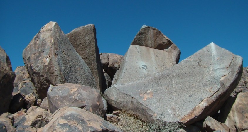
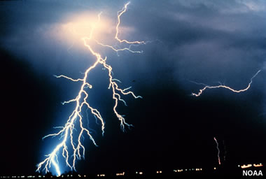 Gravity may dominate the actions of stars and galaxies (or not), but here on Earth, electricity is the dominant force. You don’t see gravity spontaneously exploding in lightning bolts that kill, do you? No, because gravity is so weak compared to electricity. Oh yes, if a piano falls on your head because of gravity, it can kill you, but that still doesn’t compare to the energy in a lightning bolt.
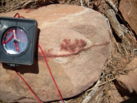
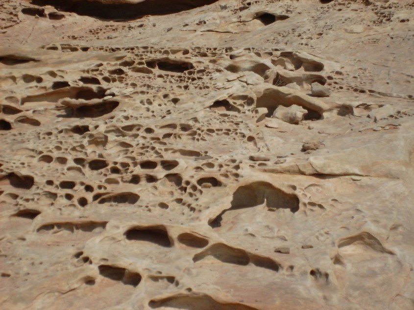


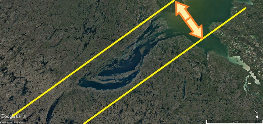


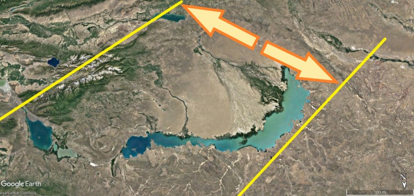


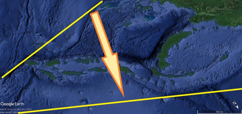


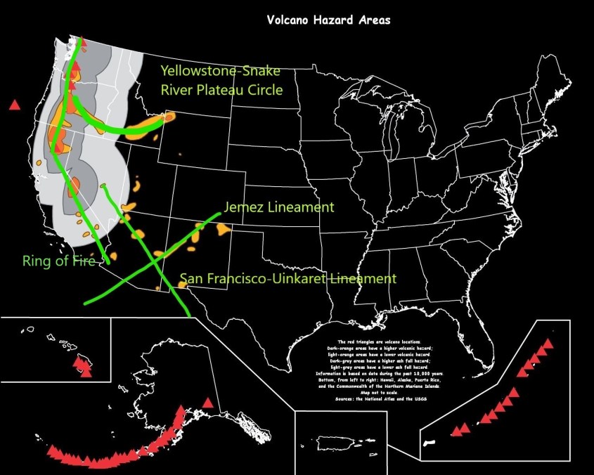


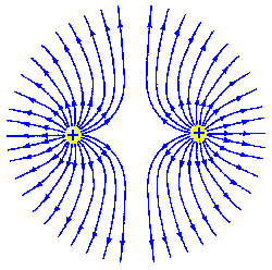
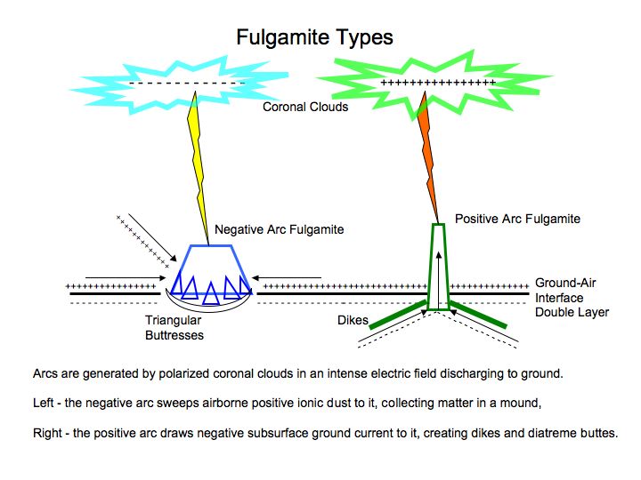

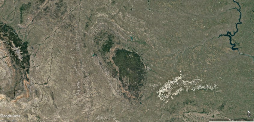

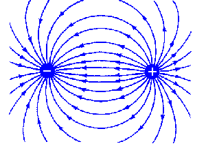
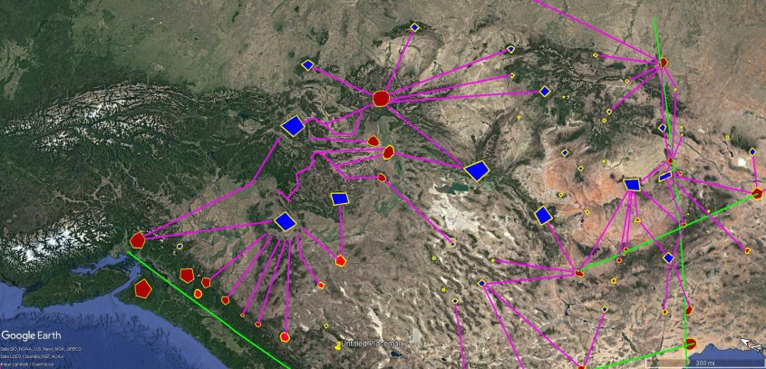


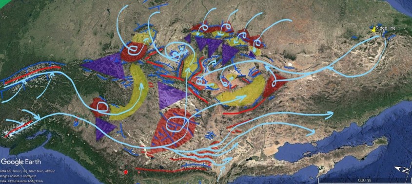


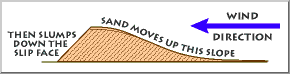
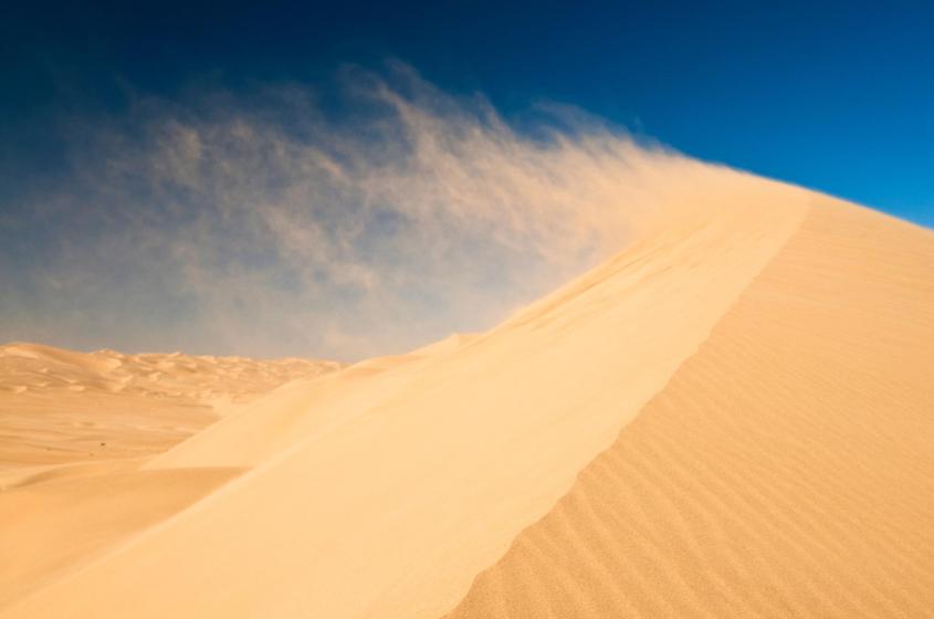


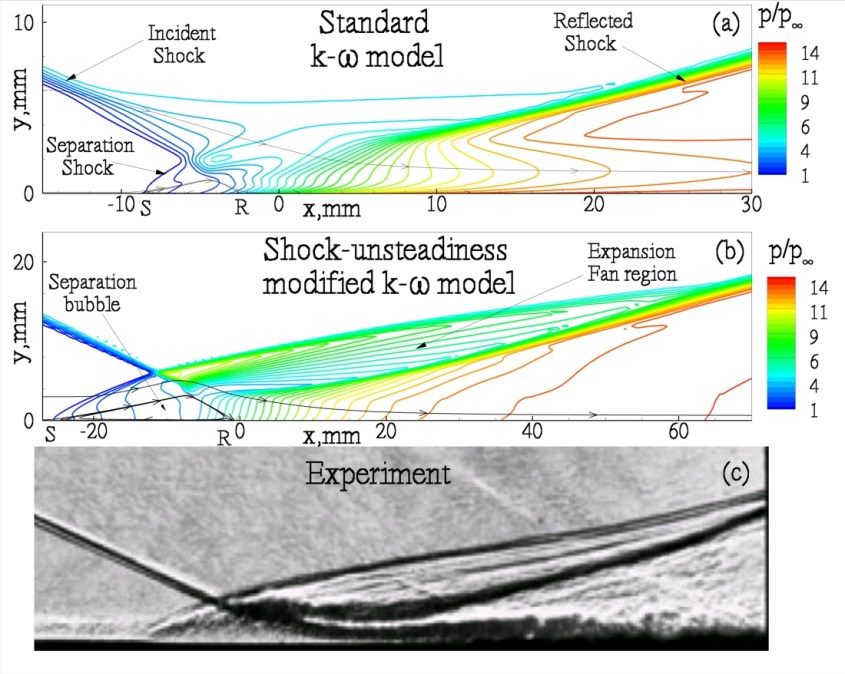
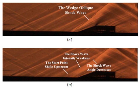
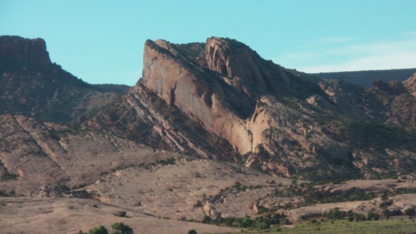

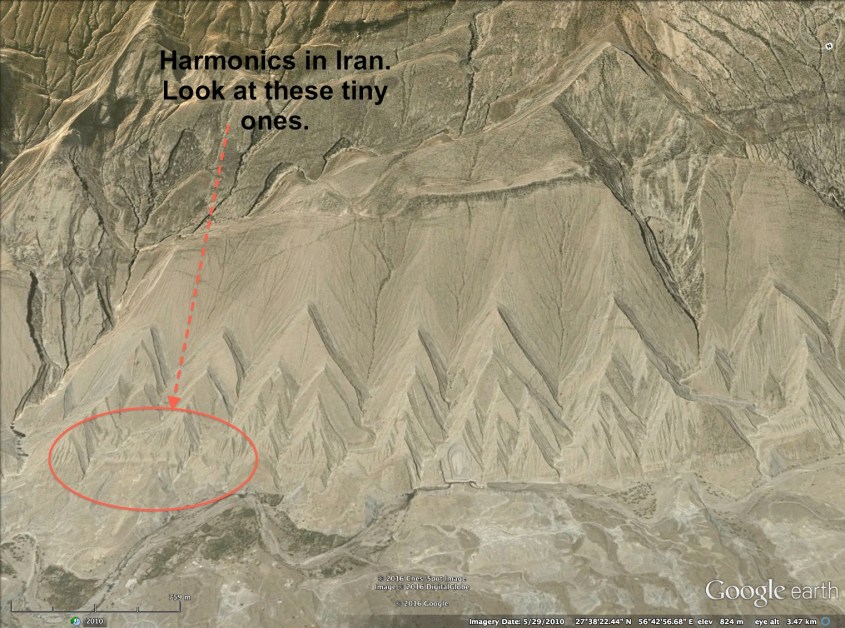
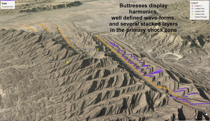
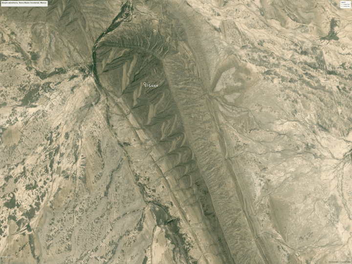
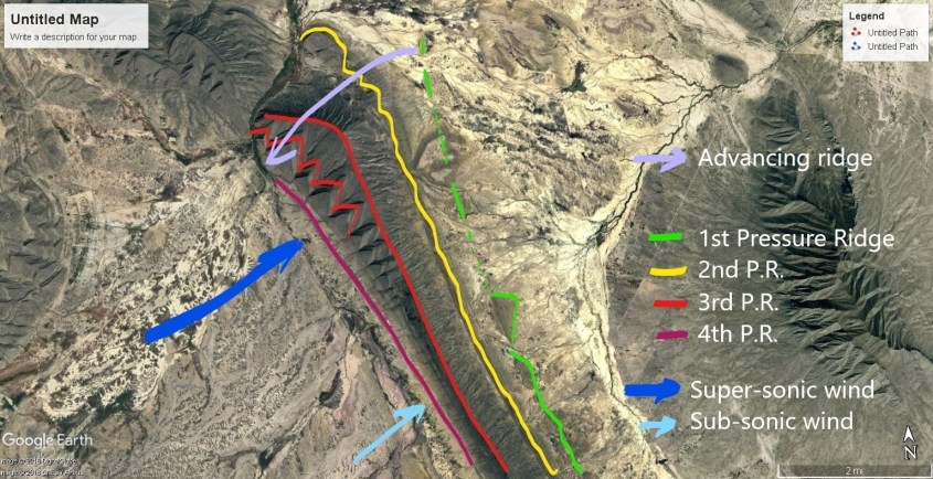
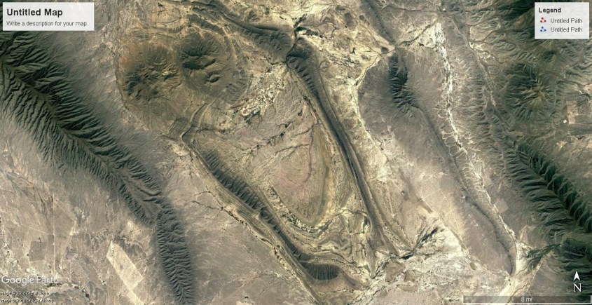
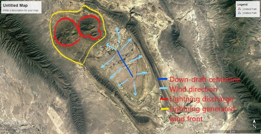
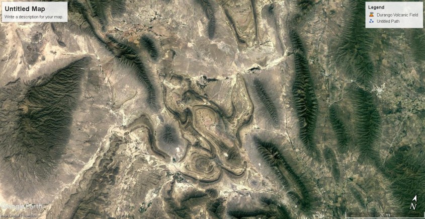
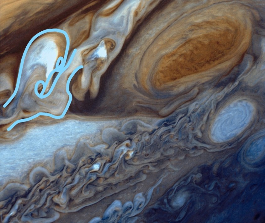
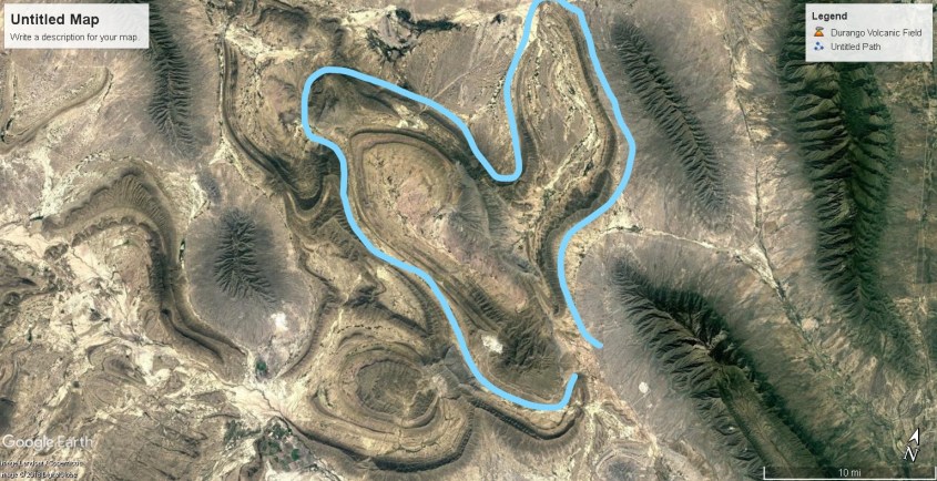
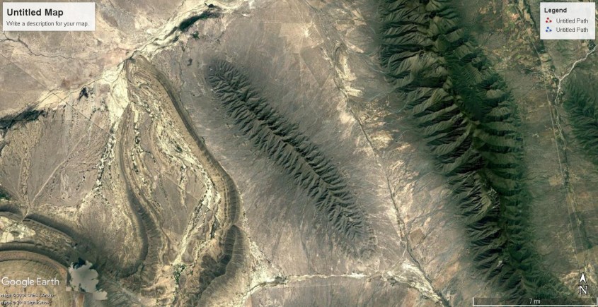
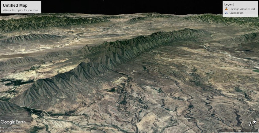
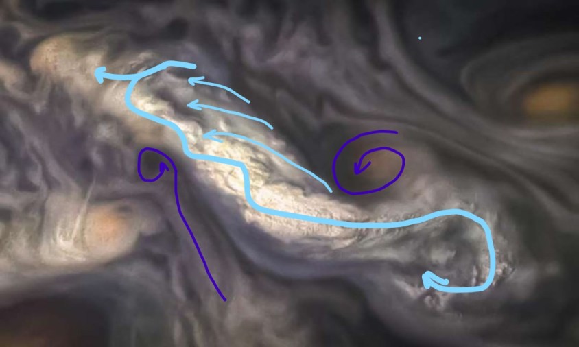
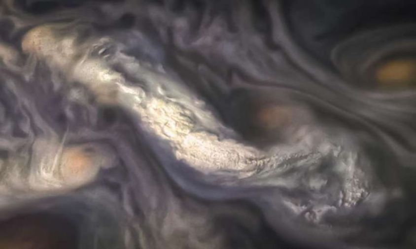
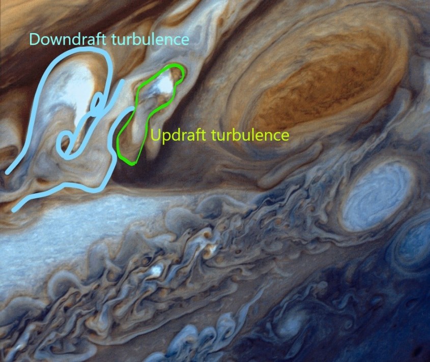
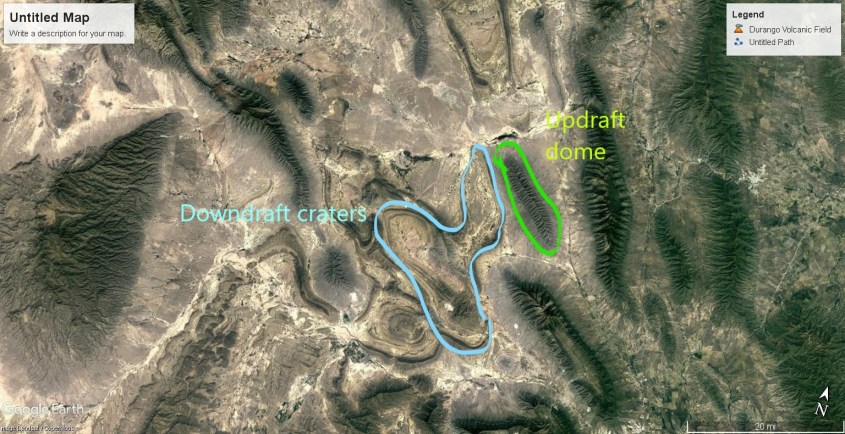
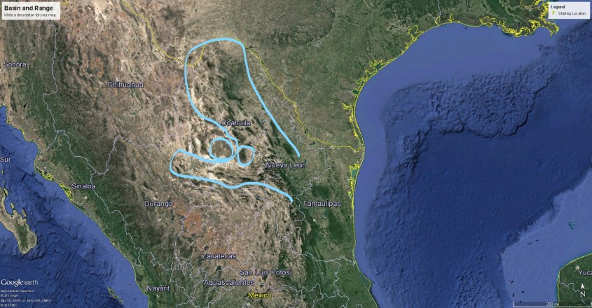
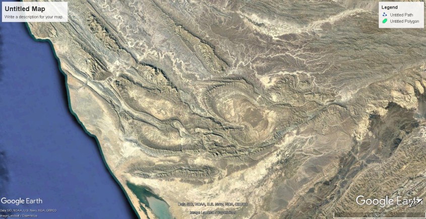
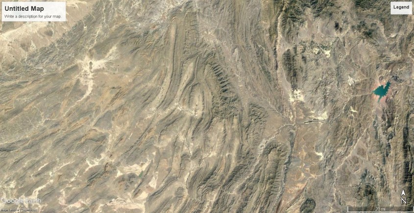
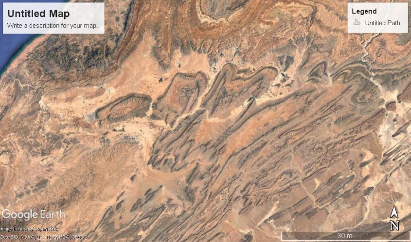
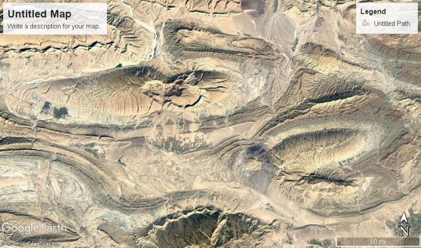
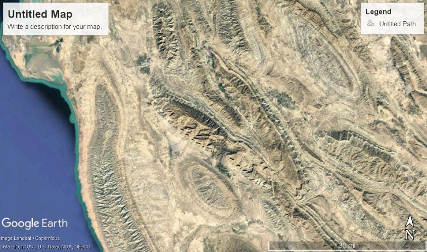
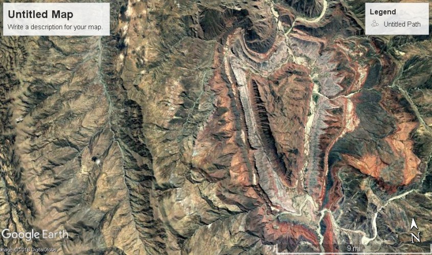
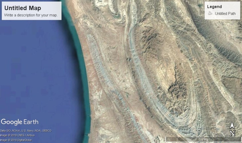
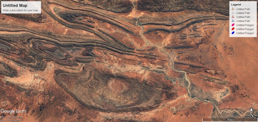


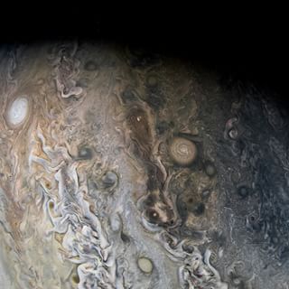
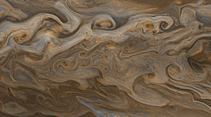
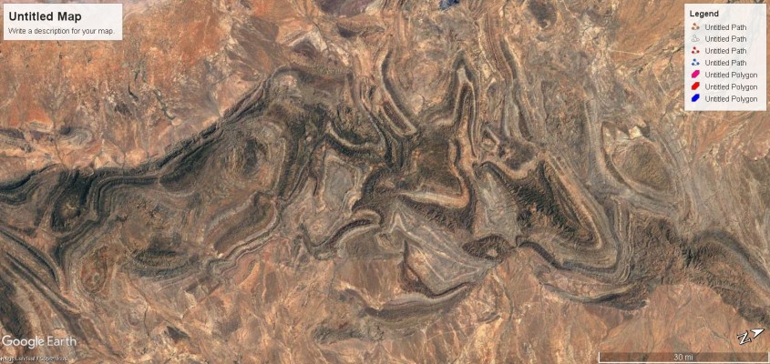
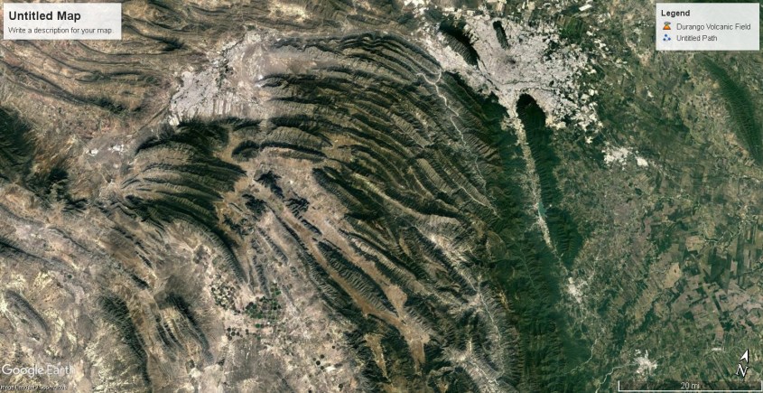
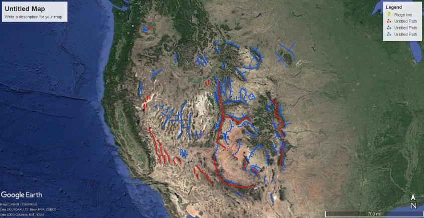
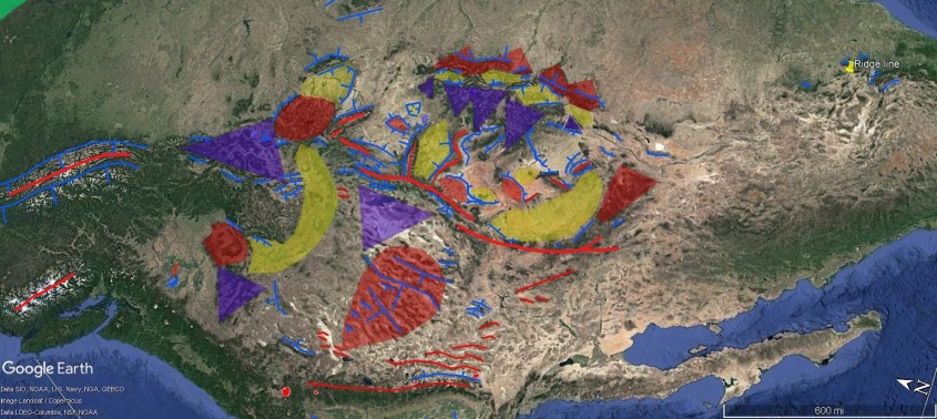
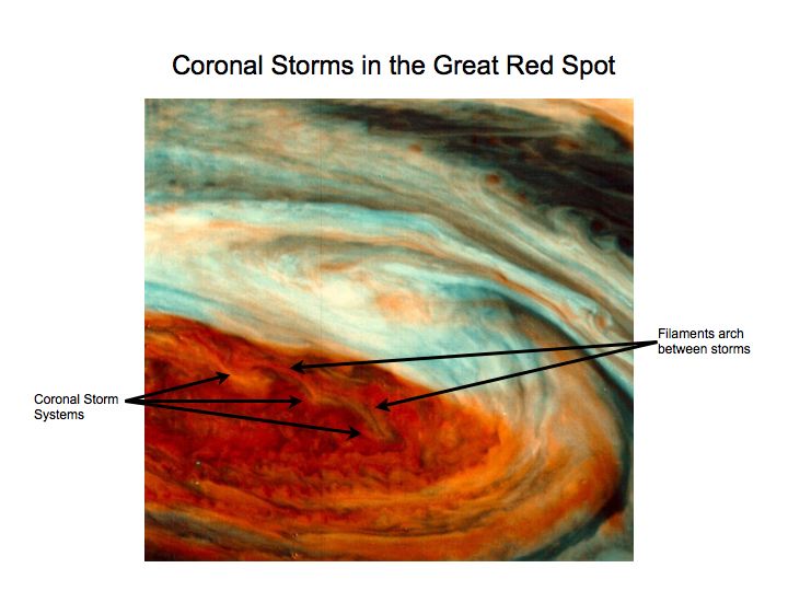
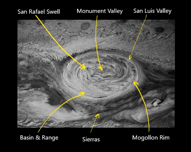
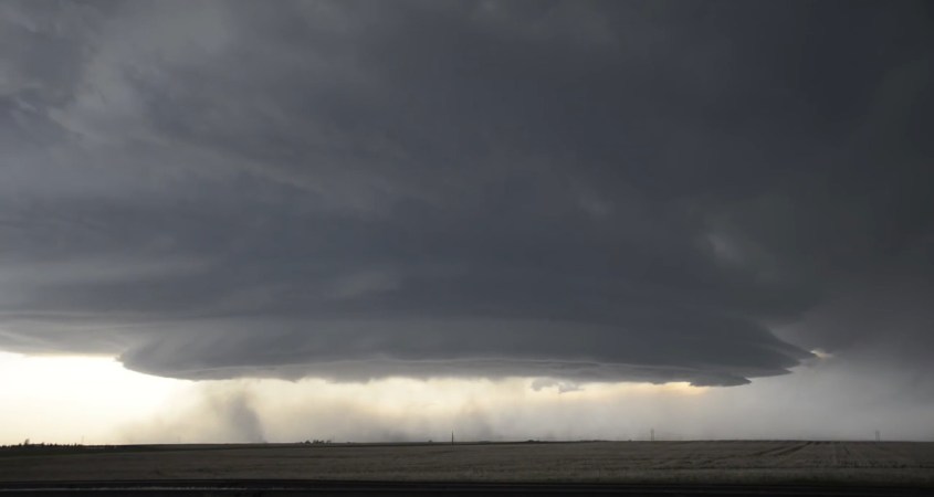
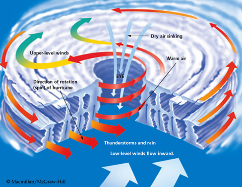
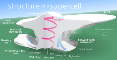
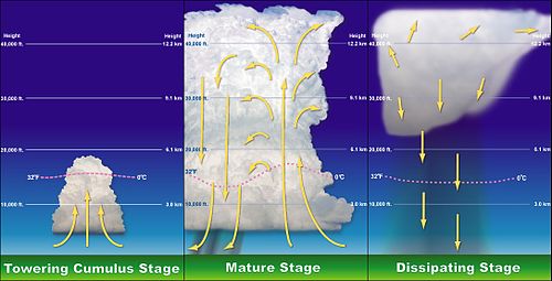
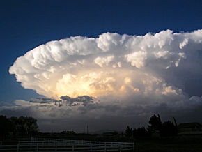
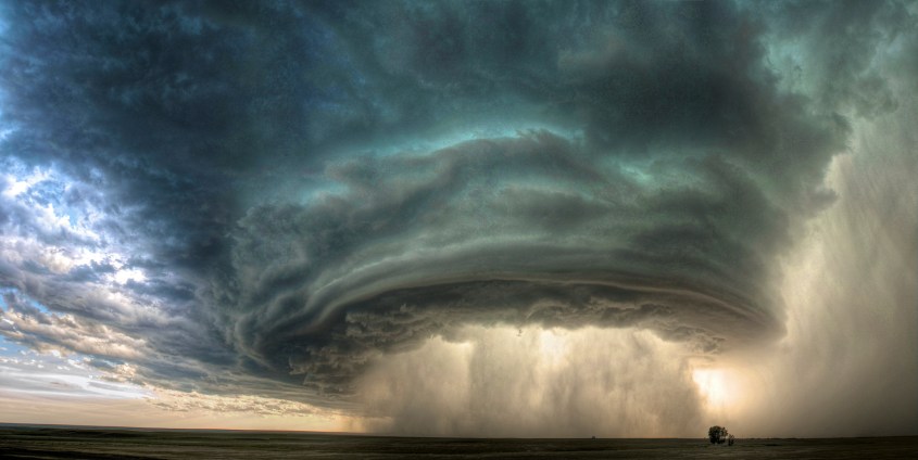


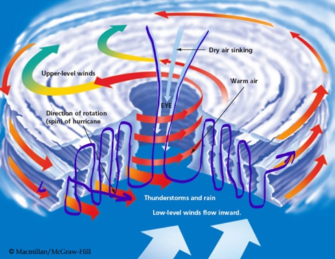
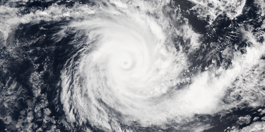
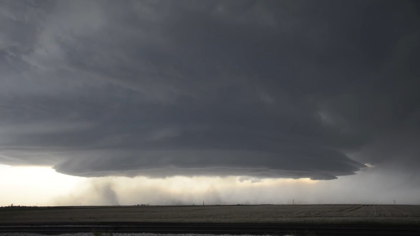
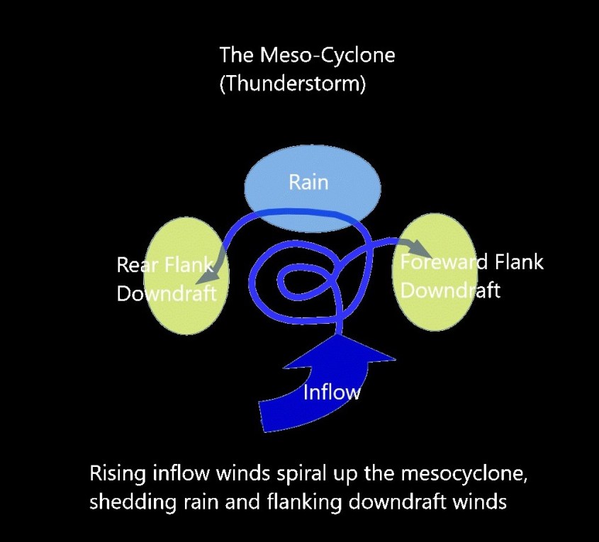
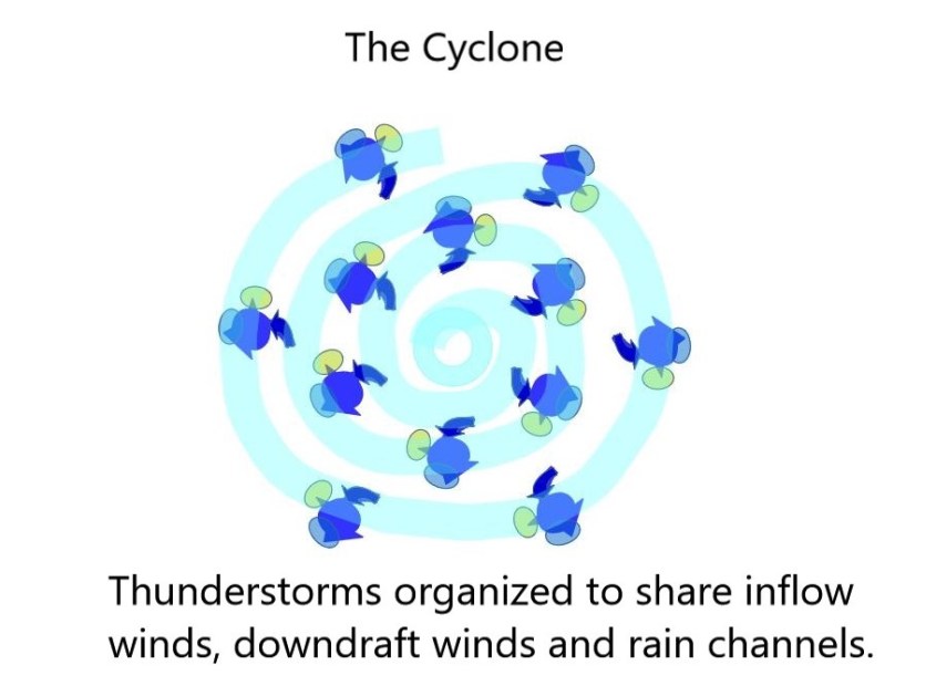
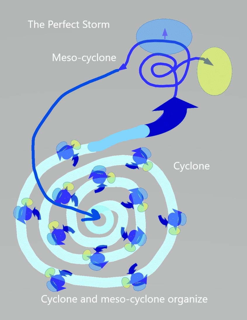
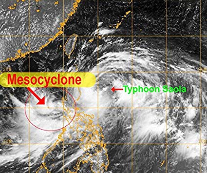
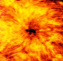
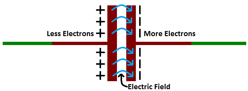
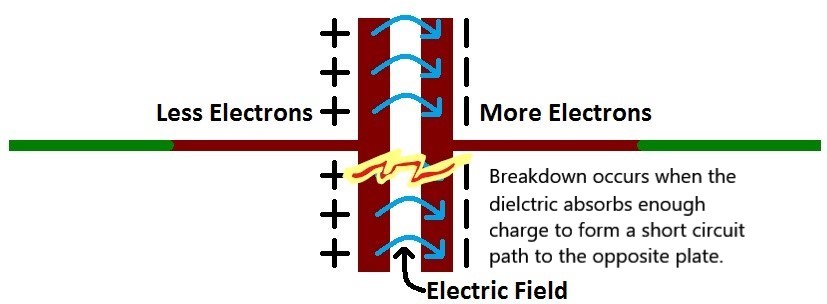

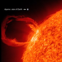
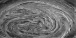

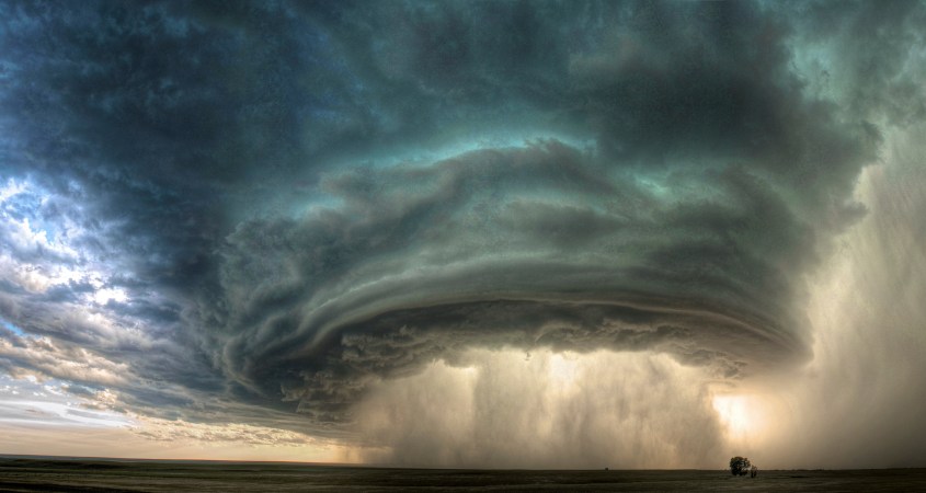
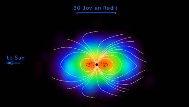
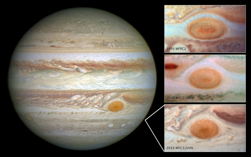
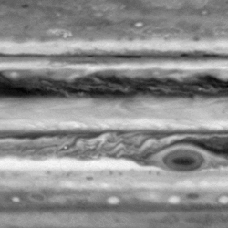
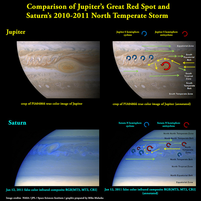
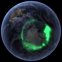
 into the atmosphere, and spread hot magma across the land.
 In every case, discharge follows the geometry of a plasmoid Earth, where the “Blue Marble” we live on is just a bubble, or drop of matter encapsulated in an electric circuit. The plasmoid circuit is what matters – what controls everything – and it flows through the atmosphere and crust to create the capacitance that motivates weather, earthquakes and volcanoes.
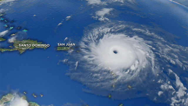
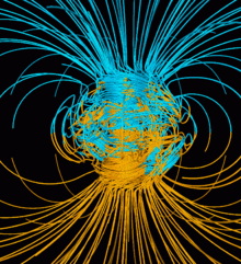
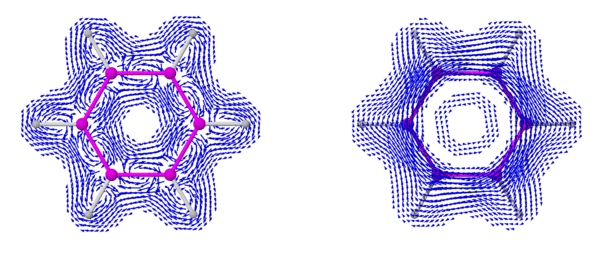
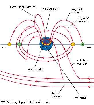
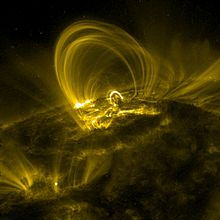

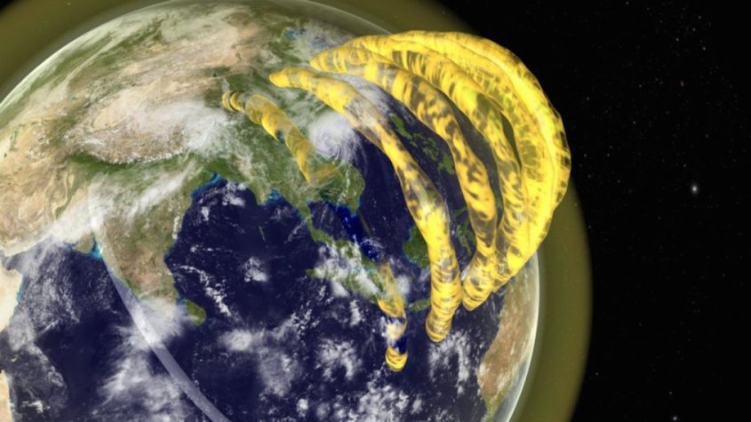
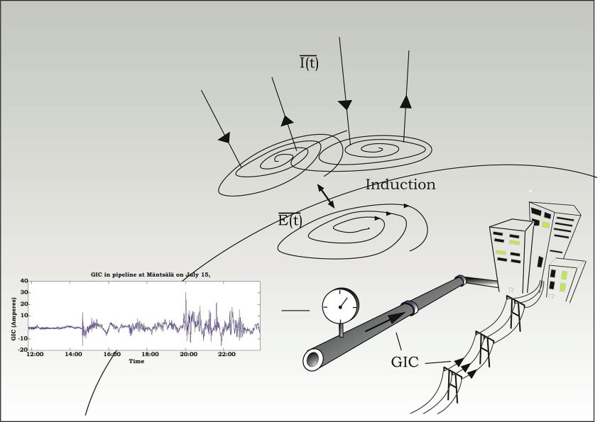
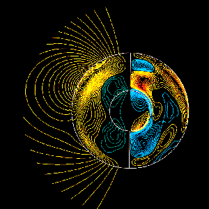
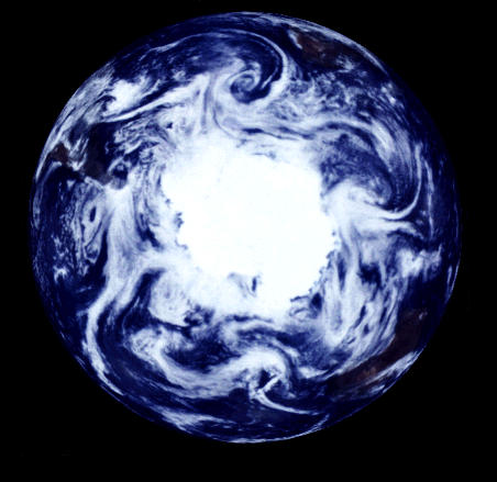
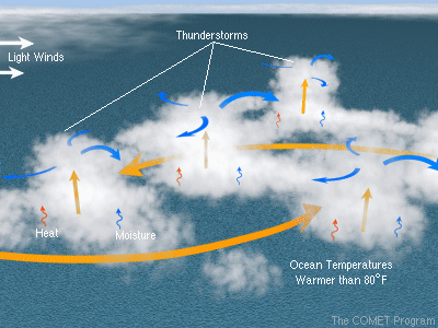
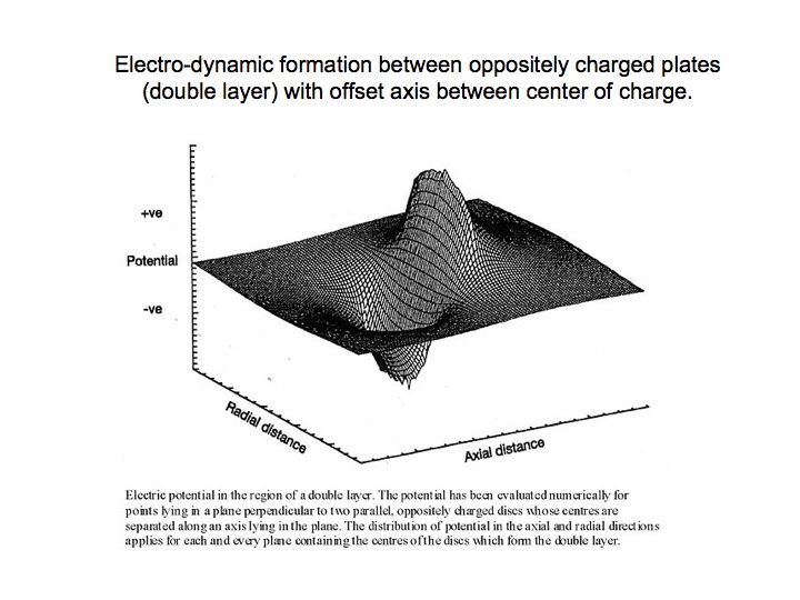 If you look at the last image, of an electromagnetic wave in a double layer, you can see, first, how a double layer of charge – a capacitor – will produce waves of electromagnetic peak and trough, like a rogue wave on the ocean.
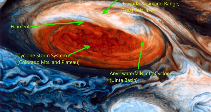
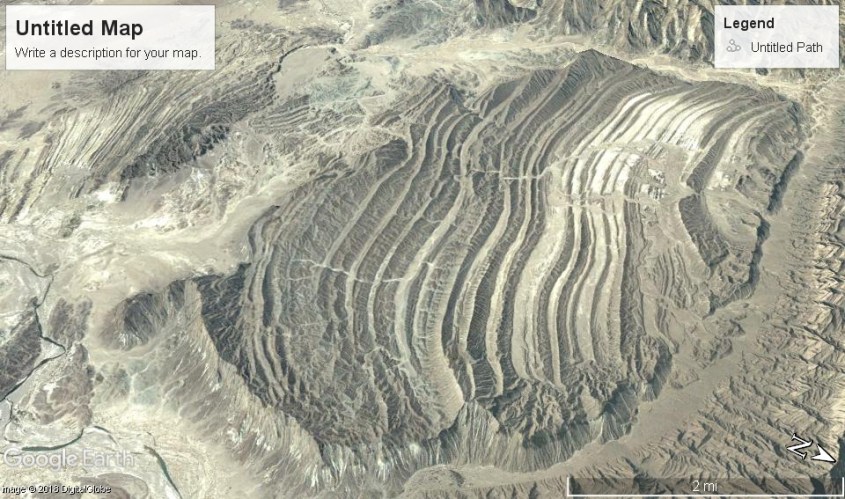
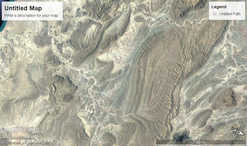
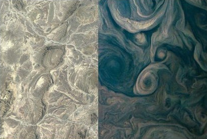
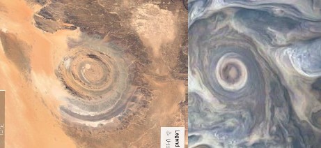
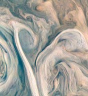
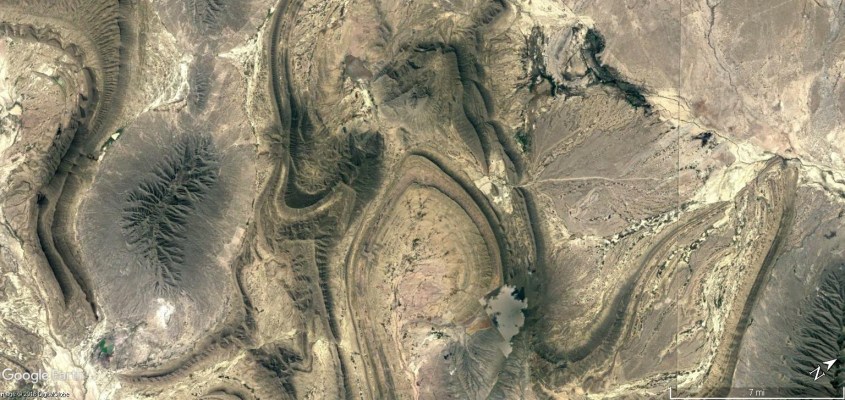
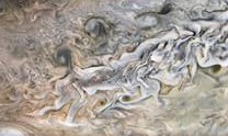
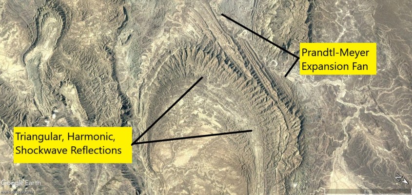

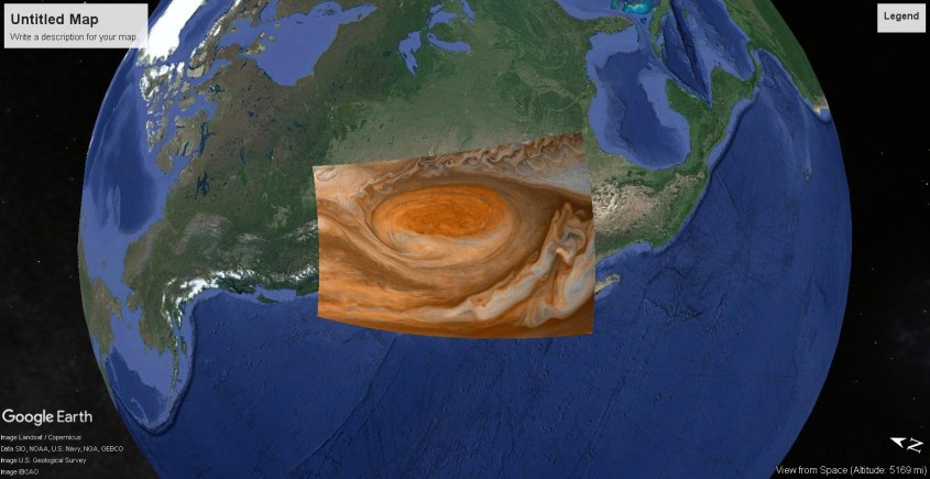
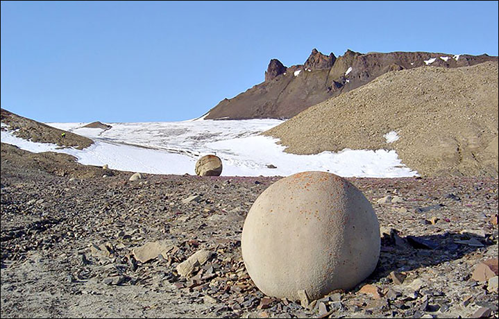


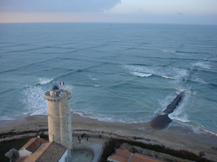
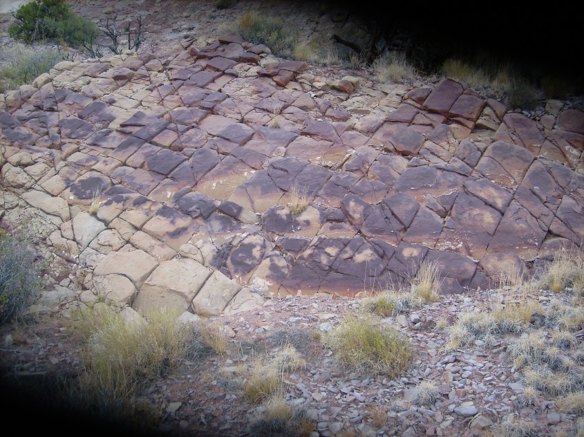
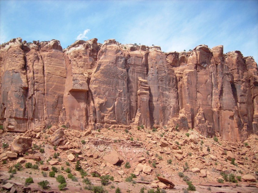
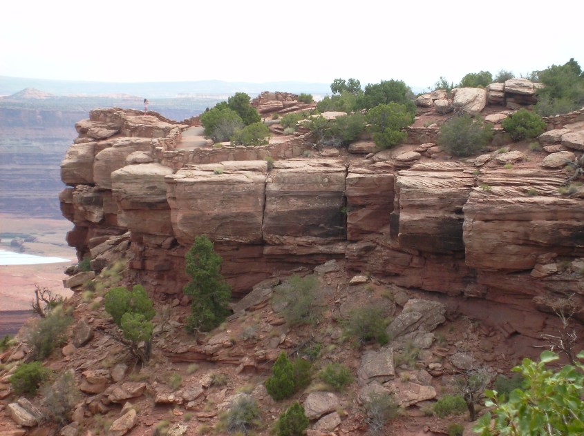
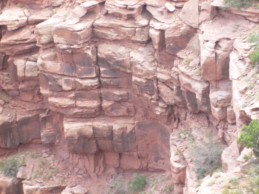
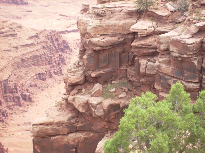
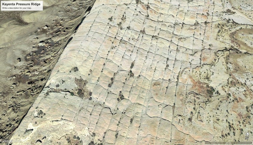
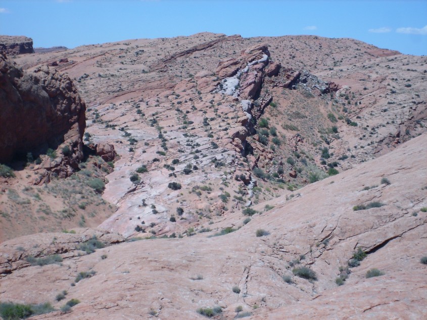
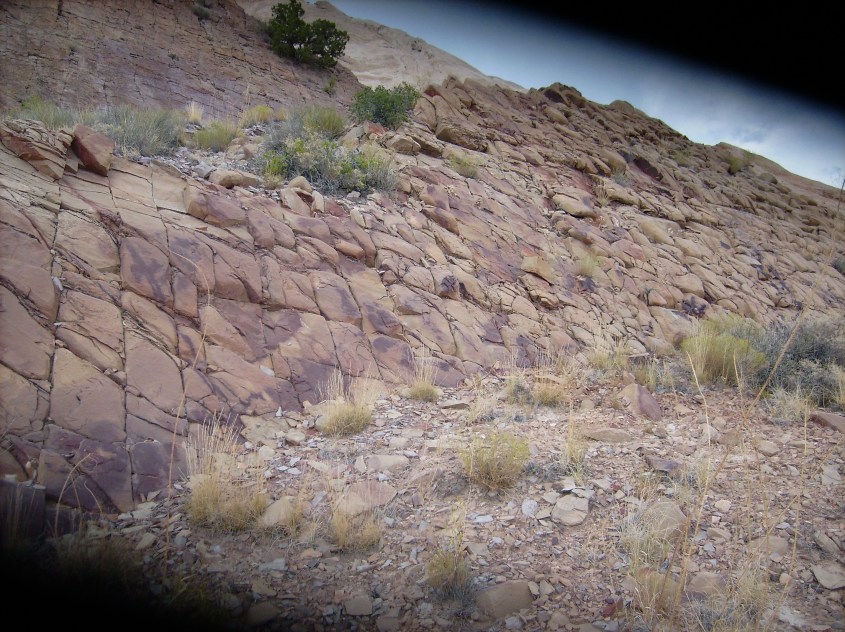
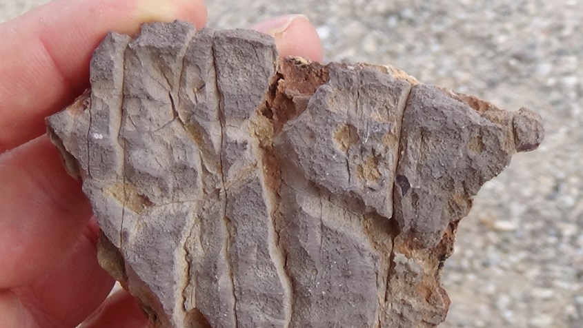
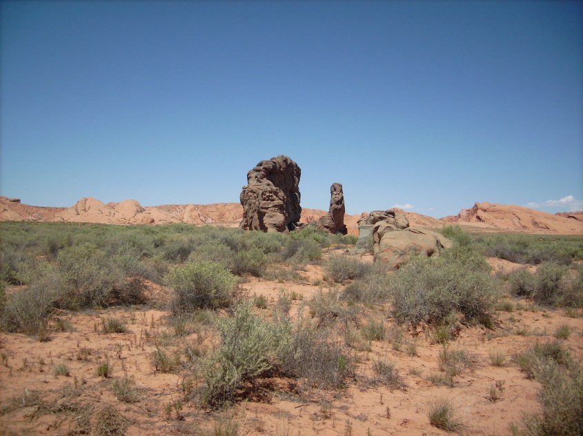
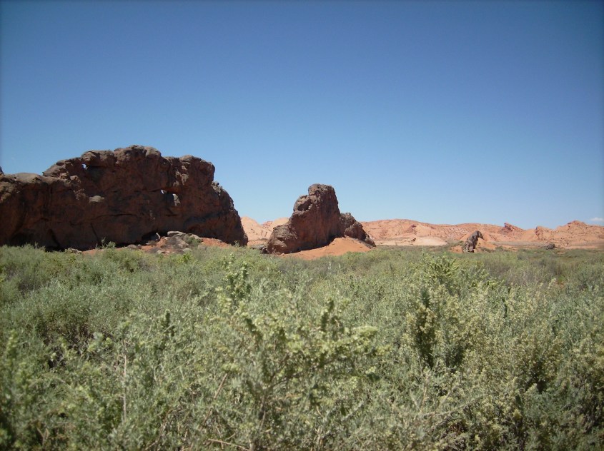
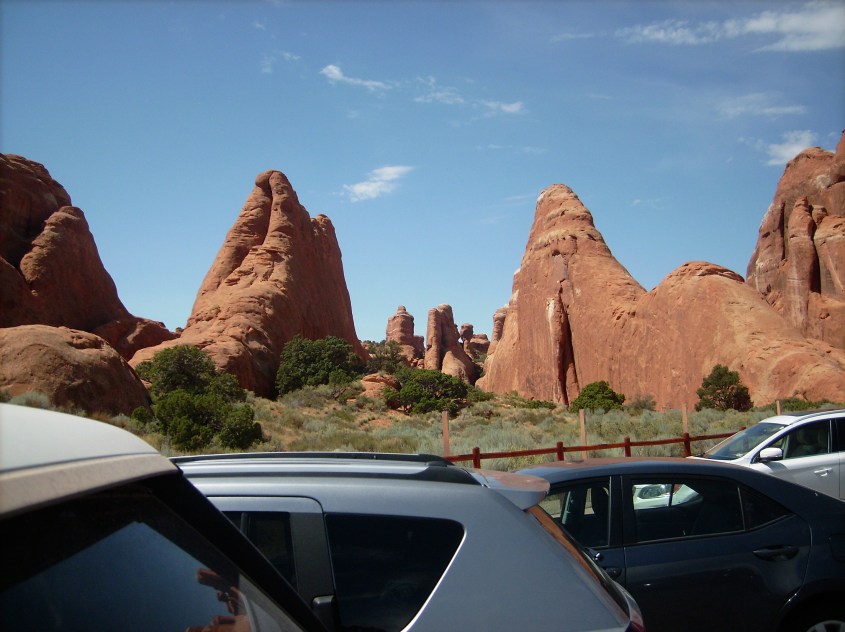
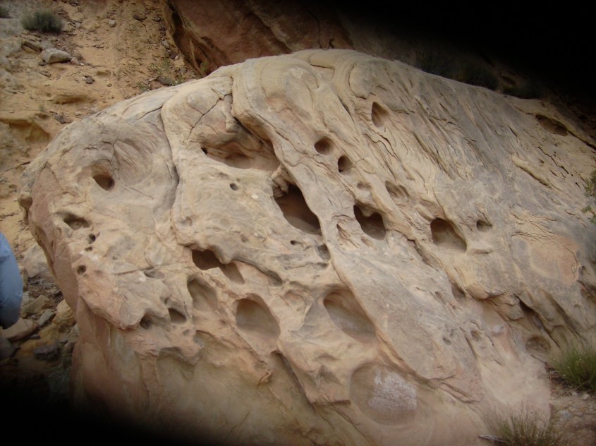
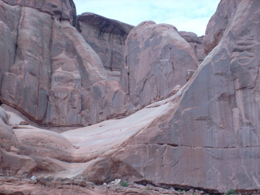
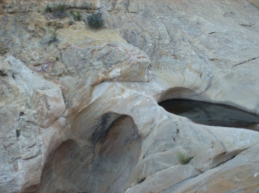
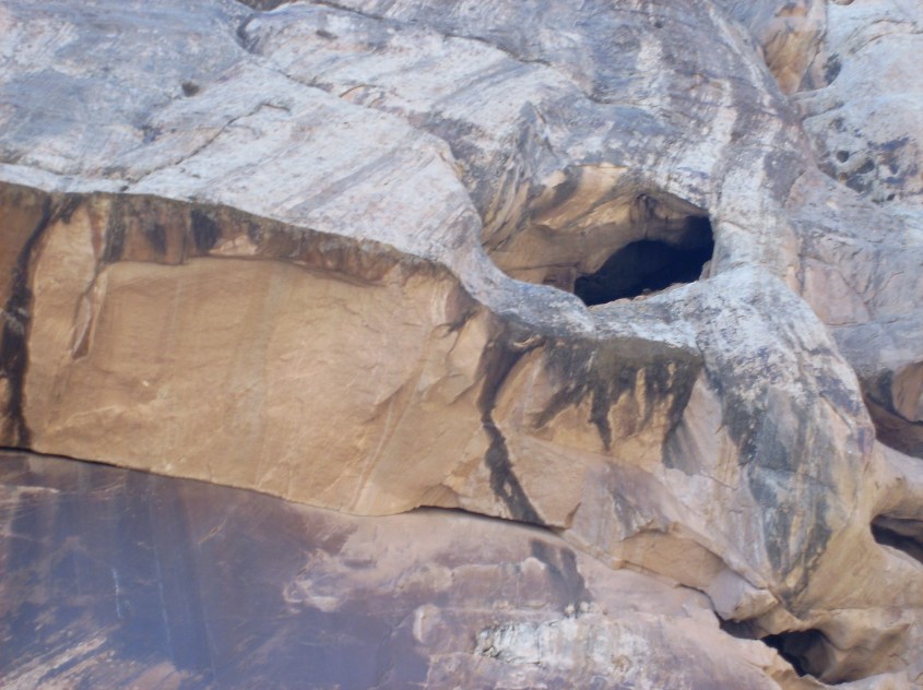
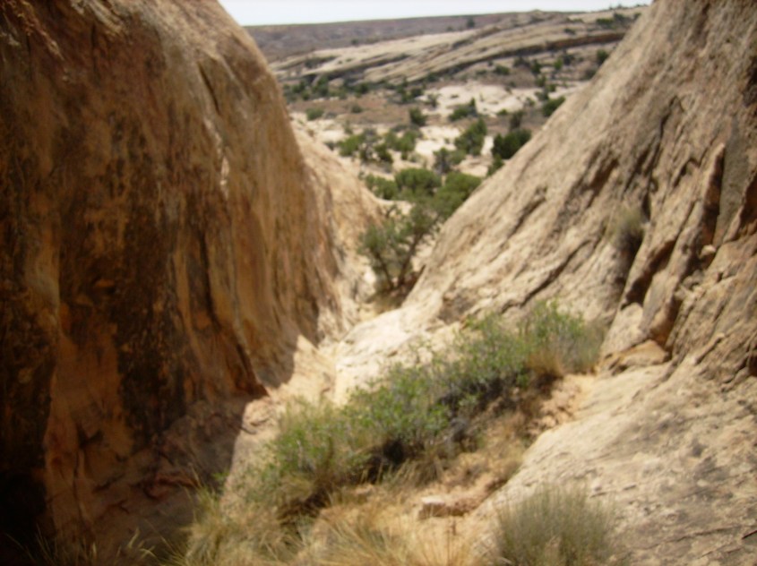
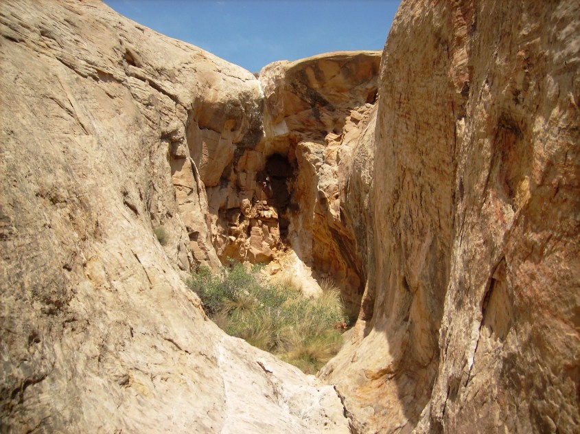
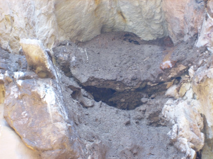
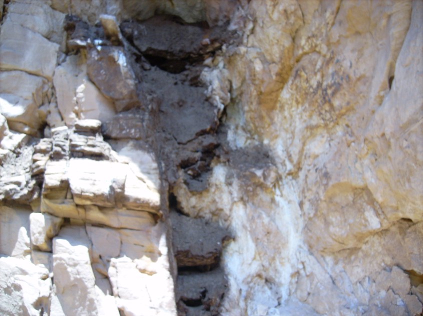
 This image shows why off-gassing bubbles are part of deposition, not sputtering. The bubbles are in the untouched surface rock above, while the scalloped break in the rock (from a cupping spall caused by sputtering) has no holes. The holes were already there when the canyon was sputtered, and are only a near surface feature caused by off-gassing.


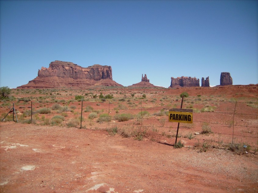
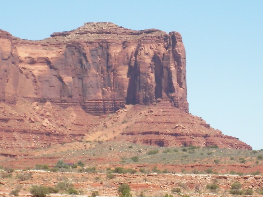
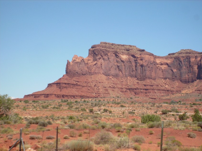 The step pyramid structure, or terracing on canyon walls and buttes is another evidence of sputtering. Each sedimentary layer has different compositions of minerals and moisture, differentiating the dielectric property of each layer. The zone of charge depletion under lightning strikes spreads out in a conical diffusion pattern, but the cone is stepped, or terraced, because there is a step voltage across each dielectric layer.
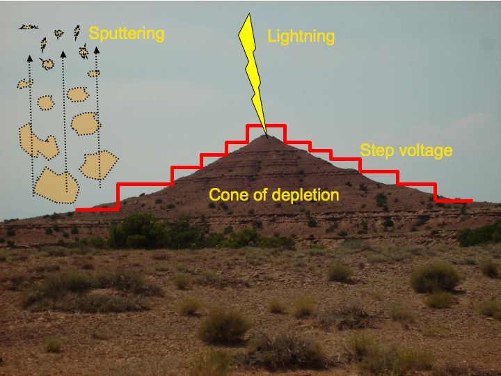 Where there are towering cliffs with sheer vertical walls, it is because it is a monolithic layer with a consistent dielectric, causing a single large voltage step.
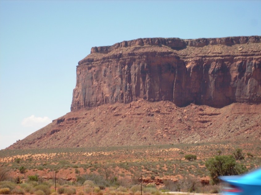
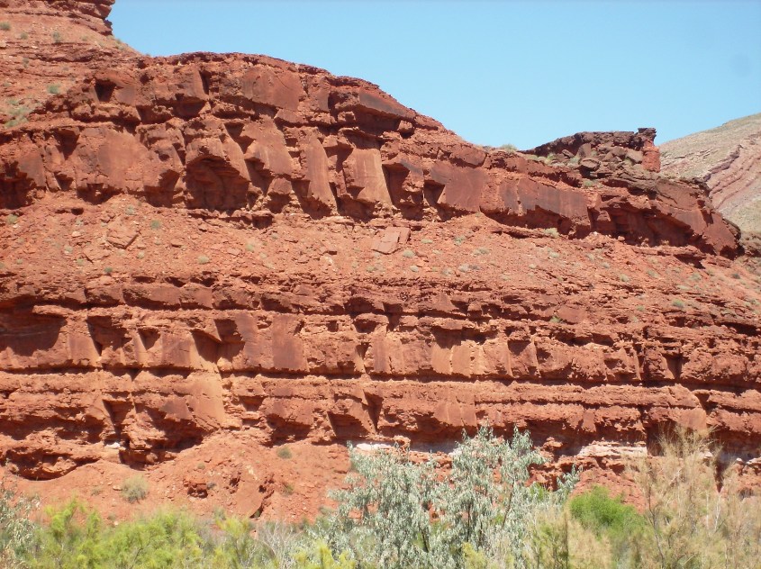 Evidence of shearing is especially evident on monolithic walls. Sharp edged breaks are everywhere, leaving smooth, flat faces, hardly roughened, or rounded by any act of erosion.
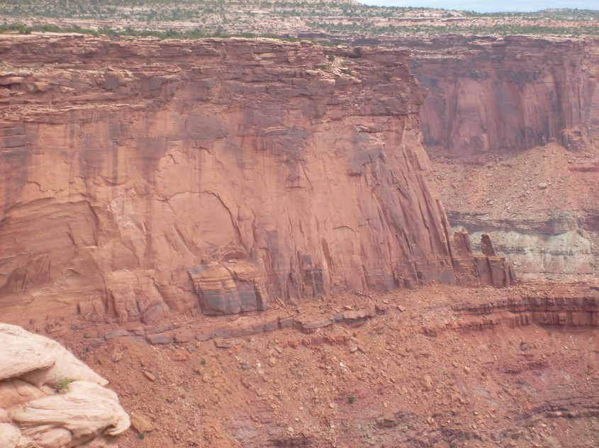
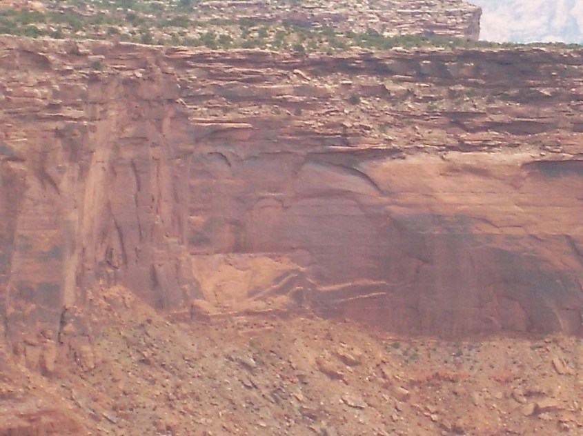
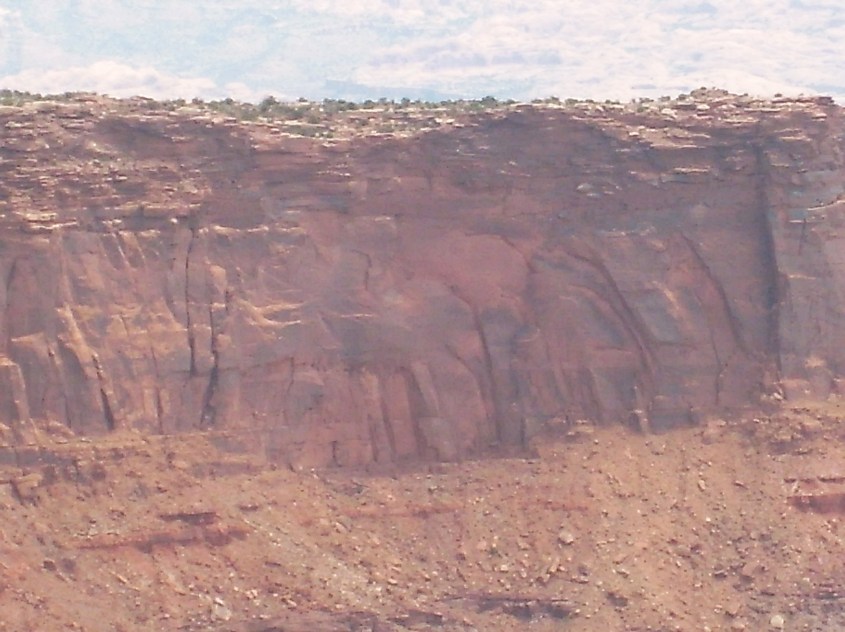
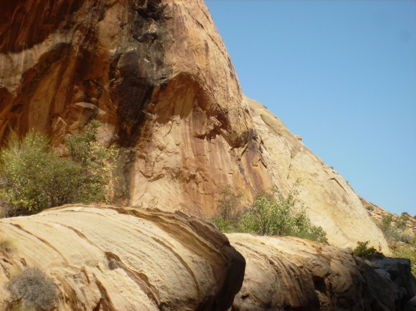
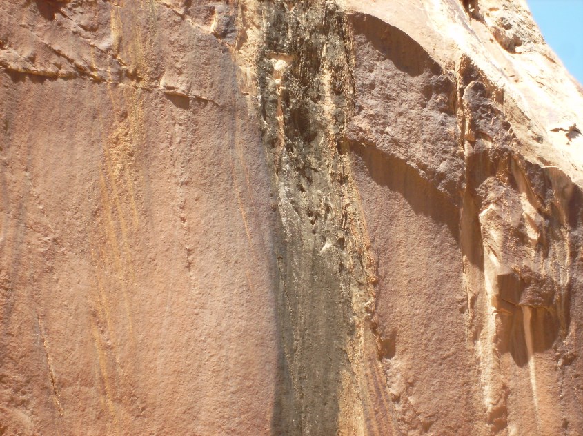
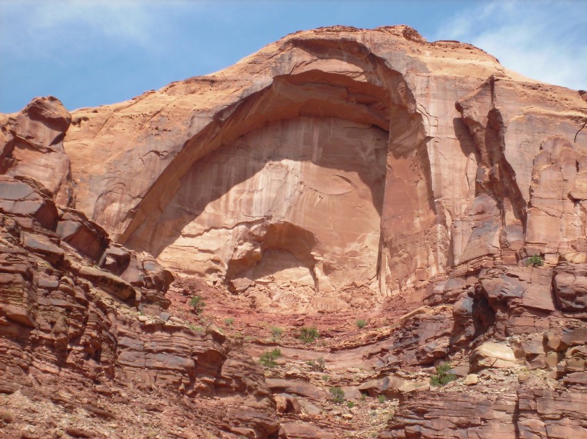
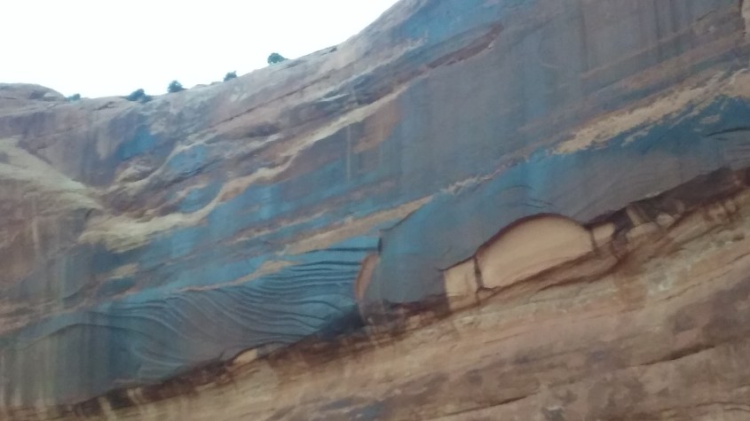
 Pinnacles in this region are of two types. Fulgarites, like the burnt shard of Agathla peak, are the direct result of lightning boiling up the crust of the earth in an electromagnetic blister. These types of pinnacles were discussed in
 More sustained, or potent striking begins to diffuse charge depletion outward, forming nodes, or star like breakouts.
 Still larger accumulation of strikes, diffuses charge further, and nodules break out into ‘wings’, or dykes of charge depleted rock.
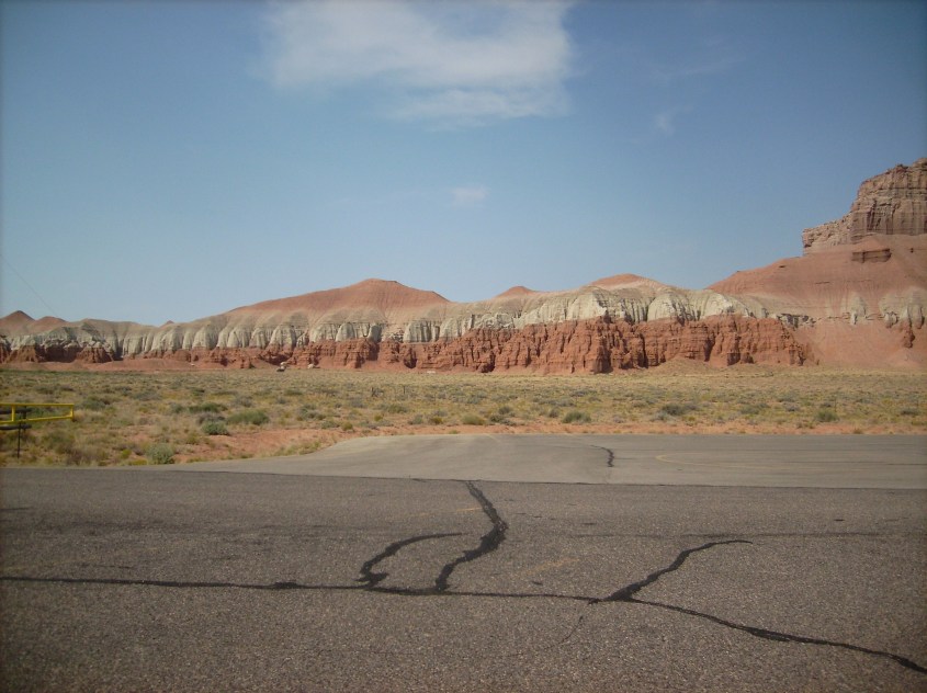
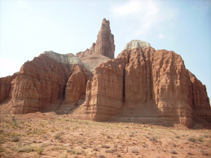 The shadow footprint grows as arcing continues, elongating charge depleted zones into wedges with dykes growing out the tips and edges. It’s actually the beginning of a fractal dendrite, as lightning bombardment soaks charge from the ground, diffusing outward in branches and creating a depleted zone protected from sputtering. If the process continued before the surroundings sputtered away, the dendrite nodules would grow and branch in ever smaller fractal repetitions, like branches of a tree.
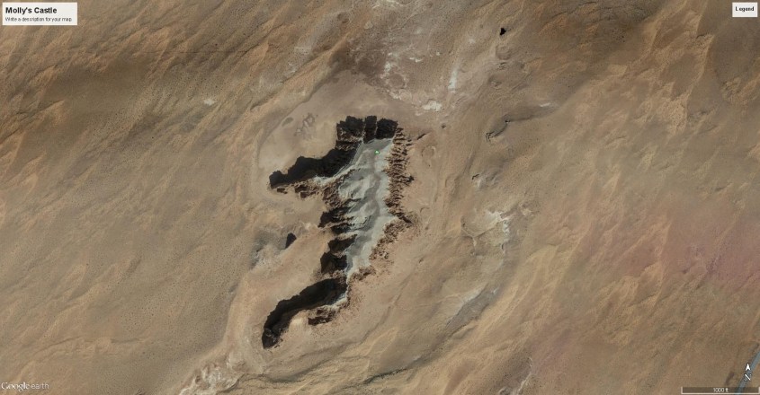
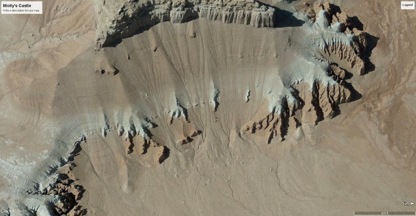
 As adjacent rock is struck, the depleted zones connect into networks of wedges, ridges and pinnacles.
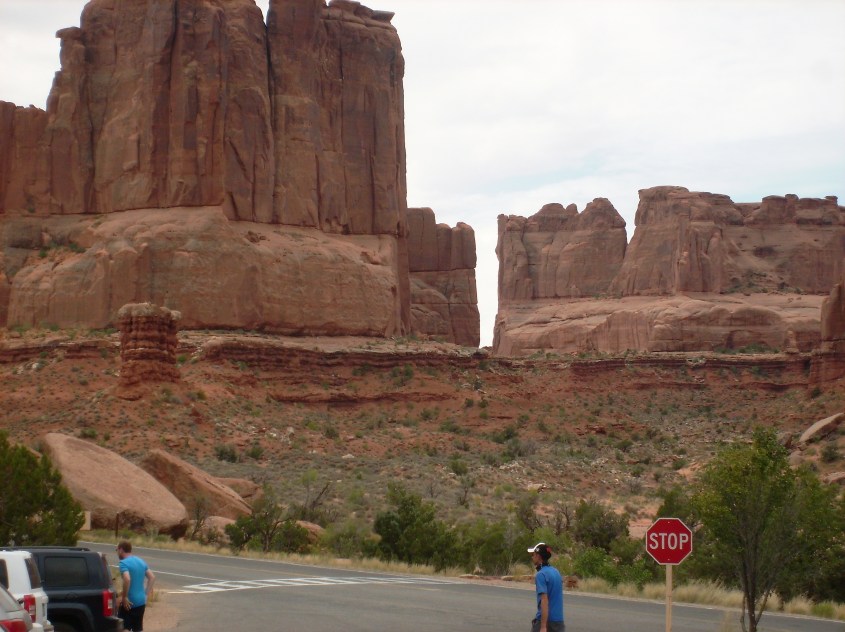
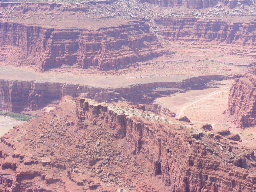
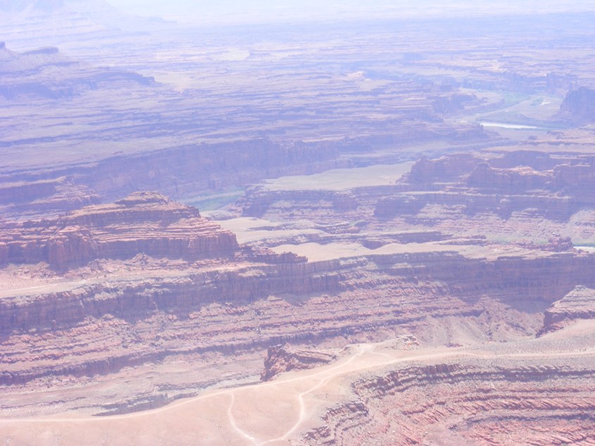
 Generally, the pinnacles and buttes left on a dome are layered flat, but in some areas buttes display a dip, indicating horizontal winds influenced the deposition. Sputtering follows the voltage gradient, and so carves away from the lightning depleted zone in alignment with the strata because the voltage gradient follows the dielectric layers, cutting at 90º to the dip angle, leaving a straight-edged non-vertical wall. If eroded by conventional notions of wind, rain and mass wasting, the rock would obey gravity and erode a vertical wall. It is in details like this that prove electrical formation.
 What we see in the stepped pyramids and terraced canyons is the result of two types of charge transport in a solid state matter. One is drift ionization caused by the external electric field of the storm, and the other is
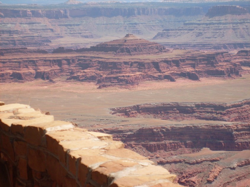
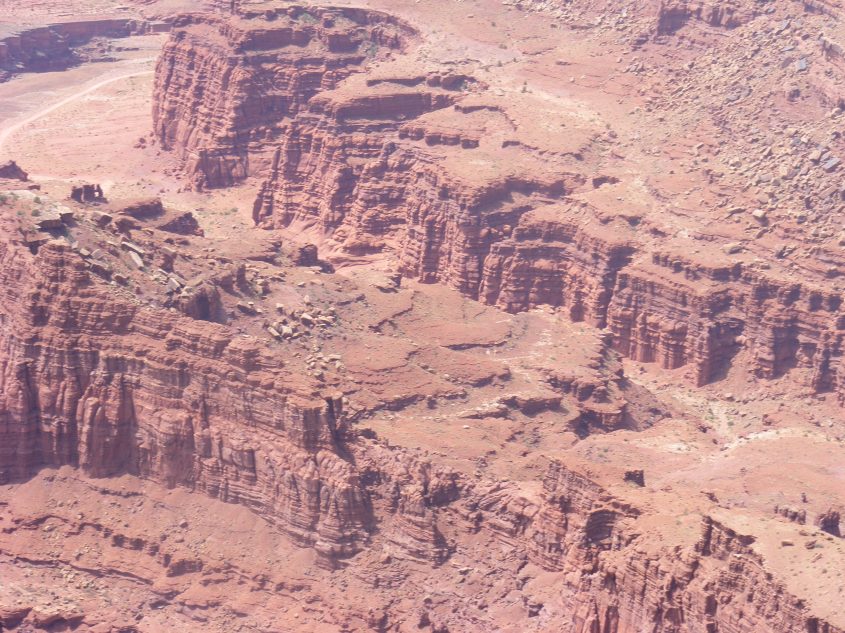
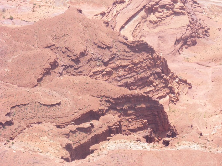
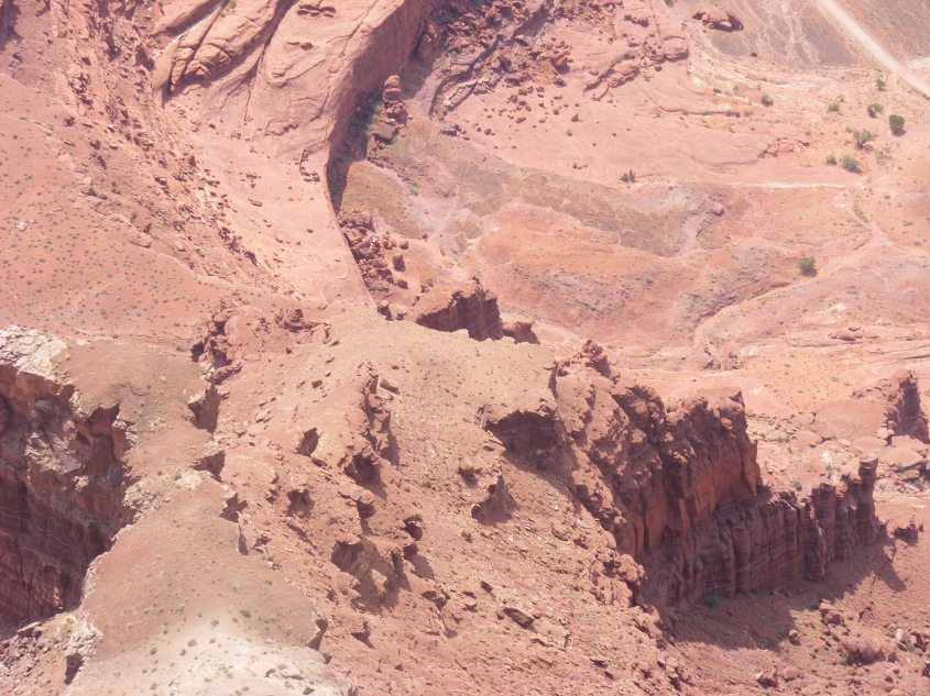
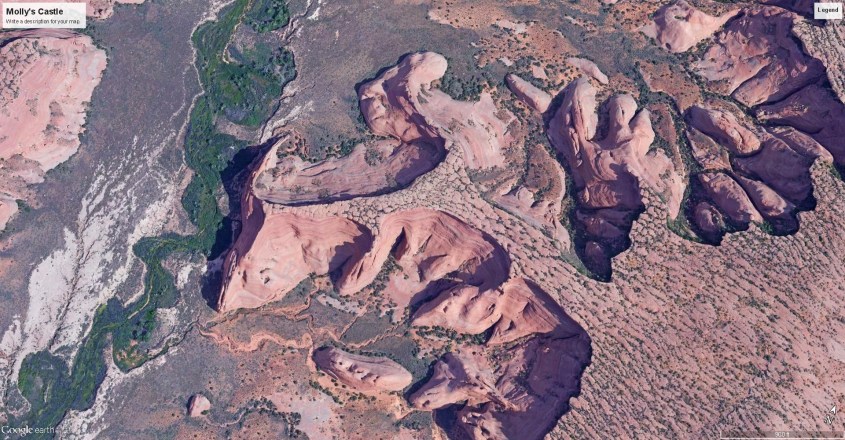
 Compelling evidence the scalloped and terraced walls are a result of charge diffusion is shown in this image, where the archetype of all fractal shapes emerges – the Mandlebrodt Set.